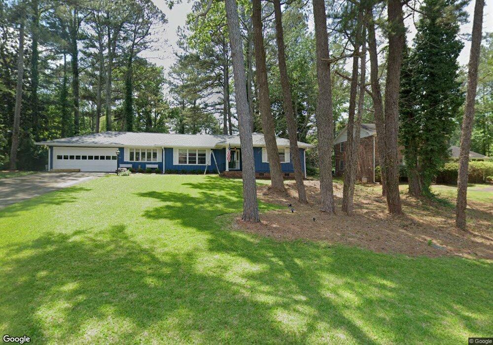
1711 Beauregard Dr SW Lilburn, GA 30047
Estimated Value: $321,000 - $341,000
3
Beds
2
Baths
1,624
Sq Ft
$203/Sq Ft
Est. Value
About This Home
This home is located at 1711 Beauregard Dr SW, Lilburn, GA 30047 and is currently estimated at $330,366, approximately $203 per square foot. 1711 Beauregard Dr SW is a home located in Gwinnett County with nearby schools including Head Elementary School, Five Forks Middle School, and Brookwood High School.
Ownership History
Date
Name
Owned For
Owner Type
Purchase Details
Closed on
Dec 11, 2020
Sold by
Soller Catherine Mary
Bought by
Catherine Mary Soller Rev Liv Tr
Current Estimated Value
Purchase Details
Closed on
Oct 24, 2007
Sold by
Hannah Annie L
Bought by
Soller Catherine M
Home Financials for this Owner
Home Financials are based on the most recent Mortgage that was taken out on this home.
Original Mortgage
$125,600
Interest Rate
6.27%
Mortgage Type
New Conventional
Create a Home Valuation Report for This Property
The Home Valuation Report is an in-depth analysis detailing your home's value as well as a comparison with similar homes in the area
Home Values in the Area
Average Home Value in this Area
Purchase History
| Date | Buyer | Sale Price | Title Company |
|---|---|---|---|
| Catherine Mary Soller Rev Liv Tr | -- | -- | |
| Soller Catherine M | $157,000 | -- |
Source: Public Records
Mortgage History
| Date | Status | Borrower | Loan Amount |
|---|---|---|---|
| Previous Owner | Soller Catherine M | $125,600 |
Source: Public Records
Tax History Compared to Growth
Tax History
| Year | Tax Paid | Tax Assessment Tax Assessment Total Assessment is a certain percentage of the fair market value that is determined by local assessors to be the total taxable value of land and additions on the property. | Land | Improvement |
|---|---|---|---|---|
| 2025 | $2,973 | $119,040 | $26,120 | $92,920 |
| 2024 | $3,237 | $108,640 | $26,120 | $82,520 |
| 2023 | $3,237 | $109,280 | $26,400 | $82,880 |
| 2022 | $3,028 | $100,400 | $26,400 | $74,000 |
| 2021 | $2,392 | $68,480 | $16,800 | $51,680 |
| 2020 | $2,407 | $68,480 | $16,800 | $51,680 |
| 2019 | $2,279 | $65,680 | $16,800 | $48,880 |
| 2018 | $2,202 | $62,200 | $14,800 | $47,400 |
| 2016 | $2,029 | $53,240 | $14,800 | $38,440 |
| 2015 | $1,834 | $47,080 | $11,200 | $35,880 |
| 2014 | -- | $47,080 | $11,200 | $35,880 |
Source: Public Records
Map
Nearby Homes
- 1732 Beauregard Dr SW
- 4107 Signal Ridge SW
- 1725 Spindle Top Ct SW
- 1640 Killian Hill Rd SW
- 4166 Signal Ridge SW
- 0 River Club Dr Unit 7650571
- 4070 Runnymede Dr SW
- 4171 Whispering Forest Ct SW
- 3868 Buckland Dr SW
- 1535 Pathfinder Way SW Unit 1
- 4268 Rocky Ledge Way
- 4353 Pond Edge Rd
- 4000 Embassy Way
- 2047 Cliffton Terrace
- 4377 Hardwood Cir SW Unit 2
- 1905 Embassy Walk Ln
- 4405 Bending River Trail SW
- 1721 Beauregard Dr SW
- 1701 Beauregard Dr SW
- 4082 Stonemont Dr SW
- 4102 Stonemont Dr SW
- 1731 Beauregard Dr SW
- 1731 Beauregard Dr SW Unit /11
- 1710 Beauregard Dr SW Unit 2
- 4063A Stonemont Dr SW
- 4063B Stonemont Dr SW
- 0 Beauregard Dr SW Unit 7472806
- 0 Beauregard Dr SW Unit 3173489
- 0 Beauregard Dr SW Unit 7617876
- 0 Beauregard Dr SW
- 1702 Beauregard Dr SW
- 4112 Stonemont Dr SW
- 1722 Beauregard Dr SW
- 4085 Indian Trace SW
- 1741 Beauregard Dr SW
- 4073 Stonemont Dr SW
- 4063 Stonemont Dr SW Unit A