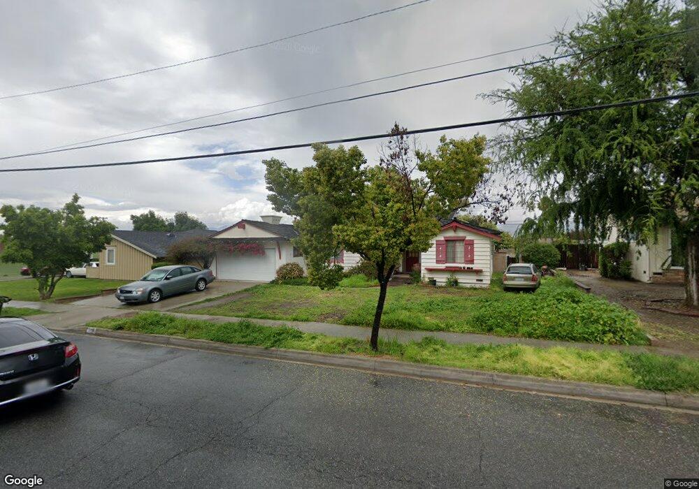
1711 E Francisquito Ave West Covina, CA 91791
Estimated Value: $769,036 - $868,000
3
Beds
2
Baths
1,429
Sq Ft
$570/Sq Ft
Est. Value
About This Home
This home is located at 1711 E Francisquito Ave, West Covina, CA 91791 and is currently estimated at $814,009, approximately $569 per square foot. 1711 E Francisquito Ave is a home located in Los Angeles County with nearby schools including Merced Elementary School, Hollencrest Middle School, and West Covina High School.
Ownership History
Date
Name
Owned For
Owner Type
Purchase Details
Closed on
Dec 1, 1998
Sold by
Sandoval Tomas
Bought by
Sandoval Veronica
Current Estimated Value
Purchase Details
Closed on
Jun 23, 1998
Sold by
Lewis Jo Era Trust
Bought by
Sandoval Veronica and Sandoval Tomas
Home Financials for this Owner
Home Financials are based on the most recent Mortgage that was taken out on this home.
Original Mortgage
$150,051
Interest Rate
6.88%
Mortgage Type
FHA
Purchase Details
Closed on
Jun 7, 1997
Sold by
Lewis Jo Era
Bought by
Gould Tiphanie and Jo Era Lewis Trust
Create a Home Valuation Report for This Property
The Home Valuation Report is an in-depth analysis detailing your home's value as well as a comparison with similar homes in the area
Home Values in the Area
Average Home Value in this Area
Purchase History
| Date | Buyer | Sale Price | Title Company |
|---|---|---|---|
| Sandoval Veronica | -- | -- | |
| Sandoval Veronica | $180,272 | First American | |
| Gould Tiphanie | -- | -- |
Source: Public Records
Mortgage History
| Date | Status | Borrower | Loan Amount |
|---|---|---|---|
| Previous Owner | Sandoval Veronica | $150,051 |
Source: Public Records
Tax History Compared to Growth
Tax History
| Year | Tax Paid | Tax Assessment Tax Assessment Total Assessment is a certain percentage of the fair market value that is determined by local assessors to be the total taxable value of land and additions on the property. | Land | Improvement |
|---|---|---|---|---|
| 2025 | $3,292 | $239,675 | $139,827 | $99,848 |
| 2024 | $3,292 | $234,977 | $137,086 | $97,891 |
| 2023 | $3,139 | $230,371 | $134,399 | $95,972 |
| 2022 | $3,159 | $225,855 | $131,764 | $94,091 |
| 2021 | $3,071 | $221,428 | $129,181 | $92,247 |
| 2019 | $2,989 | $214,862 | $125,350 | $89,512 |
| 2018 | $2,818 | $210,650 | $122,893 | $87,757 |
| 2016 | $2,570 | $202,472 | $118,122 | $84,350 |
| 2015 | $2,525 | $199,431 | $116,348 | $83,083 |
| 2014 | $2,516 | $195,525 | $114,069 | $81,456 |
Source: Public Records
Map
Nearby Homes
- 1694 Bridgeport Unit 99
- 1495 Mccabe Way
- 1450 Westcastle
- 1623 E Francisquito Ave
- 1408 Millcreek
- 1516 Wimbledon Ct
- 1300 S Fleetwell Ave
- 1306 S Cajon Ave
- 17040 E Holton St
- 1635 Park Vista Way
- 2043 Abrazo Dr
- 1512 Seneca Dr
- 1507 Elkwood Dr Unit 61
- 1910 E Calico Dr
- 2059 E Aroma Dr
- 1937 Jacaranda St
- 1408 Queen Summit Dr
- 16645 Holton St
- 1681 Aspen Village Way
- 1515 S Westridge Rd
- 1715 E Francisquito Ave
- 1703 E Francisquito Ave
- 1710 E Mcwood St
- 1702 E Mcwood St
- 1716 E Mcwood St
- 1723 E Francisquito Ave
- 1649 E Francisquito Ave
- 1643 E Francisquito Ave
- 1722 E Mcwood St
- 1648 E Mcwood St
- 1729 E Francisquito Ave
- 1411 Breckenridge Unit 50
- 1421 Breckenridge
- 1642 E Mcwood St
- 1728 E Mcwood St
- 1710 Bridgeport
- 1706 Bridgeport Unit 105
- 1696 Bridgeport
- 1642 Bridgeport
- 1698 Bridgeport