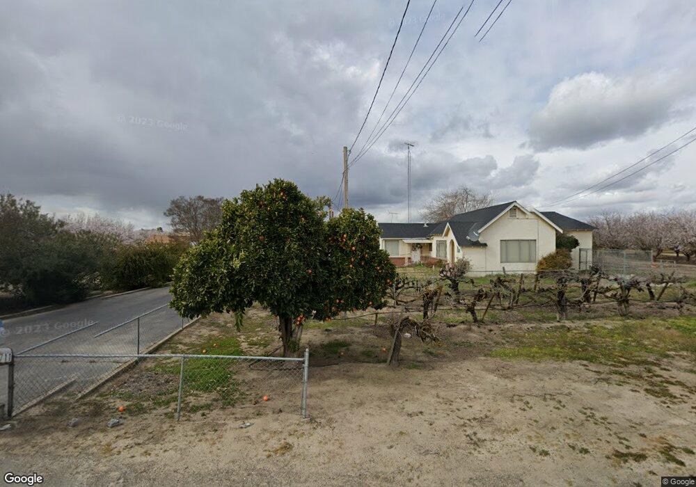
1711 Lester Rd Turlock, CA 95382
Estimated Value: $930,000 - $1,662,688
3
Beds
2
Baths
2,140
Sq Ft
$577/Sq Ft
Est. Value
About This Home
This home is located at 1711 Lester Rd, Turlock, CA 95382 and is currently estimated at $1,234,172, approximately $576 per square foot. 1711 Lester Rd is a home located in Stanislaus County with nearby schools including Denair Elementary School, Denair Middle School, and Denair High School.
Ownership History
Date
Name
Owned For
Owner Type
Purchase Details
Closed on
Aug 29, 2008
Sold by
Polous Gaby P and Polous Odette S
Bought by
Polous Gaby P and Polous Odette S
Current Estimated Value
Purchase Details
Closed on
Jul 11, 2007
Sold by
Yohannan Nellie
Bought by
Polous Gaby P and Polous Odette S
Home Financials for this Owner
Home Financials are based on the most recent Mortgage that was taken out on this home.
Original Mortgage
$632,000
Outstanding Balance
$384,589
Interest Rate
6%
Mortgage Type
Unknown
Estimated Equity
$849,584
Purchase Details
Closed on
Mar 4, 1999
Sold by
Mallickzadha Sarah B
Bought by
Baddell Sarah B
Create a Home Valuation Report for This Property
The Home Valuation Report is an in-depth analysis detailing your home's value as well as a comparison with similar homes in the area
Purchase History
| Date | Buyer | Sale Price | Title Company |
|---|---|---|---|
| Polous Gaby P | -- | None Available | |
| Polous Gaby P | $791,500 | Stewart Title Of Ca Inc | |
| Baddell Sarah B | -- | -- |
Source: Public Records
Mortgage History
| Date | Status | Borrower | Loan Amount |
|---|---|---|---|
| Open | Polous Gaby P | $632,000 |
Source: Public Records
Tax History
| Year | Tax Paid | Tax Assessment Tax Assessment Total Assessment is a certain percentage of the fair market value that is determined by local assessors to be the total taxable value of land and additions on the property. | Land | Improvement |
|---|---|---|---|---|
| 2025 | $13,967 | $1,205,683 | $774,312 | $431,371 |
| 2024 | $13,677 | $1,184,878 | $759,130 | $425,748 |
| 2023 | $13,309 | $1,163,278 | $744,246 | $419,032 |
| 2022 | $13,027 | $1,140,403 | $729,653 | $410,750 |
| 2021 | $13,001 | $1,119,685 | $715,347 | $404,338 |
| 2020 | $11,753 | $1,010,575 | $708,012 | $302,563 |
| 2019 | $11,235 | $1,000,903 | $694,130 | $306,773 |
| 2018 | $11,236 | $973,567 | $680,520 | $293,047 |
| 2017 | $11,096 | $971,429 | $667,177 | $304,252 |
| 2016 | $11,096 | $958,653 | $654,096 | $304,557 |
| 2015 | $8,907 | $794,620 | $528,000 | $266,620 |
| 2014 | $7,068 | $619,046 | $364,500 | $254,546 |
Source: Public Records
Map
Nearby Homes
- 3600 E Hawkeye Ave
- 1980 Wyndfair Dr
- 4513 E Tuolumne Rd
- 2970 E Tuolumne Rd
- 2943 Castleview Dr
- 2953 Castleview Dr
- 2912 Marazan St
- 2787 Millstream Ln
- 716 N Daubenberger Rd
- 2513 Feathermint Ln
- 3620 E Monte Vista Ave
- 1425 Forest Dr
- 2500 Mira Flores Dr
- 4114 Valkommen Dr
- 3368 Haven Way
- 4115 Valkommen Dr
- 2220 Castleview Dr
- 2355 El Capitan Dr
- 3319 N Waring Rd
- 3324 Dillion Way
- 1620 Lester Rd
- 1818 Lester Rd
- 1901 Lester Rd
- 3930 E Hawkeye Ave
- 1950 Lester Rd
- 3507 E Hawkeye Ave
- 4318 E Hawkeye Ave
- 1400 N Verduga Rd
- 3512 E Hawkeye Ave
- 4451 E Hawkeye Ave
- 4200 W Tuolumne Rd
- 2251 Lester Rd
- 1319 N Verduga Rd
- 1318 N Verduga Rd
- 3906 E Tuolumne Rd
- 3630 E Tuolumne Rd
- 4601 E Hawkeye Ave
- 3925 E Tuolumne Rd
- 3913 E Tuolumne Rd
- 2406 Jeffrey Ct
Your Personal Tour Guide
Ask me questions while you tour the home.