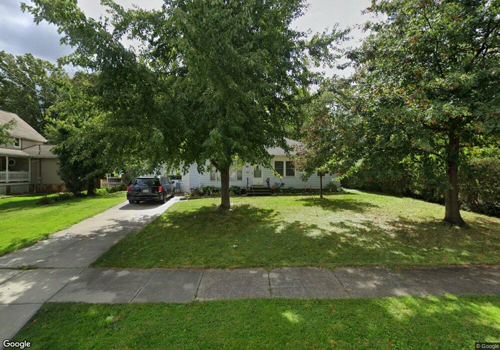
1711 Lorimer Dr Cleveland, OH 44134
Estimated Value: $153,000 - $223,000
3
Beds
1
Bath
1,092
Sq Ft
$172/Sq Ft
Est. Value
About This Home
This home is located at 1711 Lorimer Dr, Cleveland, OH 44134 and is currently estimated at $187,995, approximately $172 per square foot. 1711 Lorimer Dr is a home located in Cuyahoga County with nearby schools including Shiloh Middle School, John Muir Elementary School, and Normandy High School.
Ownership History
Date
Name
Owned For
Owner Type
Purchase Details
Closed on
Jun 11, 2021
Sold by
Moran Paul Mochael and Banks Barbara Lois
Bought by
Schauer Michael
Current Estimated Value
Home Financials for this Owner
Home Financials are based on the most recent Mortgage that was taken out on this home.
Original Mortgage
$116,400
Outstanding Balance
$105,386
Interest Rate
2.9%
Mortgage Type
New Conventional
Estimated Equity
$82,609
Purchase Details
Closed on
Dec 9, 2002
Sold by
Estate Of William T Moran
Bought by
Moran Paul Michael and Mckinley Eileen M
Purchase Details
Closed on
Apr 10, 1985
Sold by
Moran William T and Moran Helen R
Bought by
Moran William T
Purchase Details
Closed on
Jan 1, 1975
Bought by
Moran William T and Moran Helen R
Create a Home Valuation Report for This Property
The Home Valuation Report is an in-depth analysis detailing your home's value as well as a comparison with similar homes in the area
Home Values in the Area
Average Home Value in this Area
Purchase History
| Date | Buyer | Sale Price | Title Company |
|---|---|---|---|
| Schauer Michael | $120,000 | Maximum Title | |
| Moran Paul Michael | -- | -- | |
| Moran William T | -- | -- | |
| Moran William T | -- | -- |
Source: Public Records
Mortgage History
| Date | Status | Borrower | Loan Amount |
|---|---|---|---|
| Open | Schauer Michael | $116,400 |
Source: Public Records
Tax History
| Year | Tax Paid | Tax Assessment Tax Assessment Total Assessment is a certain percentage of the fair market value that is determined by local assessors to be the total taxable value of land and additions on the property. | Land | Improvement |
|---|---|---|---|---|
| 2024 | $3,078 | $47,600 | $18,900 | $28,700 |
| 2023 | $3,439 | $47,600 | $13,370 | $34,230 |
| 2022 | $3,408 | $47,600 | $13,370 | $34,230 |
| 2021 | $3,504 | $47,600 | $13,370 | $34,230 |
| 2020 | $3,254 | $39,030 | $10,960 | $28,070 |
| 2019 | $3,124 | $111,500 | $31,300 | $80,200 |
| 2018 | $2,962 | $39,030 | $10,960 | $28,070 |
| 2017 | $2,946 | $33,990 | $8,820 | $25,170 |
| 2016 | $2,929 | $33,990 | $8,820 | $25,170 |
| 2015 | -- | $33,990 | $8,820 | $25,170 |
| 2014 | -- | $36,550 | $9,490 | $27,060 |
Source: Public Records
Map
Nearby Homes
- 6180 Jamestown Dr
- 2207 Oaklawn Dr
- 100 E Decker Dr
- 916 Clearview Ave
- 423 E Decker Dr
- 5981 Northview Dr
- 2810 Grantwood Dr
- 872 E Dawnwood Dr
- 5651 Broadview Rd Unit C1
- 6258 Carlyle Dr
- 3109 George Ave
- 3255 Woodlawn Dr
- 3303 Ingleside Dr
- 3407 Wellington Ave
- 3319 Norris Ave
- 1196 N Skyline Dr
- 3104 Liggett Dr
- 1026 Joy Oval
- 3214 Liggett Dr
- 3323 Dellwood Dr
- 1719 Lorimer Dr
- 1703 Lorimer Dr
- 1723 Lorimer Dr
- 1621 Lorimer Dr
- 1609 Lorimer Dr
- 1801 Lorimer Dr
- 1716 Lorimer Rd
- 1624 Grantwood Dr
- 1618 Grantwood Dr
- 1702 Lorimer Dr
- 1618 Lorimer Dr
- 1614 Lorimer Dr
- 1720 Grantwood Dr
- 1706 Lorimer Dr
- 1610 Lorimer Dr
- 1716 Lorimer Dr
- 1575 Lorimer Dr
- 1722 Lorimer Rd
- 1608 Grantwood Dr
- 1800 Grantwood Dr
Your Personal Tour Guide
Ask me questions while you tour the home.