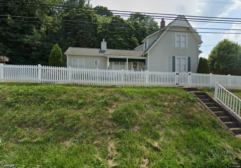
1711 Old Logan Rd SE Lancaster, OH 43130
Estimated Value: $299,000 - $341,636
2
Beds
2
Baths
1,302
Sq Ft
$250/Sq Ft
Est. Value
About This Home
This home is located at 1711 Old Logan Rd SE, Lancaster, OH 43130 and is currently estimated at $325,409, approximately $249 per square foot. 1711 Old Logan Rd SE is a home located in Fairfield County with nearby schools including Berne Union Elementary School, Berne Union High School, and St Mary Elementary School.
Ownership History
Date
Name
Owned For
Owner Type
Purchase Details
Closed on
Nov 8, 2005
Sold by
Deeds Donald E and Deeds Christine
Bought by
Potts Thomas O and Potts Barbara J
Current Estimated Value
Home Financials for this Owner
Home Financials are based on the most recent Mortgage that was taken out on this home.
Original Mortgage
$13,500
Outstanding Balance
$7,438
Interest Rate
6.13%
Mortgage Type
Unknown
Estimated Equity
$317,971
Purchase Details
Closed on
Dec 1, 1987
Create a Home Valuation Report for This Property
The Home Valuation Report is an in-depth analysis detailing your home's value as well as a comparison with similar homes in the area
Home Values in the Area
Average Home Value in this Area
Purchase History
| Date | Buyer | Sale Price | Title Company |
|---|---|---|---|
| Potts Thomas O | $135,000 | Title First | |
| -- | $55,000 | -- |
Source: Public Records
Mortgage History
| Date | Status | Borrower | Loan Amount |
|---|---|---|---|
| Open | Potts Thomas O | $13,500 | |
| Open | Potts Thomas O | $108,000 |
Source: Public Records
Tax History Compared to Growth
Tax History
| Year | Tax Paid | Tax Assessment Tax Assessment Total Assessment is a certain percentage of the fair market value that is determined by local assessors to be the total taxable value of land and additions on the property. | Land | Improvement |
|---|---|---|---|---|
| 2024 | $6,192 | $85,760 | $16,930 | $68,830 |
| 2023 | $2,638 | $85,760 | $16,930 | $68,830 |
| 2022 | $2,649 | $85,760 | $16,930 | $68,830 |
| 2021 | $2,155 | $65,840 | $14,720 | $51,120 |
| 2020 | $2,223 | $67,550 | $14,720 | $52,830 |
| 2019 | $2,228 | $67,550 | $14,720 | $52,830 |
| 2018 | $1,462 | $46,840 | $15,700 | $31,140 |
| 2017 | $1,366 | $48,100 | $15,700 | $32,400 |
| 2016 | $1,343 | $48,100 | $15,700 | $32,400 |
| 2015 | $1,316 | $46,670 | $15,700 | $30,970 |
| 2014 | $1,246 | $46,670 | $15,700 | $30,970 |
| 2013 | $1,246 | $46,670 | $15,700 | $30,970 |
Source: Public Records
Map
Nearby Homes
- 959 Lane St
- 767 S Maple St
- 0 Hornbeck Ave
- 810 4th St
- 915 3rd St
- 855 S Broad St
- 0 Hamburg Rd SW
- 308 Wheat St
- 1406 S Broad St
- 1905 Sugar Grove Rd SE
- 0 Bis Rd SW Unit 225005143
- 126 Twin Creek Way
- 303 Spring St
- 233 Lewis Ave
- 1106 E Walnut St
- 403 S Ewing St
- 403 Reese Ave
- 1112 E Chestnut St
- 534 E Wheeling St
- 507 W Hubert Ave
- 998 Woodland Ave
- 1208 Old Logan Rd
- 988 Woodland Ave
- 1775 Old Logan Rd SE
- 1375 Old Logan Rd
- 948 Ford St
- 947 Ford St
- 1795 Old Logan Rd SE
- 936 Ford St
- 939 Ford St
- 934 Ford St
- 1377 S Memorial Dr
- 240 Ford St
- 1132 Joyce Ave
- 0 Terry St
- 2222 Brentford St Unit WATERFORD
- 2222 Brentford St Unit MAPLEWOOD
- 2222 Brentford St Unit BELMONT INSIDE
- 1815 Old Logan Rd SE
- 929 Ford St