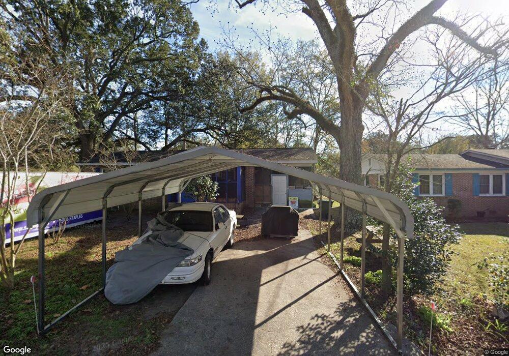
1711 Robin Rd Conway, SC 29527
Estimated Value: $112,000 - $160,000
3
Beds
2
Baths
1,040
Sq Ft
$132/Sq Ft
Est. Value
About This Home
This home is located at 1711 Robin Rd, Conway, SC 29527 and is currently estimated at $137,054, approximately $131 per square foot. 1711 Robin Rd is a home located in Horry County with nearby schools including Waccamaw Elementary School, Black Water Middle School, and Carolina Forest High School.
Ownership History
Date
Name
Owned For
Owner Type
Purchase Details
Closed on
Nov 9, 2016
Sold by
Rogers Aswan
Bought by
Rogers Charlie G
Current Estimated Value
Purchase Details
Closed on
Sep 9, 2015
Sold by
Estate Of Doris A Herriott Warren
Bought by
Hill Christine D and Rogers Sabrina D
Purchase Details
Closed on
Oct 29, 2013
Sold by
Spain John H
Bought by
Herriott Warren Doris A
Purchase Details
Closed on
Sep 24, 2013
Sold by
Spain Christine L
Bought by
Spain John H
Purchase Details
Closed on
Aug 3, 2012
Sold by
Spain Christine L
Bought by
Herriott Warren Doris A
Create a Home Valuation Report for This Property
The Home Valuation Report is an in-depth analysis detailing your home's value as well as a comparison with similar homes in the area
Home Values in the Area
Average Home Value in this Area
Purchase History
| Date | Buyer | Sale Price | Title Company |
|---|---|---|---|
| Rogers Charlie G | -- | -- | |
| Hill Christine D | -- | -- | |
| Herriott Warren Doris A | -- | -- | |
| Herriott Warren Doris A | -- | -- | |
| Spain John H | -- | -- | |
| Spain John H | -- | -- | |
| Herriott Warren Doris A | -- | -- |
Source: Public Records
Tax History
| Year | Tax Paid | Tax Assessment Tax Assessment Total Assessment is a certain percentage of the fair market value that is determined by local assessors to be the total taxable value of land and additions on the property. | Land | Improvement |
|---|---|---|---|---|
| 2025 | $1,740 | $0 | $0 | $0 |
| 2024 | $1,740 | $6,455 | $2,326 | $4,129 |
| 2023 | $1,418 | $3,082 | $310 | $2,772 |
| 2021 | $158 | $4,623 | $465 | $4,158 |
| 2020 | $148 | $4,623 | $465 | $4,158 |
| 2019 | $148 | $4,623 | $465 | $4,158 |
| 2018 | $0 | $4,161 | $465 | $3,696 |
| 2017 | -- | $4,161 | $465 | $3,696 |
| 2016 | -- | $4,161 | $465 | $3,696 |
| 2015 | $112 | $2,774 | $310 | $2,464 |
| 2014 | $383 | $2,774 | $310 | $2,464 |
Source: Public Records
Map
Nearby Homes
- TBD 4.48 acres E Highway 501
- TBD HWY 501 E Highway 501
- 903 Durant St
- TBD Highway 378
- 2204 6th Ave
- 1009 Tin Top Aly
- 1011 Tin Top Aly
- 1011 Hickory Cir
- 1708 9th Ave
- 1105 Hickory Dr
- 411 Apple Ln
- 1795 Hemingway St
- 1503 Ward Cir
- 1613 4th Ave
- 7921 U S 701 Hwy
- 1520 4th Ave
- 1712 Singleton St
- 351 Myrtle St Unit 413D
- 354 Myrtle St Unit 469C
- 352 Myrtle St Unit 469B
- 1713 Robin Rd
- 1708 Hiland Ave
- 1715 Robin Rd
- 1710 Robin Rd
- 1708 Robin Rd
- 1712 Robin Rd
- 1712 Hiland Ave
- 1700 Hiland Ave
- 1717 Robin Rd
- 1714 Robin Rd
- 1711 Hiland Ave
- 1714 Hiland Ave
- 1709 Hiland Ave
- 1710A Hiland Ave
- 1710 Hiland Ave
- 1713 Hiland Ave
- 1713 Hiland Ave Unit 1713 B Hiland Ave
- 1623 9th Ave
- 1719 Robin Rd
- 1625 9th Ave
Your Personal Tour Guide
Ask me questions while you tour the home.