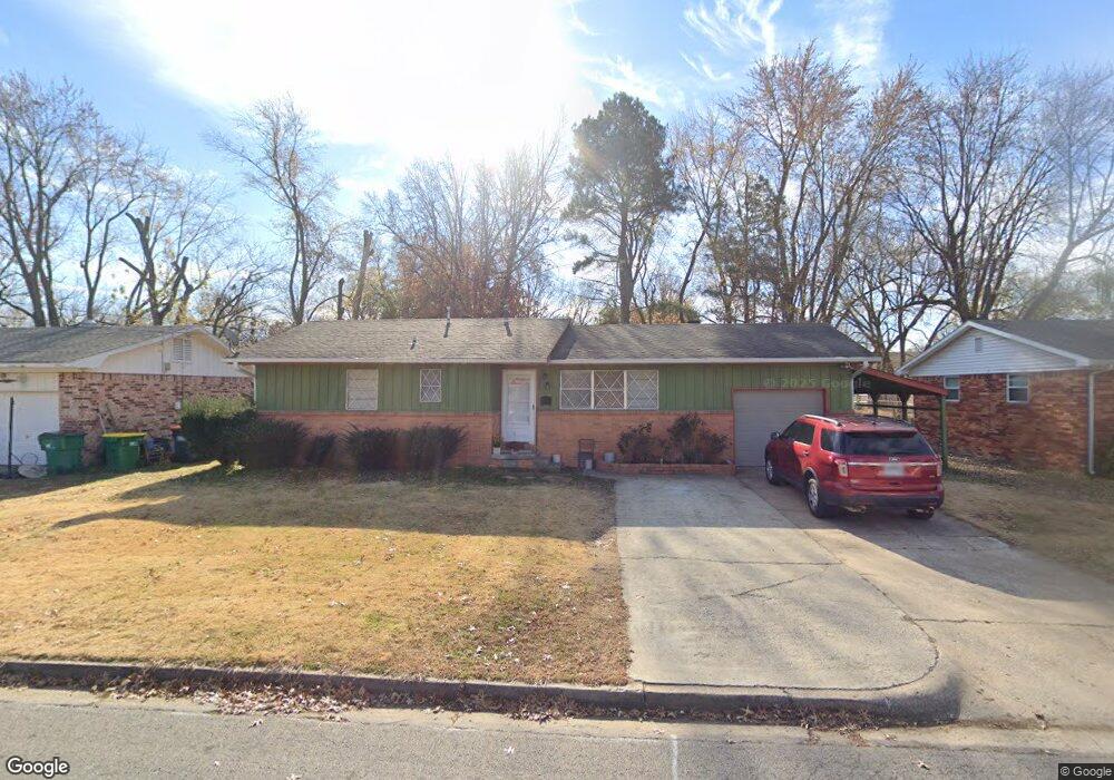
1711 Sisco Ave Springdale, AR 72762
Estimated Value: $214,000 - $231,000
Studio
1
Bath
1,258
Sq Ft
$176/Sq Ft
Est. Value
About This Home
This home is located at 1711 Sisco Ave, Springdale, AR 72762 and is currently estimated at $221,620, approximately $176 per square foot. 1711 Sisco Ave is a home located in Washington County with nearby schools including Westwood Elementary School, Southwest Junior High School, and Helen Tyson Middle School.
Ownership History
Date
Name
Owned For
Owner Type
Purchase Details
Closed on
Jul 20, 2005
Sold by
Escuadra Alejandro A
Bought by
Lopez Leonel Jauregui
Current Estimated Value
Home Financials for this Owner
Home Financials are based on the most recent Mortgage that was taken out on this home.
Original Mortgage
$65,000
Outstanding Balance
$33,540
Interest Rate
5.58%
Mortgage Type
Fannie Mae Freddie Mac
Estimated Equity
$188,080
Purchase Details
Closed on
Mar 31, 1997
Bought by
Escuadra Alejandro A
Purchase Details
Closed on
Jul 22, 1993
Bought by
Usrey Wesley A and Usrey Linda A
Purchase Details
Closed on
Dec 20, 1991
Bought by
Kesner Jim
Purchase Details
Closed on
Jul 7, 1977
Bought by
Otis Ronald Lee and Otis Leonda M
Create a Home Valuation Report for This Property
The Home Valuation Report is an in-depth analysis detailing your home's value as well as a comparison with similar homes in the area
Purchase History
| Date | Buyer | Sale Price | Title Company |
|---|---|---|---|
| Lopez Leonel Jauregui | $65,000 | Lenders | |
| Escuadra Alejandro A | $63,000 | -- | |
| Usrey Wesley A | $54,000 | -- | |
| Kesner Jim | $45,000 | -- | |
| Otis Ronald Lee | -- | -- |
Source: Public Records
Mortgage History
| Date | Status | Borrower | Loan Amount |
|---|---|---|---|
| Open | Lopez Leonel Jauregui | $65,000 |
Source: Public Records
Tax History
| Year | Tax Paid | Tax Assessment Tax Assessment Total Assessment is a certain percentage of the fair market value that is determined by local assessors to be the total taxable value of land and additions on the property. | Land | Improvement |
|---|---|---|---|---|
| 2025 | $233 | $36,010 | $14,000 | $22,010 |
| 2024 | $333 | $36,010 | $14,000 | $22,010 |
| 2023 | $424 | $36,010 | $14,000 | $22,010 |
| 2022 | $474 | $26,010 | $6,000 | $20,010 |
| 2021 | $474 | $26,010 | $6,000 | $20,010 |
| 2020 | $474 | $26,010 | $6,000 | $20,010 |
| 2019 | $433 | $15,340 | $4,500 | $10,840 |
| 2018 | $458 | $15,340 | $4,500 | $10,840 |
| 2017 | $451 | $15,340 | $4,500 | $10,840 |
| 2016 | $451 | $15,340 | $4,500 | $10,840 |
| 2015 | $451 | $15,340 | $4,500 | $10,840 |
| 2014 | $525 | $16,770 | $4,500 | $12,270 |
Source: Public Records
Map
Nearby Homes
- TBD N Westwood Ln
- 1714 Horseshoe Dr
- TBD W Emma (New) Ave
- 1807 Westwood Ave
- 1713 W Huntsville Ave
- 1825 McRay Ave
- 2000 A & B Dee Ave
- 1510 Circle Dr
- 2005 Patti Ave
- 2003 Dee Ave
- 508 Geneva St
- 126 Rogers Circle Dr
- 2007 W Huntsville Ave
- 506 Dyer St
- 1713 Shelby Ave
- 603 Thomas Blvd
- 2014 Dee Ave
- 500 N West End St
- 2107 Patti Ave
- 301 Michael St
Your Personal Tour Guide
Ask me questions while you tour the home.