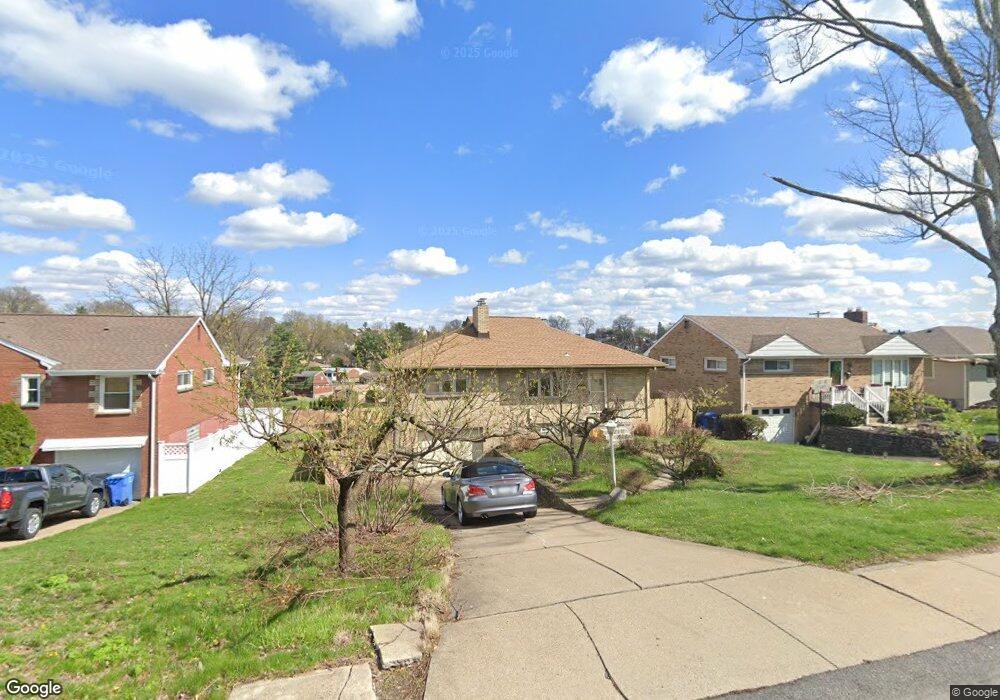
1711 Worcester Dr Pittsburgh, PA 15243
Estimated Value: $267,000 - $282,000
3
Beds
2
Baths
1,248
Sq Ft
$221/Sq Ft
Est. Value
About This Home
This home is located at 1711 Worcester Dr, Pittsburgh, PA 15243 and is currently estimated at $275,738, approximately $220 per square foot. 1711 Worcester Dr is a home located in Allegheny County with nearby schools including Chartiers Valley Primary School, Chartiers Valley Intermediate School, and Chartiers Valley Middle School.
Ownership History
Date
Name
Owned For
Owner Type
Purchase Details
Closed on
Jul 17, 2007
Sold by
Amato Michelle L
Bought by
Isaac Michael C
Current Estimated Value
Purchase Details
Closed on
Nov 27, 2002
Sold by
Greenberg Florence and Greenberg Paul
Bought by
Amato Michelle L
Purchase Details
Closed on
Jun 17, 2002
Sold by
Greenberg Paul and Greenberg Peggy
Bought by
Greenberg Florence and Greenberg Peggy
Create a Home Valuation Report for This Property
The Home Valuation Report is an in-depth analysis detailing your home's value as well as a comparison with similar homes in the area
Home Values in the Area
Average Home Value in this Area
Purchase History
| Date | Buyer | Sale Price | Title Company |
|---|---|---|---|
| Isaac Michael C | $150,000 | -- | |
| Amato Michelle L | $113,000 | -- | |
| Greenberg Florence | -- | -- |
Source: Public Records
Tax History Compared to Growth
Tax History
| Year | Tax Paid | Tax Assessment Tax Assessment Total Assessment is a certain percentage of the fair market value that is determined by local assessors to be the total taxable value of land and additions on the property. | Land | Improvement |
|---|---|---|---|---|
| 2025 | $3,891 | $118,300 | $40,200 | $78,100 |
| 2024 | $3,891 | $118,300 | $40,200 | $78,100 |
| 2023 | $3,466 | $118,300 | $40,200 | $78,100 |
| 2022 | $3,390 | $118,300 | $40,200 | $78,100 |
| 2021 | $560 | $118,300 | $40,200 | $78,100 |
| 2020 | $3,249 | $118,300 | $40,200 | $78,100 |
| 2019 | $3,191 | $118,300 | $40,200 | $78,100 |
| 2018 | $560 | $118,300 | $40,200 | $78,100 |
| 2017 | $3,155 | $118,300 | $40,200 | $78,100 |
| 2016 | $560 | $118,300 | $40,200 | $78,100 |
| 2015 | $560 | $118,300 | $40,200 | $78,100 |
| 2014 | $2,991 | $118,300 | $40,200 | $78,100 |
Source: Public Records
Map
Nearby Homes
- 1612 Worcester Dr
- 1923 Berkwood Dr
- 1512 Worcester Dr
- 1960 Worcester Dr
- 1963 Worcester Dr
- 623 Kelso Rd
- 2026 Borland Rd
- 2075 Borland Rd
- 1808 Sillview Dr
- 855 Lochlin Dr
- 2066 Spring Valley Rd
- 600 Pat Haven Dr
- 809 Bethany Dr
- 1304 Bower Hill Rd
- 1299 Sylvandell Dr
- 1223 Driftwood Dr
- 840 Robb Hollow Rd
- 1241 Arrowood Dr
- 50 Robb Hollow Rd
- 1371 Blue Jay Dr
- 1715 Worcester Dr
- 1707 Worcester Dr
- 1721 Worcester Dr
- 1701 Worcester Dr
- 1710 Berkwood Dr
- 1714 Berkwood Dr
- 1706 Berkwood Dr
- 1725 Worcester Dr
- 1712 Worcester Dr
- 1651 Worcester Dr
- 1720 Berkwood Dr
- 1700 Berkwood Dr
- 1708 Worcester Dr
- 1718 Worcester Dr
- 1724 Berkwood Dr
- 1702 Worcester Dr
- 1729 Worcester Dr
- 1722 Worcester Dr
- 1638 Berkwood Dr
- 1647 Worcester Dr