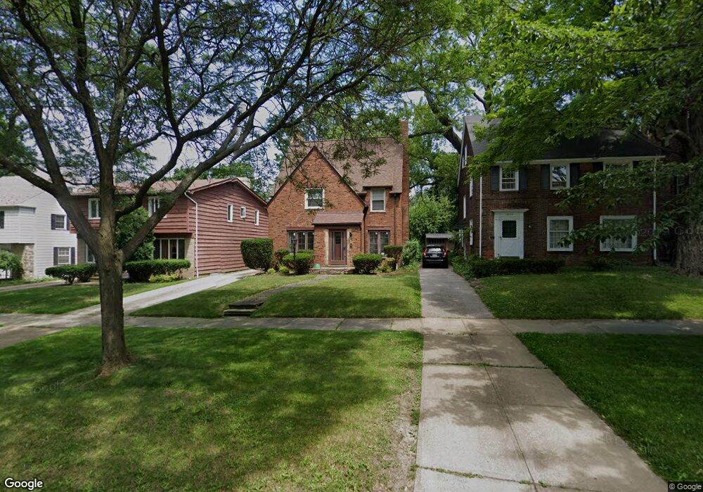
17113 Scottsdale Blvd Cleveland, OH 44120
Estimated Value: $211,000 - $284,000
3
Beds
2
Baths
1,834
Sq Ft
$136/Sq Ft
Est. Value
About This Home
This home is located at 17113 Scottsdale Blvd, Cleveland, OH 44120 and is currently estimated at $249,348, approximately $135 per square foot. 17113 Scottsdale Blvd is a home located in Cuyahoga County with nearby schools including Fernway Elementary School, Woodbury Elementary School, and Shaker Heights Middle School.
Ownership History
Date
Name
Owned For
Owner Type
Purchase Details
Closed on
Jan 26, 2024
Sold by
Payne Keith V and Tracy Lea
Bought by
Payne Keith V and Payne Tracy Learrington
Current Estimated Value
Purchase Details
Closed on
Oct 29, 1999
Sold by
Thornton George L and Thornton Delores
Bought by
Payne Keith
Home Financials for this Owner
Home Financials are based on the most recent Mortgage that was taken out on this home.
Original Mortgage
$123,364
Interest Rate
7.87%
Mortgage Type
FHA
Purchase Details
Closed on
Mar 29, 1985
Sold by
Thornton Geo L and Thornton Delores
Bought by
Thornton George L and Thornton Delores
Purchase Details
Closed on
Jan 1, 1975
Bought by
Thornton Geo L and Thornton Delores
Create a Home Valuation Report for This Property
The Home Valuation Report is an in-depth analysis detailing your home's value as well as a comparison with similar homes in the area
Home Values in the Area
Average Home Value in this Area
Purchase History
| Date | Buyer | Sale Price | Title Company |
|---|---|---|---|
| Payne Keith V | -- | Harvard Title | |
| Payne Keith | $127,000 | Progressive Land Title | |
| Thornton George L | -- | -- | |
| Thornton Geo L | -- | -- |
Source: Public Records
Mortgage History
| Date | Status | Borrower | Loan Amount |
|---|---|---|---|
| Previous Owner | Payne Keith | $123,364 |
Source: Public Records
Tax History Compared to Growth
Tax History
| Year | Tax Paid | Tax Assessment Tax Assessment Total Assessment is a certain percentage of the fair market value that is determined by local assessors to be the total taxable value of land and additions on the property. | Land | Improvement |
|---|---|---|---|---|
| 2024 | $7,183 | $80,360 | $15,260 | $65,100 |
| 2023 | $6,795 | $60,280 | $11,520 | $48,760 |
| 2022 | $6,605 | $60,270 | $11,520 | $48,760 |
| 2021 | $6,583 | $60,270 | $11,520 | $48,760 |
| 2020 | $6,361 | $54,780 | $10,470 | $44,310 |
| 2019 | $6,269 | $156,500 | $29,900 | $126,600 |
| 2018 | $6,074 | $54,780 | $10,470 | $44,310 |
| 2017 | $6,093 | $50,330 | $9,030 | $41,300 |
| 2016 | $5,850 | $50,330 | $9,030 | $41,300 |
| 2015 | $5,948 | $50,330 | $9,030 | $41,300 |
| 2014 | $5,948 | $49,360 | $8,860 | $40,500 |
Source: Public Records
Map
Nearby Homes
- 3702 Daleford Rd
- 16805 Scottsdale Blvd
- 3662 Avalon Rd
- 17426 Invermere Ave
- 17104 Throckley Ave
- 3716 Rolliston Rd
- 17008 Throckley Ave
- 17211 Walden Ave
- 17511 Throckley Ave
- 17416 Throckley Ave
- 3658 Normandy Rd
- 17422 Lomond Blvd
- 17425 Walden Ave
- 3666 Lindholm Rd
- 17725 Scottsdale Blvd
- 17718 Lomond Blvd
- 17415 Talford Ave
- 3624 Rolliston Rd
- 17120 Talford Ave
- 17604 Walden Ave
- 17117 Scottsdale Blvd
- 17109 Scottsdale Blvd
- 17121 Scottsdale Blvd
- 17105 Scottsdale Blvd
- 3727 Riedham Rd
- 3726 Avalon Rd
- 17125 Scottsdale Blvd
- 3723 Riedham Rd
- 3719 Riedham Rd
- 17025 Scottsdale Blvd
- 3718 Avalon Rd
- 3715 Riedham Rd
- 17118 Scottsdale Blvd
- 17112 Scottsdale Blvd
- 3714 Avalon Rd
- 17122 Scottsdale Blvd
- 17021 Scottsdale Blvd
- 17106 Scottsdale Blvd
- 3728 Riedham Rd
- 3711 Riedham Rd