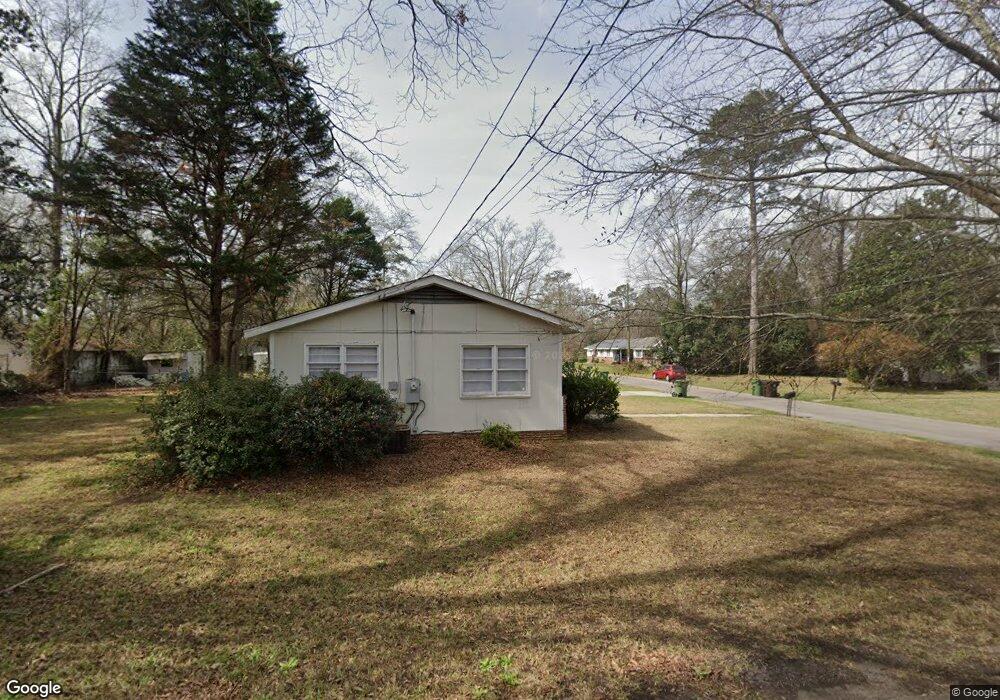
1712 Creekmore Ln Hattiesburg, MS 39401
The Heights-Avenues NeighborhoodEstimated Value: $104,000 - $146,000
3
Beds
2
Baths
1,215
Sq Ft
$110/Sq Ft
Est. Value
About This Home
This home is located at 1712 Creekmore Ln, Hattiesburg, MS 39401 and is currently estimated at $133,432, approximately $109 per square foot. 1712 Creekmore Ln is a home located in Forrest County with nearby schools including Woodley Elementary School, N.R. Burger Middle School, and Hattiesburg High School.
Ownership History
Date
Name
Owned For
Owner Type
Purchase Details
Closed on
Apr 15, 2011
Sold by
Bagingito Julia M
Bought by
Creekmore Land Properties Ii Llc
Current Estimated Value
Purchase Details
Closed on
Mar 26, 2010
Sold by
Browning Doug and Browning Jennifer
Bought by
Bagingito Julia M
Home Financials for this Owner
Home Financials are based on the most recent Mortgage that was taken out on this home.
Original Mortgage
$80,108
Interest Rate
5.02%
Create a Home Valuation Report for This Property
The Home Valuation Report is an in-depth analysis detailing your home's value as well as a comparison with similar homes in the area
Home Values in the Area
Average Home Value in this Area
Purchase History
| Date | Buyer | Sale Price | Title Company |
|---|---|---|---|
| Creekmore Land Properties Ii Llc | -- | -- | |
| Bagingito Julia M | -- | -- |
Source: Public Records
Mortgage History
| Date | Status | Borrower | Loan Amount |
|---|---|---|---|
| Previous Owner | Bagingito Julia M | $80,108 |
Source: Public Records
Tax History Compared to Growth
Tax History
| Year | Tax Paid | Tax Assessment Tax Assessment Total Assessment is a certain percentage of the fair market value that is determined by local assessors to be the total taxable value of land and additions on the property. | Land | Improvement |
|---|---|---|---|---|
| 2024 | $1,507 | $8,176 | $0 | $0 |
| 2023 | $1,507 | $54,500 | $0 | $0 |
| 2022 | $1,510 | $8,176 | $0 | $0 |
| 2021 | $1,510 | $8,176 | $0 | $0 |
| 2020 | $1,457 | $7,966 | $0 | $0 |
| 2019 | $1,452 | $7,966 | $0 | $0 |
| 2018 | $1,457 | $7,966 | $0 | $0 |
| 2017 | $1,447 | $7,966 | $0 | $0 |
| 2016 | $1,421 | $7,874 | $0 | $0 |
| 2015 | -- | $7,874 | $0 | $0 |
| 2014 | -- | $7,874 | $0 | $0 |
Source: Public Records
Map
Nearby Homes
- 1714 Creekmore Ln
- 106 Dixie Ave
- 105 Dixie Ave
- 1716 Creekmore Ln
- 1715 Creekmore Ln
- 109 Dixie Ave
- 101 Dixie Ave
- 1718 Creekmore Ln
- 1717 Creekmore Ln
- 115 Dixie Ave
- 1711 Hardy St
- 1721 Hardy St
- 1719 Creekmore Ln
- 1804 Pearl St
- 111 S 17th Ave
- 105 Park Ave
- 906 Wedgewood Dr
- 103 Park Ave
- 211 Dixie Ave
- 908 Wedgewood Dr