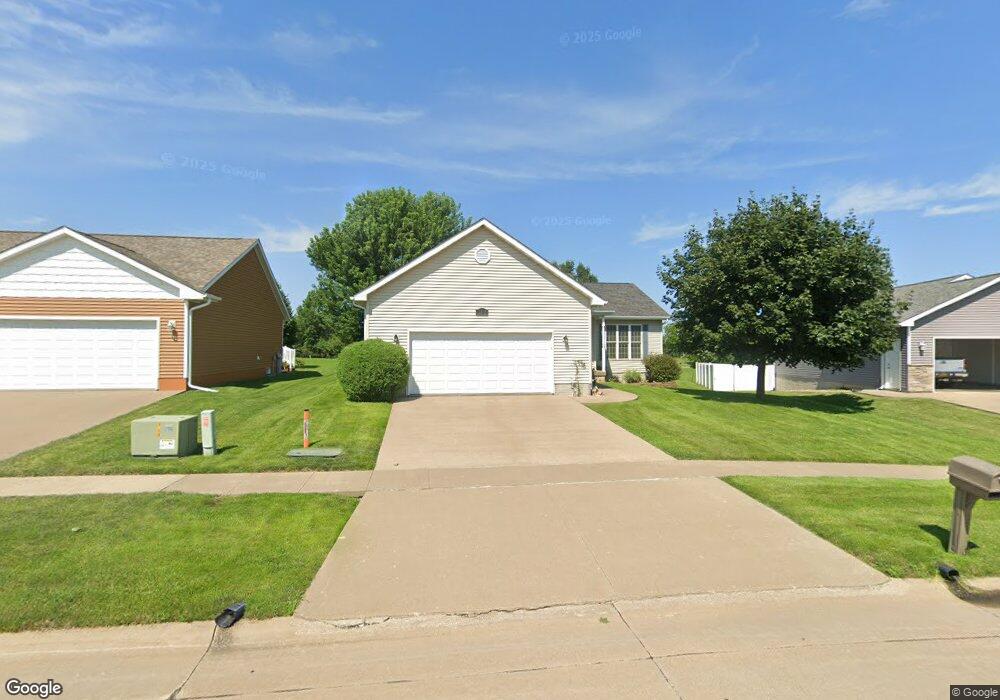
1712 Duncan Dr Muscatine, IA 52761
Estimated Value: $273,000 - $315,000
2
Beds
5
Baths
1,216
Sq Ft
$242/Sq Ft
Est. Value
About This Home
This home is located at 1712 Duncan Dr, Muscatine, IA 52761 and is currently estimated at $293,778, approximately $241 per square foot. 1712 Duncan Dr is a home located in Muscatine County with nearby schools including McKinley Elementary School, Susan Clark Junior High School, and Muscatine High School.
Ownership History
Date
Name
Owned For
Owner Type
Purchase Details
Closed on
Nov 1, 2013
Sold by
Zeck Gary L and Zeck Jane A
Bought by
Robbs Ernest C and Robbs Joy L
Current Estimated Value
Home Financials for this Owner
Home Financials are based on the most recent Mortgage that was taken out on this home.
Original Mortgage
$131,250
Outstanding Balance
$98,918
Interest Rate
4.5%
Mortgage Type
New Conventional
Estimated Equity
$194,860
Purchase Details
Closed on
Jul 6, 2007
Sold by
Vazquez Ramiro and Vazquez Guadalupe
Bought by
Zeck Gary L and Zeck Jane A
Home Financials for this Owner
Home Financials are based on the most recent Mortgage that was taken out on this home.
Original Mortgage
$60,000
Interest Rate
6.37%
Mortgage Type
New Conventional
Create a Home Valuation Report for This Property
The Home Valuation Report is an in-depth analysis detailing your home's value as well as a comparison with similar homes in the area
Home Values in the Area
Average Home Value in this Area
Purchase History
| Date | Buyer | Sale Price | Title Company |
|---|---|---|---|
| Robbs Ernest C | $175,000 | None Available | |
| Zeck Gary L | $160,500 | None Available |
Source: Public Records
Mortgage History
| Date | Status | Borrower | Loan Amount |
|---|---|---|---|
| Open | Robbs Ernest C | $131,250 | |
| Previous Owner | Zeck Gary L | $60,000 |
Source: Public Records
Tax History Compared to Growth
Tax History
| Year | Tax Paid | Tax Assessment Tax Assessment Total Assessment is a certain percentage of the fair market value that is determined by local assessors to be the total taxable value of land and additions on the property. | Land | Improvement |
|---|---|---|---|---|
| 2025 | $4,480 | $256,910 | $33,410 | $223,500 |
| 2024 | $4,480 | $257,370 | $33,410 | $223,960 |
| 2023 | $4,332 | $259,350 | $33,411 | $225,939 |
| 2022 | $3,762 | $218,260 | $31,520 | $186,740 |
| 2021 | $3,762 | $193,310 | $31,520 | $161,790 |
| 2020 | $3,774 | $193,310 | $31,520 | $161,790 |
| 2019 | $3,706 | $176,320 | $0 | $0 |
| 2018 | $3,652 | $176,320 | $0 | $0 |
| 2017 | $3,652 | $168,280 | $0 | $0 |
| 2016 | $3,608 | $168,280 | $0 | $0 |
| 2015 | $3,608 | $165,710 | $0 | $0 |
| 2014 | $3,574 | $157,530 | $0 | $0 |
Source: Public Records
Map
Nearby Homes
- 1604 Duncan Dr
- 3103 Ginkgo Ln
- 3010 W Fulliam Ave
- 1507 Duncan Dr
- 1416 Duncan Dr
- 3120 Linden Ln
- CEDAR Plaza Parcel
- 2018 W Bay Dr
- 2106 Clarabek St
- 2108 Clarabek St
- 1617 W Acre Dr
- 2210 Imperial Oaks Dr
- 1619 Devitt Ave
- 2109 Americana Ave
- LOT 4 Fridley Subdivision
- 208 Fletcher Ave
- 1902 W Fulliam Ave
- LOT 6 Fridley Subdivision
- 2207 Lucas St
- PARCEL ID 0834280023 Dillaway St
- LOT 29 Duncan Dr
- 1708 Duncan Dr
- 1716 Duncan Dr
- 1704 Duncan Dr
- 1800 Duncan Dr
- 1807 Duncan Dr
- 1707 Duncan Dr
- 1804 Duncan Dr
- 3025 W Fulliam Ave
- 1811 Duncan Dr
- 1808 Duncan Dr
- 1613 Duncan Dr
- 3114 Harmony Ln
- 3110 Harmony Ln
- 3021 W Fulliam Ave
- 3106 Harmony Ln
- 1812 Duncan Dr
- 1609 Duncan Dr
- 3200 Harmony Ln
- 3102 Harmony Ln