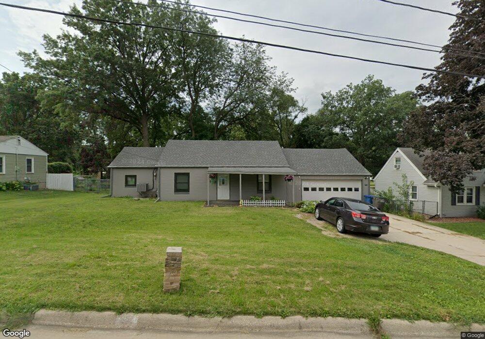
1712 Highview Dr Des Moines, IA 50315
Watrous South NeighborhoodEstimated Value: $223,000 - $241,000
2
Beds
1
Bath
1,456
Sq Ft
$158/Sq Ft
Est. Value
About This Home
This home is located at 1712 Highview Dr, Des Moines, IA 50315 and is currently estimated at $229,350, approximately $157 per square foot. 1712 Highview Dr is a home located in Polk County with nearby schools including Wright Elementary School, Brody Middle School, and Lincoln High School.
Ownership History
Date
Name
Owned For
Owner Type
Purchase Details
Closed on
Jan 28, 2016
Sold by
Naberhaus Adam P and Naberhaus Alena L
Bought by
Paxton Kenneth and Paxton Alexandria
Current Estimated Value
Home Financials for this Owner
Home Financials are based on the most recent Mortgage that was taken out on this home.
Original Mortgage
$119,790
Outstanding Balance
$96,619
Interest Rate
4.4%
Mortgage Type
FHA
Estimated Equity
$132,731
Purchase Details
Closed on
Sep 8, 2011
Sold by
Wilson David E and Wilson Linda R
Bought by
Naberhaus Adam P and Naberhaus Alena I
Home Financials for this Owner
Home Financials are based on the most recent Mortgage that was taken out on this home.
Original Mortgage
$91,824
Interest Rate
3.37%
Mortgage Type
New Conventional
Create a Home Valuation Report for This Property
The Home Valuation Report is an in-depth analysis detailing your home's value as well as a comparison with similar homes in the area
Home Values in the Area
Average Home Value in this Area
Purchase History
| Date | Buyer | Sale Price | Title Company |
|---|---|---|---|
| Paxton Kenneth | $122,000 | None Available | |
| Naberhaus Adam P | $92,500 | None Available |
Source: Public Records
Mortgage History
| Date | Status | Borrower | Loan Amount |
|---|---|---|---|
| Open | Paxton Kenneth | $119,790 | |
| Previous Owner | Naberhaus Adam P | $91,824 |
Source: Public Records
Tax History
| Year | Tax Paid | Tax Assessment Tax Assessment Total Assessment is a certain percentage of the fair market value that is determined by local assessors to be the total taxable value of land and additions on the property. | Land | Improvement |
|---|---|---|---|---|
| 2025 | $3,796 | $213,800 | $40,000 | $173,800 |
| 2024 | $3,796 | $203,400 | $37,400 | $166,000 |
| 2023 | $3,620 | $203,400 | $37,400 | $166,000 |
| 2022 | $3,592 | $162,500 | $31,100 | $131,400 |
| 2021 | $3,492 | $162,500 | $31,100 | $131,400 |
| 2020 | $3,622 | $148,500 | $28,300 | $120,200 |
| 2019 | $3,338 | $148,500 | $28,300 | $120,200 |
| 2018 | $3,298 | $132,700 | $24,700 | $108,000 |
| 2017 | $3,074 | $132,700 | $24,700 | $108,000 |
| 2016 | $2,990 | $122,200 | $22,400 | $99,800 |
| 2015 | $2,990 | $122,200 | $22,400 | $99,800 |
| 2014 | $2,816 | $114,700 | $20,600 | $94,100 |
Source: Public Records
Map
Nearby Homes
- 1616 Southlawn Dr
- 1515 Highview Dr
- 1512 Highview Dr
- 6006 SW 15th St
- 2008 Southlawn Dr
- 6001 SW 13th Place
- 5413 SW 19th St
- 1304 Wall Ave
- 1310 Leland Ave
- 6504 SW 17th St
- 1324 Army Post Rd
- 1715 Frazier Ave
- 5120 SW 14th St
- 5915 SW 12th St
- 1225 West St
- 1014 Leland Ave
- 919 Randolph St
- 6824 SW 15th St
- 1243 Hackley Ave
- 6825 SW 15th St
- 1706 Highview Dr
- 1716 Highview Dr
- 1702 Highview Dr
- 1721 Payton Ave
- 1715 Payton Ave
- 1725 Payton Ave
- 1616 Highview Dr
- 1804 Highview Dr
- 1701 Payton Ave
- 1711 Highview Dr
- 1705 Highview Dr
- 1715 Highview Dr
- 5908 SW 18th St
- 1701 Highview Dr
- 1625 Payton Ave
- 1612 Highview Dr
- 1808 Highview Dr
- 1615 Highview Dr
- 1801 Highview Dr
- 1807 Payton Ave
Your Personal Tour Guide
Ask me questions while you tour the home.