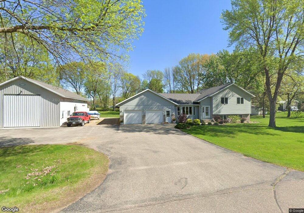
1712 Le Sueur Ave Mankato, MN 56001
Estimated Value: $403,716 - $439,000
5
Beds
2
Baths
1,352
Sq Ft
$312/Sq Ft
Est. Value
About This Home
This home is located at 1712 Le Sueur Ave, Mankato, MN 56001 and is currently estimated at $421,429, approximately $311 per square foot. 1712 Le Sueur Ave is a home located in Blue Earth County with nearby schools including Roosevelt Elementary School, Dakota Meadows Middle School, and Mankato West Senior High School.
Ownership History
Date
Name
Owned For
Owner Type
Purchase Details
Closed on
Jul 31, 2017
Sold by
Rasmussen Randy S and Rasmussen Lana M
Bought by
Avina Monte James and Avina Susan Lee
Current Estimated Value
Home Financials for this Owner
Home Financials are based on the most recent Mortgage that was taken out on this home.
Original Mortgage
$150,000
Outstanding Balance
$124,960
Interest Rate
3.9%
Mortgage Type
New Conventional
Estimated Equity
$296,469
Create a Home Valuation Report for This Property
The Home Valuation Report is an in-depth analysis detailing your home's value as well as a comparison with similar homes in the area
Home Values in the Area
Average Home Value in this Area
Purchase History
| Date | Buyer | Sale Price | Title Company |
|---|---|---|---|
| Avina Monte James | $312,500 | North American Title |
Source: Public Records
Mortgage History
| Date | Status | Borrower | Loan Amount |
|---|---|---|---|
| Open | Avina Monte James | $150,000 |
Source: Public Records
Tax History Compared to Growth
Tax History
| Year | Tax Paid | Tax Assessment Tax Assessment Total Assessment is a certain percentage of the fair market value that is determined by local assessors to be the total taxable value of land and additions on the property. | Land | Improvement |
|---|---|---|---|---|
| 2025 | $3,272 | $375,500 | $45,900 | $329,600 |
| 2024 | $3,272 | $328,300 | $45,900 | $282,400 |
| 2023 | $3,510 | $349,700 | $45,900 | $303,800 |
| 2022 | $3,120 | $334,300 | $45,900 | $288,400 |
| 2021 | $3,092 | $270,900 | $45,900 | $225,000 |
| 2020 | $2,840 | $249,800 | $36,700 | $213,100 |
| 2019 | $2,300 | $249,800 | $36,700 | $213,100 |
| 2018 | $1,940 | $228,300 | $36,700 | $191,600 |
| 2017 | $1,742 | $205,700 | $36,700 | $169,000 |
| 2016 | $1,680 | $198,700 | $36,700 | $162,000 |
| 2015 | $17 | $170,900 | $22,800 | $148,100 |
| 2014 | $1,790 | $172,800 | $22,800 | $150,000 |
Source: Public Records
Map
Nearby Homes
- 210 Bird St S
- 204 Sturgis St N
- 204 204 N Sturgis St
- 237 W Skyline Ct
- 237 237 W Skyline Ct
- 629 Marie Ln
- 626 Marie Ln
- 233 Allan Ave
- 55856 River Fort Dr
- 630 Marie Ln
- 3202 3202 Noble Dr
- 3111 3111 Scotch Ln
- 1030 Oak Terrace Dr
- 1030 1030 Oak Terrace Dr
- 19 19 Skyline Dr
- 23 23 Holiday Ct
- 31 Holiday Ct
- 31 31 Holiday Ct
- 419 Royal Rd
- 17 Oriole Place
- 1712 1712 Lesueur Ave
- 1730 Le Sueur Ave
- 1634 Le Sueur Ave
- XX Goldeneye
- 1713 Le Sueur Ave
- 1715 Goldeneye Ave
- 1637 Goldeneye Ave
- 1635 5th St
- 1635 Goldeneye Ave
- 1721 Le Sueur Ave
- 000 Henning Ln
- 1619 Goldeneye Ave
- 1629 Le Sueur Ave
- 1712 Goldeneye Ave
- 1729 Goldeneye Ave
- 414 Union St
- 1632 Goldeneye Ave
- 1632 Goldeneye Ave Unit 1632 Goldeneye Avenu
- 1618 Goldeneye Ave
- 410 Pintail St