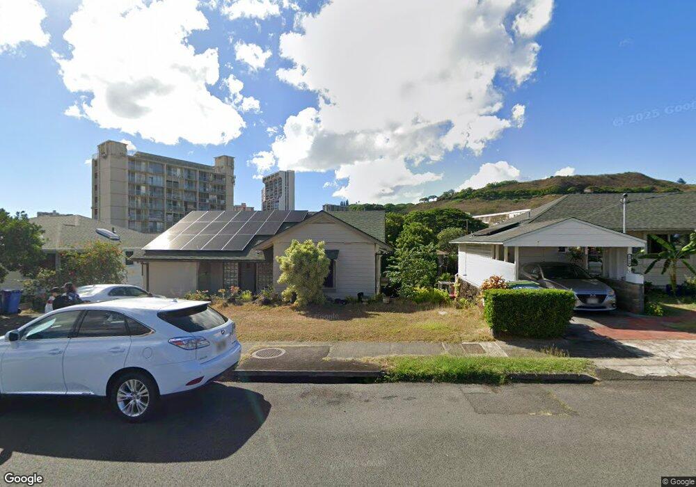
1712 Lewalani Dr Honolulu, HI 96822
Makiki NeighborhoodEstimated Value: $1,388,000 - $1,703,000
3
Beds
2
Baths
1,380
Sq Ft
$1,138/Sq Ft
Est. Value
About This Home
This home is located at 1712 Lewalani Dr, Honolulu, HI 96822 and is currently estimated at $1,570,076, approximately $1,137 per square foot. 1712 Lewalani Dr is a home located in Honolulu County with nearby schools including President Abraham Lincoln Elementary School, Robert Louis Stevenson Middle School, and President Theodore Roosevelt High School.
Ownership History
Date
Name
Owned For
Owner Type
Purchase Details
Closed on
Jun 13, 2022
Sold by
Lum Young Sandra Sunn Lynn and Lum Maelynn
Bought by
Hee Thomas Kong Hoy and Hee Maelynn Lum
Current Estimated Value
Purchase Details
Closed on
Mar 11, 2022
Sold by
Laura Lum Family Trust and Young Sandra Sunn
Bought by
Young Sandra Sunn Lynn Lu and Hee Maelyn Lum
Purchase Details
Closed on
Feb 8, 1995
Sold by
Lum Laura Lee
Bought by
Lum Laura Lee
Create a Home Valuation Report for This Property
The Home Valuation Report is an in-depth analysis detailing your home's value as well as a comparison with similar homes in the area
Home Values in the Area
Average Home Value in this Area
Purchase History
| Date | Buyer | Sale Price | Title Company |
|---|---|---|---|
| Hee Thomas Kong Hoy | -- | Old Republic Title | |
| Hee Thomas Kong Hoy | -- | Old Republic Title | |
| Young Sandra Sunn Lynn Lu | -- | Old Republic Title | |
| Young Sandra Sunn Lynn Lu | -- | Old Republic Title | |
| Young Sandra Sunn Lynn Lu | -- | Old Republic Title | |
| Lum Laura Lee | -- | -- |
Source: Public Records
Mortgage History
| Date | Status | Borrower | Loan Amount |
|---|---|---|---|
| Closed | Hee Thomas Kong Hoy | $0 |
Source: Public Records
Tax History Compared to Growth
Tax History
| Year | Tax Paid | Tax Assessment Tax Assessment Total Assessment is a certain percentage of the fair market value that is determined by local assessors to be the total taxable value of land and additions on the property. | Land | Improvement |
|---|---|---|---|---|
| 2025 | $6,146 | $1,728,600 | $1,622,800 | $105,800 |
| 2024 | $6,146 | $1,876,000 | $1,571,200 | $304,800 |
| 2023 | $5,563 | $1,789,400 | $1,512,200 | $277,200 |
| 2022 | $4,592 | $1,451,900 | $1,374,600 | $77,300 |
| 2021 | $4,647 | $1,467,800 | $1,374,600 | $93,200 |
| 2020 | $4,850 | $1,525,600 | $1,326,100 | $199,500 |
| 2019 | $4,555 | $1,534,900 | $1,326,100 | $208,800 |
| 2018 | $4,555 | $1,421,500 | $1,326,100 | $95,400 |
| 2017 | $4,715 | $1,467,200 | $1,212,900 | $254,300 |
| 2016 | $4,170 | $1,311,500 | $1,172,500 | $139,000 |
| 2015 | $4,040 | $1,274,300 | $1,067,400 | $206,900 |
| 2014 | $3,238 | $1,238,100 | $1,018,800 | $219,300 |
Source: Public Records
Map
Nearby Homes
- 1687 Pensacola St Unit 1004
- 1650 Piikoi St Unit 403
- 1630 Liholiho St Unit 1701
- 1630 Liholiho St Unit 2309
- 1630 Liholiho St Unit 506
- 1630 Liholiho St Unit 2001
- 1630 Liholiho St Unit 1203
- 1630 Liholiho St Unit 2205
- 1630 Liholiho St Unit 1403
- 1717 Mott Smith Dr Unit 2304
- 1717 Mott Smith Dr Unit 3206
- 1717 Mott Smith Dr Unit 2212
- 1624 Liholiho St
- 1137 Wilder Ave Unit 801
- 1121 Wilder Ave Unit 900
- 1111 Wilder Ave Unit 9
- 1111 Wilder Ave Unit PHA
- 1010 Wilder Ave Unit 1302
- 1214 Nehoa St Unit A
- 1639 Liholiho St
- 1704 Lewalani Dr Unit 1704
- 1704A Lewalani Dr
- 1718 Lewalani Dr
- 1709 Pensacola St
- 1715 Pensacola St
- 1698 Lewalani Dr
- 1703 Pensacola St
- 1721 Pensacola St
- 1105 Clio St
- 1035 Nehoa St
- 1692 Lewalani Dr
- 1732 Lewalani Dr Unit 406
- 1106 Clio St
- 1701 Lewalani Dr
- 1051 Nehoa St
- 1687 Pensacola St Unit 606
- 1687 Pensacola St Unit 1205
- 1687 Pensacola St Unit 1106
- 1687 Pensacola St Unit 1005
- 1687 Pensacola St Unit 803