Estimated Value: $228,000 - $279,000
3
Beds
2
Baths
1,906
Sq Ft
$134/Sq Ft
Est. Value
About This Home
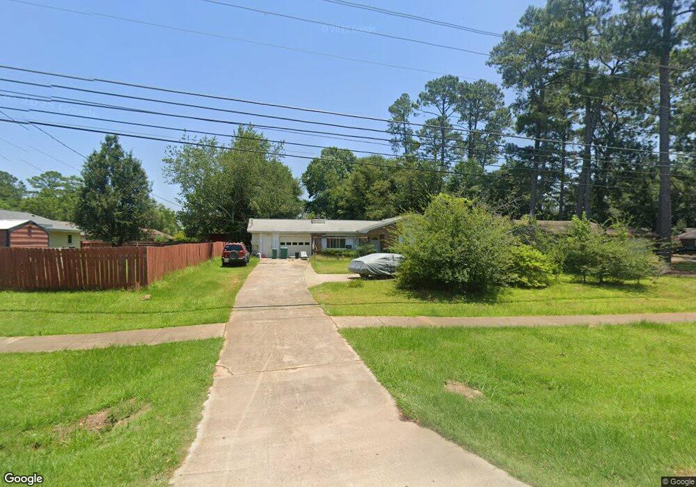
This home is located at 1712 Macon Rd, Perry, GA 31069 and is currently estimated at $254,531, approximately $133 per square foot. 1712 Macon Rd is a home located in Houston County with nearby schools including Morningside Elementary School, Perry Middle School, and Perry High School.
Ownership History
Date
Name
Owned For
Owner Type
Purchase Details
Closed on
May 21, 2003
Sold by
Siu Buck J
Bought by
Siu Buck J and K'Da K*
Current Estimated Value
Purchase Details
Closed on
Dec 22, 1999
Sold by
Johnson Stanley C and Johnson Brenda W
Bought by
Siu Buck J
Purchase Details
Closed on
Dec 14, 1984
Sold by
Mcilrath James R and Mcilrath Deborah A
Bought by
Johnson Stanley C and Johnson Brenda W
Purchase Details
Closed on
Sep 24, 1979
Sold by
Gottschalk William C
Bought by
Mcilrath James R and Mcilrath Deborah A
Purchase Details
Closed on
Oct 21, 1977
Bought by
Gottschalk William C
Create a Home Valuation Report for This Property
The Home Valuation Report is an in-depth analysis detailing your home's value as well as a comparison with similar homes in the area
Home Values in the Area
Average Home Value in this Area
Purchase History
| Date | Buyer | Sale Price | Title Company |
|---|---|---|---|
| Siu Buck J | -- | -- | |
| Siu Buck J | -- | -- | |
| Johnson Stanley C | -- | -- | |
| Mcilrath James R | -- | -- | |
| Gottschalk William C | -- | -- |
Source: Public Records
Tax History Compared to Growth
Tax History
| Year | Tax Paid | Tax Assessment Tax Assessment Total Assessment is a certain percentage of the fair market value that is determined by local assessors to be the total taxable value of land and additions on the property. | Land | Improvement |
|---|---|---|---|---|
| 2024 | $2,412 | $65,640 | $10,000 | $55,640 |
| 2023 | $2,089 | $56,480 | $10,000 | $46,480 |
| 2022 | $1,188 | $51,680 | $10,000 | $41,680 |
| 2021 | $1,095 | $47,360 | $10,000 | $37,360 |
| 2020 | $963 | $41,440 | $10,000 | $31,440 |
| 2019 | $963 | $41,440 | $10,000 | $31,440 |
| 2018 | $963 | $41,440 | $10,000 | $31,440 |
| 2017 | $964 | $41,440 | $10,000 | $31,440 |
| 2016 | $965 | $41,440 | $10,000 | $31,440 |
| 2015 | $967 | $41,440 | $10,000 | $31,440 |
| 2014 | -- | $41,440 | $10,000 | $31,440 |
| 2013 | -- | $41,440 | $10,000 | $31,440 |
Source: Public Records
Map
Nearby Homes
- 1008 Ridge Cir S
- 108 Christine Cir
- 311 Rusty Plow Ln Unit 16
- 307 Rusty Plow Ln
- 104 Red Barn Ct
- 102 Kanza Trail
- 307 Rusty Plow Ln Unit 14
- 0 Perimeter Roads Unit 20145464
- 1402 Park Ave
- 500 Legacy Park Dr
- 0 Perimeter Rd Unit 236479
- 0 Perimeter Rd Unit 20145467
- 0 Perimeter Rd Unit 236478
- The Pearson Plan at Avalon
- The Crawford Plan at Avalon
- The Piedmont Plan at Avalon
- The McGinnis Plan at Avalon
- The Coleman Plan at Avalon
- The Lawson Plan at Avalon
- The Bradley Plan at Avalon
- 1710 Macon Rd
- 900 Chapel Ridge Dr
- 902 Chapel Ridge Dr
- 1708 Macon Rd
- 1002 Ridge Cir S
- 904 Chapel Ridge Dr
- 1004 Ridge Cir S
- S Chapel Ridge Dr
- 108 Springfield Ct
- 112 Springfield Ct
- 906 Chapel Ridge Dr
- 1706 Macon Rd
- 1006 Ridge Cir S
- 106 Springfield Ct
- 114 Springfield Ct
- 104 Springfield Ct
- 100 Spring Creek Dr
- 1704 Macon Rd
- 115 Springfield Ct
- 903 Chapel Ridge Dr