Estimated Value: $229,000 - $295,079
3
Beds
2
Baths
1,067
Sq Ft
$248/Sq Ft
Est. Value
About This Home
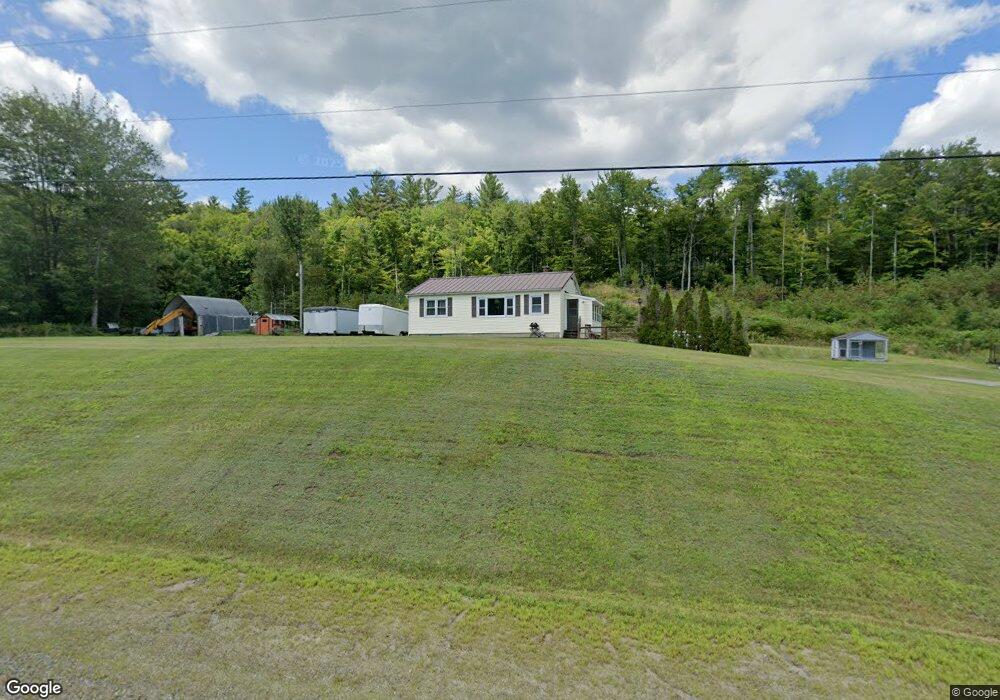
This home is located at 1712 Stark Hwy, Stark, NH 03582 and is currently estimated at $265,020, approximately $248 per square foot. 1712 Stark Hwy is a home located in Coos County.
Create a Home Valuation Report for This Property
The Home Valuation Report is an in-depth analysis detailing your home's value as well as a comparison with similar homes in the area
Home Values in the Area
Average Home Value in this Area
Tax History Compared to Growth
Tax History
| Year | Tax Paid | Tax Assessment Tax Assessment Total Assessment is a certain percentage of the fair market value that is determined by local assessors to be the total taxable value of land and additions on the property. | Land | Improvement |
|---|---|---|---|---|
| 2024 | $2,667 | $245,600 | $106,600 | $139,000 |
| 2023 | $2,279 | $110,000 | $45,400 | $64,600 |
| 2022 | $1,800 | $110,000 | $45,400 | $64,600 |
| 2021 | $2,191 | $110,000 | $45,400 | $64,600 |
| 2020 | $1,980 | $110,000 | $45,400 | $64,600 |
| 2019 | $1,988 | $110,000 | $45,400 | $64,600 |
| 2018 | $1,880 | $104,700 | $36,600 | $68,100 |
| 2017 | $1,904 | $104,700 | $36,600 | $68,100 |
| 2016 | $1,824 | $104,700 | $36,600 | $68,100 |
| 2015 | $1,781 | $104,700 | $36,600 | $68,100 |
| 2014 | $1,830 | $104,700 | $36,600 | $68,100 |
| 2013 | $1,979 | $113,200 | $37,100 | $76,100 |
Source: Public Records
Map
Nearby Homes
- 238 Northside Rd
- 750 Percy Rd
- 1435 Lost Nation Rd
- 406 New Hampshire 110
- 388 Percy Rd
- 13 Hillside Ave
- 41 Crow Hill St
- 338 Percy Rd
- 18 State St
- 50 Church St
- 102 Hillside Ave
- 38 Riverside Dr
- 14 Summer St
- 88 State St
- 112 Normand Rd
- 68 Short Rd
- 413 Lancaster Rd
- 53 Montgomery Rd
- 0 Town Line Rd Unit 1 and 33 4953131
- 00 Bell Hill Rd
- 1690 Stark Hwy
- 30 Potter Rd
- 93 Potter Rd
- 20 Potter Rd
- 103 Potter Rd
- 29 Ripaldi Rd
- 1676 Stark Hwy
- 106 Potter Rd
- 9 Potter Rd
- 1730 Stark Hwy
- 0 Potter Rd
- 7 Cold Spring Rd
- 1603 Stark Hwy
- 0 Cold Spring Rd Unit 4675439
- 0 Cold Spring Rd Unit 2724597
- Lot 1.6 Sullivan
- Lot 7 Page Hill Rd and Chellie Ln
- Lot 8 Page Hill Rd at Chellie Ln
- Lot 6 Page Hill Rd at Chellie Ln
- Lot 4 Page Hill Rd at Chellie Ln