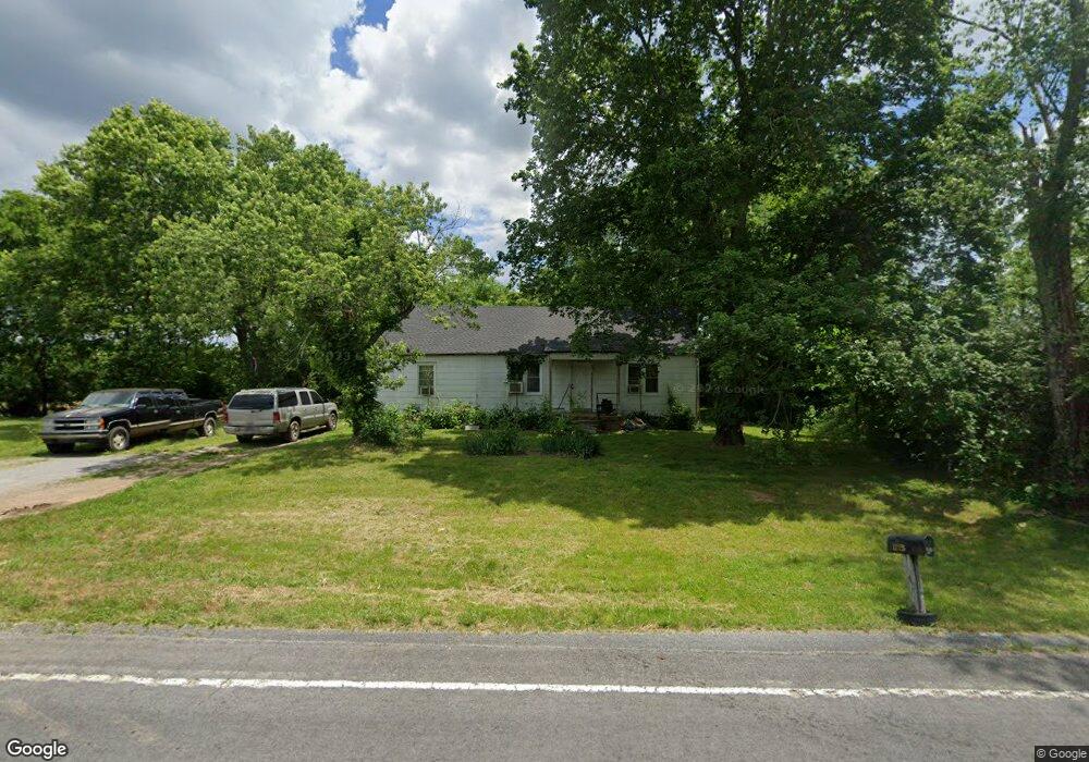
1713 Belfast Farmington Rd Lewisburg, TN 37091
Estimated Value: $231,000 - $2,238,925
--
Bed
1
Bath
1,274
Sq Ft
$969/Sq Ft
Est. Value
About This Home
This home is located at 1713 Belfast Farmington Rd, Lewisburg, TN 37091 and is currently estimated at $1,234,963, approximately $969 per square foot. 1713 Belfast Farmington Rd is a home located in Marshall County with nearby schools including Oak Grove Elementary School, Marshall Elementary School, and Westhills Elementary School.
Ownership History
Date
Name
Owned For
Owner Type
Purchase Details
Closed on
Dec 10, 2015
Sold by
Baymar Farms L P
Bought by
Baymar Family Trust Co-Trustees Pamela R Alle
Current Estimated Value
Purchase Details
Closed on
Feb 27, 2015
Sold by
Baymar Farms Lp
Bought by
Hill Charles N and Hill Patty W
Purchase Details
Closed on
May 19, 2003
Sold by
Roberts Charles E
Bought by
Baymar Farm Lp
Purchase Details
Closed on
Apr 5, 1997
Sold by
Smith Richard M
Bought by
Smith Richard M
Create a Home Valuation Report for This Property
The Home Valuation Report is an in-depth analysis detailing your home's value as well as a comparison with similar homes in the area
Home Values in the Area
Average Home Value in this Area
Purchase History
| Date | Buyer | Sale Price | Title Company |
|---|---|---|---|
| Baymar Family Trust Co-Trustees Pamela R Alle | -- | -- | |
| Allen Pamela Roberts | -- | -- | |
| Hill Charles N | $7,100 | -- | |
| Baymar Farm Lp | -- | -- | |
| Smith Richard M | $32,000 | -- |
Source: Public Records
Tax History Compared to Growth
Tax History
| Year | Tax Paid | Tax Assessment Tax Assessment Total Assessment is a certain percentage of the fair market value that is determined by local assessors to be the total taxable value of land and additions on the property. | Land | Improvement |
|---|---|---|---|---|
| 2024 | $2,437 | $134,000 | $121,950 | $12,050 |
| 2023 | $2,437 | $134,000 | $121,950 | $12,050 |
| 2022 | $2,437 | $134,000 | $121,950 | $12,050 |
| 2021 | $2,774 | $98,650 | $92,225 | $6,425 |
| 2020 | $2,774 | $98,650 | $92,225 | $6,425 |
| 2019 | $2,774 | $98,650 | $92,225 | $6,425 |
| 2018 | $2,791 | $101,075 | $92,225 | $8,850 |
| 2017 | $2,791 | $101,075 | $92,225 | $8,850 |
| 2016 | $2,516 | $78,150 | $71,575 | $6,575 |
| 2015 | $2,516 | $78,150 | $71,575 | $6,575 |
| 2014 | $2,521 | $78,300 | $71,725 | $6,575 |
Source: Public Records
Map
Nearby Homes
- 2150 Highway 40
- 2001 Highway 40
- 1798 Twin Caves Dr
- 2373 Phillips Rd
- 2624 Highway 64
- 2220 Hunter Bills Rd
- 2309 Hunter Rd
- 3077 Nashville Hwy
- 1820 Wade Brown Rd
- 3130 Nashville Hwy
- 1830 Bethbirei Rd
- 1816 Wade Brown Rd
- 0 Wallace Thompson Rd
- 2109 Mae Ln
- 2882 Gold Rd
- 1755 Mcbride Rd
- 1800 Mcbride Rd
- 1401 Hobby Ln
- 385 Palmetto Rd
- 339 Jack Pickle Rd
- 2102 John R Hill Rd
- 1871 Belfast Farmington Rd
- 2197 Highway 40
- 1879 Belfast Farmington Rd
- 2271 Highway 40
- 1885 Belfast Farmington Rd
- 1880 Belfast Farmington Rd
- 2277 Highway 40
- 2257 Highway 40
- 2279 Highway 64
- 2231 Highway 64
- 1893 Belfast Farmington Rd
- 2153 Highway 40
- 2243 Highway 40
- 1899 Belfast Farmington Rd
- 1896 Belfast Farmington Rd
- 2183 Highway 40
- 2333 Highway 64
- 2268 Highway 40
- 2239 Highway 40