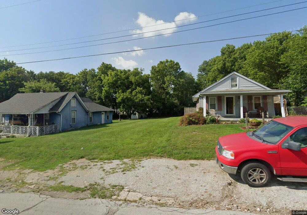
1713 Sheridan Ave Middletown, OH 45044
Amanda-Oneida Neighborhood
2
Beds
1
Bath
769
Sq Ft
6,273
Sq Ft Lot
About This Home
This home is located at 1713 Sheridan Ave, Middletown, OH 45044. 1713 Sheridan Ave is a home located in Butler County with nearby schools including Amanda Elementary School, Highview 6th Grade Center, and Middletown Middle School.
Ownership History
Date
Name
Owned For
Owner Type
Purchase Details
Closed on
Jun 29, 2020
Sold by
Butler County Land Reutilization Corp
Bought by
City Of Middletown
Purchase Details
Closed on
Jun 25, 2020
Sold by
State Of Ohio
Bought by
State Of Ohio Forfeited Land Sale
Purchase Details
Closed on
Jun 16, 2020
Sold by
County Of Butler
Bought by
Butler County Land Reutilization Corp
Purchase Details
Closed on
May 27, 2020
Sold by
Parcelnomics Llc
Bought by
State Of Ohio Forfeited Land Sale
Purchase Details
Closed on
Aug 4, 2014
Sold by
County Of Butler
Bought by
Parcelnomics Llc
Purchase Details
Closed on
Mar 19, 2008
Sold by
Lewis Consolidated Agencies Inc
Bought by
Decker Ronald R and Treadway Michael
Home Financials for this Owner
Home Financials are based on the most recent Mortgage that was taken out on this home.
Original Mortgage
$39,917
Interest Rate
6%
Mortgage Type
Seller Take Back
Purchase Details
Closed on
Jul 22, 2005
Sold by
Lewis Group Of Companies Inc
Bought by
Lewis Consolidated Agencies Inc
Purchase Details
Closed on
Sep 24, 2003
Sold by
Farco Inc
Bought by
Lewis Group Of Companies Inc
Purchase Details
Closed on
Jun 10, 2003
Sold by
Us Bank Na
Bought by
Farco Inc
Purchase Details
Closed on
May 27, 2003
Sold by
Bowling Roy
Bought by
U S Bank Na
Purchase Details
Closed on
Jul 1, 1993
Purchase Details
Closed on
Dec 1, 1990
Purchase Details
Closed on
Jul 1, 1988
Create a Home Valuation Report for This Property
The Home Valuation Report is an in-depth analysis detailing your home's value as well as a comparison with similar homes in the area
Home Values in the Area
Average Home Value in this Area
Purchase History
| Date | Buyer | Sale Price | Title Company |
|---|---|---|---|
| City Of Middletown | -- | None Available | |
| State Of Ohio Forfeited Land Sale | -- | -- | |
| Butler County Land Reutilization Corp | -- | None Available | |
| State Of Ohio Forfeited Land Sale | -- | -- | |
| Parcelnomics Llc | -- | None Available | |
| Decker Ronald R | -- | Attorney | |
| Lewis Consolidated Agencies Inc | -- | -- | |
| Lewis Group Of Companies Inc | $5,000 | -- | |
| Farco Inc | $4,500 | -- | |
| U S Bank Na | $15,000 | -- | |
| -- | $26,000 | -- | |
| -- | $16,900 | -- | |
| -- | $12,000 | -- |
Source: Public Records
Mortgage History
| Date | Status | Borrower | Loan Amount |
|---|---|---|---|
| Previous Owner | Decker Ronald R | $39,917 |
Source: Public Records
Tax History Compared to Growth
Tax History
| Year | Tax Paid | Tax Assessment Tax Assessment Total Assessment is a certain percentage of the fair market value that is determined by local assessors to be the total taxable value of land and additions on the property. | Land | Improvement |
|---|---|---|---|---|
| 2024 | -- | $3,440 | $3,440 | -- |
| 2023 | -- | $3,440 | $3,440 | -- |
| 2022 | $0 | $3,440 | $3,440 | $0 |
| 2021 | $0 | $3,440 | $3,440 | $0 |
| 2020 | $0 | $3,440 | $3,440 | $0 |
| 2019 | $236 | $3,260 | $3,260 | $0 |
| 2018 | $11,067 | $3,260 | $3,260 | $0 |
| 2017 | $212 | $3,260 | $3,260 | $0 |
| 2016 | $221 | $3,260 | $3,260 | $0 |
| 2015 | $218 | $3,260 | $3,260 | $0 |
| 2014 | $20,322 | $3,260 | $3,260 | $0 |
| 2013 | $20,322 | $4,070 | $4,070 | $0 |
Source: Public Records
Map
Nearby Homes
- 1702 Glenwood Ave
- 1613 Sheridan Ave
- 1717 Pershing Ave
- 2900 Morgan St
- 3107 Rufus St
- 3113 Rufus St
- 3102 Omaha St
- 3209 Rufus St
- 3111 Omaha St
- 3221 Yankee Rd
- 1709 Oxford State Rd
- 1602 Oxford State Rd
- 1808 Meadow Ave
- 3009 Seneca St
- 1511 Meadow Ave
- 3004 Judy Dr
- 2012 Pearl St
- 1713 Lafayette Ave
- 1514 Taylor Ave
- 1102 Forrer St
- 1711 Sheridan Ave
- 1715 Sheridan Ave
- 1717 Sheridan Ave
- 1712 Glenn Ave
- 1714 Glenn Ave
- 1710 Glenn Ave
- 2904 Pearl St
- 1801 Sheridan Ave
- 1708 Glenn Ave
- 1705 Sheridan Ave
- 1706 Glenn Ave
- 1710 Glenwood Ave
- 1712 Sheridan Ave
- 1803 Sheridan Ave
- 1710 Sheridan Ave
- 1703 Sheridan Ave
- 1800 Glenn Ave
- 1716 Sheridan Ave
- 1708 Sheridan Ave
- 1704 Glenn Ave