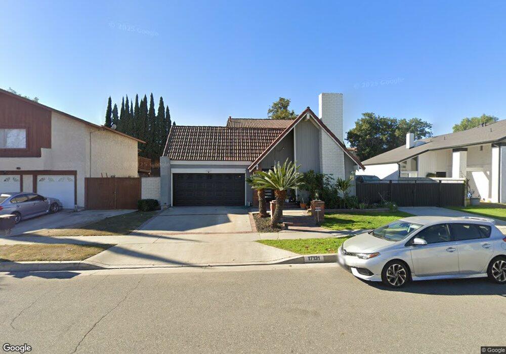
17131 Michaels Ave Cerritos, CA 90703
Estimated Value: $1,288,385 - $1,537,000
4
Beds
3
Baths
2,427
Sq Ft
$577/Sq Ft
Est. Value
About This Home
This home is located at 17131 Michaels Ave, Cerritos, CA 90703 and is currently estimated at $1,400,346, approximately $576 per square foot. 17131 Michaels Ave is a home located in Los Angeles County with nearby schools including Wittmann (Helen) Elementary School, Carmenita Middle School, and Gahr High School.
Ownership History
Date
Name
Owned For
Owner Type
Purchase Details
Closed on
Nov 4, 2014
Sold by
Tran Anh Tuan
Bought by
The Abundo Revocable Living Trust
Current Estimated Value
Home Financials for this Owner
Home Financials are based on the most recent Mortgage that was taken out on this home.
Original Mortgage
$440,000
Outstanding Balance
$336,057
Interest Rate
3.92%
Mortgage Type
New Conventional
Estimated Equity
$1,064,289
Purchase Details
Closed on
Apr 18, 2002
Sold by
Abundo Rodolfo T
Bought by
Tran Ahn Tuan and Tran Kirsten
Home Financials for this Owner
Home Financials are based on the most recent Mortgage that was taken out on this home.
Original Mortgage
$339,625
Interest Rate
7.13%
Mortgage Type
Stand Alone First
Purchase Details
Closed on
Sep 1, 1999
Sold by
Abundo Rodolfo T
Bought by
Abundo Rodolfo T and Abundo Susan C
Create a Home Valuation Report for This Property
The Home Valuation Report is an in-depth analysis detailing your home's value as well as a comparison with similar homes in the area
Home Values in the Area
Average Home Value in this Area
Purchase History
| Date | Buyer | Sale Price | Title Company |
|---|---|---|---|
| The Abundo Revocable Living Trust | $440,000 | Chicago Title Company | |
| Tran Ahn Tuan | $325,000 | Lawyers Title Company | |
| Abundo Rodolfo T | -- | -- |
Source: Public Records
Mortgage History
| Date | Status | Borrower | Loan Amount |
|---|---|---|---|
| Open | The Abundo Revocable Living Trust | $440,000 | |
| Previous Owner | Tran Ahn Tuan | $339,625 |
Source: Public Records
Tax History Compared to Growth
Tax History
| Year | Tax Paid | Tax Assessment Tax Assessment Total Assessment is a certain percentage of the fair market value that is determined by local assessors to be the total taxable value of land and additions on the property. | Land | Improvement |
|---|---|---|---|---|
| 2025 | $6,354 | $517,030 | $162,491 | $354,539 |
| 2024 | $6,354 | $506,893 | $159,305 | $347,588 |
| 2023 | $6,150 | $496,955 | $156,182 | $340,773 |
| 2022 | $6,056 | $487,212 | $153,120 | $334,092 |
| 2021 | $5,907 | $477,660 | $150,118 | $327,542 |
| 2019 | $5,772 | $463,494 | $145,666 | $317,828 |
| 2018 | $5,349 | $454,407 | $142,810 | $311,597 |
| 2016 | $5,123 | $436,764 | $137,265 | $299,499 |
| 2015 | $5,057 | $430,205 | $135,204 | $295,001 |
| 2014 | $4,958 | $421,779 | $132,556 | $289,223 |
Source: Public Records
Map
Nearby Homes
- 16822 Sierra Vista Way
- 12567 Semora St
- 12525 Semora St
- 12422 Cuesta Dr Unit 71
- 16611 Shenandoah Ave
- 13010 Artesia Blvd
- 12417 Rose St
- 16429 Westbrook Ln
- 17103 Cortner Ave
- 16308 Indian Creek Rd
- 12356 Reva St
- 12161 Napoli Dr
- 0 Parcel: 7016-014-017 Ave Unit PW25183248
- 16329 Cherry Fall Ln
- 18006 Point Conception Place
- 12512 Sandycreek Ln
- 17721 Norwalk Blvd Unit 47
- 16118 Rockyriver Ln
- 12360 Hedda Dr
- 13210 Sutton St
- 17137 Michaels Ave
- 17125 Michaels Ave
- 17143 Michaels Ave
- 17117 Michaels Ave
- 12703 Brian Ct
- 17116 Michaels Ave
- 17124 Michaels Ave
- 17116 Michael Ave
- 17201 Michaels Ave
- 12709 Brian Ct
- 17113 Michaels Ave
- 12688 Palm St
- 17207 Michaels Ave
- 12700 Palm St
- 12672 Palm St
- 12716 Brian Ct
- 12713 Brian Ct
- 12704 Palm St
- 12664 Palm St
- 12658 Palm St