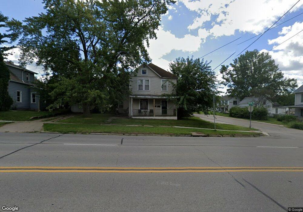
1715 Division St Burlington, IA 52601
Estimated Value: $62,349 - $108,000
3
Beds
2
Baths
1,953
Sq Ft
$47/Sq Ft
Est. Value
About This Home
This home is located at 1715 Division St, Burlington, IA 52601 and is currently estimated at $92,087, approximately $47 per square foot. 1715 Division St is a home located in Des Moines County with nearby schools including Burlington Community High School, Burlington Notre Dame Catholic Elementary School, and Burlington Christian School.
Ownership History
Date
Name
Owned For
Owner Type
Purchase Details
Closed on
Apr 14, 2024
Sold by
Reid Derek and Reid Danielle
Bought by
Mono Azul Llc
Current Estimated Value
Purchase Details
Closed on
Nov 30, 2006
Sold by
Great River Property Management Co Llc
Bought by
Perkins Ronnie G
Home Financials for this Owner
Home Financials are based on the most recent Mortgage that was taken out on this home.
Original Mortgage
$11,780
Interest Rate
6.4%
Mortgage Type
Stand Alone Second
Create a Home Valuation Report for This Property
The Home Valuation Report is an in-depth analysis detailing your home's value as well as a comparison with similar homes in the area
Home Values in the Area
Average Home Value in this Area
Purchase History
| Date | Buyer | Sale Price | Title Company |
|---|---|---|---|
| Mono Azul Llc | -- | None Listed On Document | |
| Perkins Ronnie G | $59,000 | None Available |
Source: Public Records
Mortgage History
| Date | Status | Borrower | Loan Amount |
|---|---|---|---|
| Previous Owner | Perkins Ronnie G | $11,780 |
Source: Public Records
Tax History Compared to Growth
Tax History
| Year | Tax Paid | Tax Assessment Tax Assessment Total Assessment is a certain percentage of the fair market value that is determined by local assessors to be the total taxable value of land and additions on the property. | Land | Improvement |
|---|---|---|---|---|
| 2025 | $1,020 | $60,200 | $6,000 | $54,200 |
| 2024 | $1,020 | $52,500 | $6,000 | $46,500 |
| 2023 | $892 | $52,500 | $6,000 | $46,500 |
| 2022 | $906 | $44,500 | $6,000 | $38,500 |
| 2021 | $906 | $44,500 | $6,000 | $38,500 |
| 2020 | $966 | $44,500 | $6,000 | $38,500 |
| 2019 | $1,328 | $44,500 | $6,000 | $38,500 |
| 2018 | $1,330 | $57,700 | $6,900 | $50,800 |
| 2017 | $1,330 | $55,200 | $0 | $0 |
| 2016 | $1,256 | $55,200 | $0 | $0 |
| 2015 | $1,256 | $55,200 | $0 | $0 |
| 2014 | $1,274 | $59,200 | $0 | $0 |
Source: Public Records
Map
Nearby Homes
- 1615 Smith St
- 410 S Starr Ave
- 418 S Leebrick St
- 415 S Garfield Ave
- 420 S Plane St
- 218 S Gunnison St
- 526 S Plane St
- 410 S Marshall St
- 100 S Marshall St
- 1432 Cleveland Ave
- 513 Hagemann Ave
- 2204 Williams St
- 320 N Plane St
- 809 S Starr Ave
- 671 Higbee Ave
- 310 Curran St
- 123 Shields St
- 2503 Clearview Dr
- 817 S Plane St
- 2600 Amelia St
- 1709 Division St
- 306 S Adams St
- 308 S Adams St
- 216 S Adams St
- 301 S Adams St
- 301 S Leebrick St
- 307 S Leebrick St
- 307 S Adams St
- 322 S Adams St
- 309 S Leebrick St
- 212 S Adams St
- 309 S Adams St
- 1708 Division St
- 324 S Adams St
- 1712 Division St
- 317 S Leebrick St
- 217 S Leebrick St
- 219 S Adams St
- 219 S Adams St
- 315 S Adams St