Estimated Value: $718,000 - $837,000
3
Beds
2
Baths
3,800
Sq Ft
$205/Sq Ft
Est. Value
About This Home
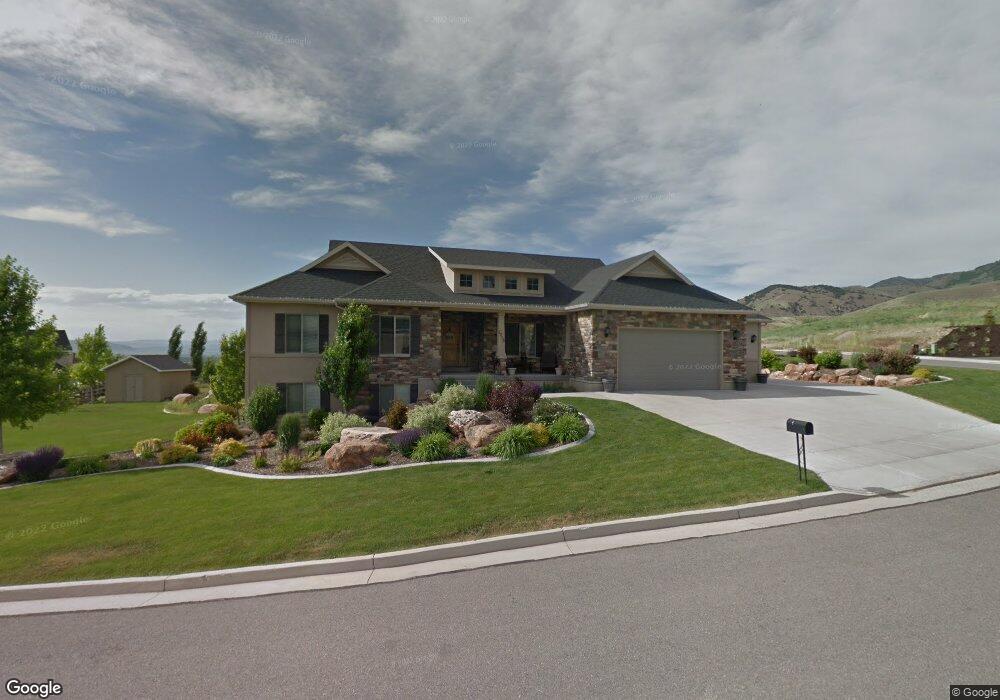
This home is located at 1715 N Bronco Rd, Logan, UT 84341 and is currently estimated at $779,789, approximately $205 per square foot. 1715 N Bronco Rd is a home located in Cache County with nearby schools including Greenville School, Cedar Ridge School, and North Cache Middle School.
Ownership History
Date
Name
Owned For
Owner Type
Purchase Details
Closed on
Apr 4, 2007
Sold by
Visionary Homes Inc
Bought by
Hansen Steven J
Current Estimated Value
Home Financials for this Owner
Home Financials are based on the most recent Mortgage that was taken out on this home.
Original Mortgage
$285,000
Outstanding Balance
$171,082
Interest Rate
6.2%
Mortgage Type
Construction
Estimated Equity
$608,707
Create a Home Valuation Report for This Property
The Home Valuation Report is an in-depth analysis detailing your home's value as well as a comparison with similar homes in the area
Home Values in the Area
Average Home Value in this Area
Purchase History
| Date | Buyer | Sale Price | Title Company |
|---|---|---|---|
| Hansen Steven J | -- | Cache Title Company |
Source: Public Records
Mortgage History
| Date | Status | Borrower | Loan Amount |
|---|---|---|---|
| Open | Hansen Steven J | $285,000 |
Source: Public Records
Tax History
| Year | Tax Paid | Tax Assessment Tax Assessment Total Assessment is a certain percentage of the fair market value that is determined by local assessors to be the total taxable value of land and additions on the property. | Land | Improvement |
|---|---|---|---|---|
| 2025 | $2,896 | $405,395 | $0 | $0 |
| 2024 | $3,101 | $403,965 | $0 | $0 |
| 2023 | $3,335 | $401,610 | $0 | $0 |
| 2022 | $3,490 | $401,610 | $0 | $0 |
| 2021 | $3,059 | $545,324 | $92,000 | $453,324 |
| 2020 | $2,910 | $486,195 | $92,000 | $394,195 |
| 2019 | $3,047 | $486,195 | $92,000 | $394,195 |
| 2018 | $2,750 | $424,760 | $72,800 | $351,960 |
| 2017 | $2,761 | $224,400 | $0 | $0 |
| 2016 | $2,805 | $194,910 | $0 | $0 |
| 2015 | $2,447 | $194,910 | $0 | $0 |
| 2014 | $2,391 | $194,910 | $0 | $0 |
| 2013 | -- | $196,155 | $0 | $0 |
Source: Public Records
Map
Nearby Homes
- 1715 E 3450 N Unit 7
- 1715 E 3450 N
- 3493 N 1860 Cir E
- 3501 N 1800 E Unit 6
- 3501 N 1800 E
- 1615 N Bronco Rd Unit 5
- 1697 E 3450 N
- 1708 E 3450 N
- 1708 Bronco Rd Unit 8
- 3433 N 1800 E
- 3474 N 1800 E Unit 10
- 1718 E 3550 N Unit 5
- 1718 E 3550 N Unit 5
- 1718 E Mahogany Dr
- 3454 N 1800 E
- 1684 E 3450 N
- 3415 N 1730 E
- 1679 E 3450 N
- 1696 E 3550 N Unit 4
- 3395 N 1730 E
Your Personal Tour Guide
Ask me questions while you tour the home.