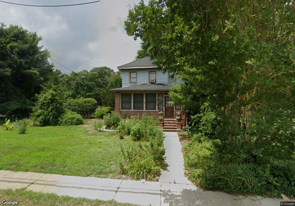
1715 Shore Rd Linwood, NJ 08221
Estimated Value: $389,000 - $450,000
--
Bed
--
Bath
1,440
Sq Ft
$289/Sq Ft
Est. Value
About This Home
This home is located at 1715 Shore Rd, Linwood, NJ 08221 and is currently estimated at $415,981, approximately $288 per square foot. 1715 Shore Rd is a home located in Atlantic County with nearby schools including Seaview Elementary School, Belhaven Middle School, and Mainland Regional High School.
Ownership History
Date
Name
Owned For
Owner Type
Purchase Details
Closed on
Sep 29, 2011
Sold by
Stites George M
Bought by
Stites Nancy J
Current Estimated Value
Purchase Details
Closed on
Apr 15, 2005
Sold by
Desch Nancy J
Bought by
Stites George M and Stites Nancy J
Home Financials for this Owner
Home Financials are based on the most recent Mortgage that was taken out on this home.
Original Mortgage
$250,000
Outstanding Balance
$88,144
Interest Rate
1%
Mortgage Type
New Conventional
Estimated Equity
$327,837
Create a Home Valuation Report for This Property
The Home Valuation Report is an in-depth analysis detailing your home's value as well as a comparison with similar homes in the area
Home Values in the Area
Average Home Value in this Area
Purchase History
| Date | Buyer | Sale Price | Title Company |
|---|---|---|---|
| Stites Nancy J | -- | Madison Title Agency Llc | |
| Stites George M | -- | -- |
Source: Public Records
Mortgage History
| Date | Status | Borrower | Loan Amount |
|---|---|---|---|
| Open | Stites George M | $250,000 |
Source: Public Records
Tax History Compared to Growth
Tax History
| Year | Tax Paid | Tax Assessment Tax Assessment Total Assessment is a certain percentage of the fair market value that is determined by local assessors to be the total taxable value of land and additions on the property. | Land | Improvement |
|---|---|---|---|---|
| 2025 | $8,713 | $228,400 | $125,500 | $102,900 |
| 2024 | $8,713 | $228,400 | $125,500 | $102,900 |
| 2023 | $8,309 | $228,400 | $125,500 | $102,900 |
| 2022 | $8,309 | $228,400 | $125,500 | $102,900 |
| 2021 | $8,236 | $228,400 | $125,500 | $102,900 |
| 2020 | $8,122 | $228,400 | $125,500 | $102,900 |
| 2019 | $7,948 | $228,400 | $125,500 | $102,900 |
| 2018 | $7,770 | $228,400 | $125,500 | $102,900 |
| 2017 | $7,615 | $228,400 | $125,500 | $102,900 |
| 2016 | $7,407 | $229,900 | $125,500 | $104,400 |
| 2015 | $7,414 | $229,900 | $125,500 | $104,400 |
| 2014 | $7,127 | $229,900 | $125,500 | $104,400 |
Source: Public Records
Map
Nearby Homes
- 110 E Seaview Ave
- 108 Holly Ln
- 110 E Patcong Ave
- 1930 Shore Rd
- 1860 Franklin Blvd
- 102 Morris Ave
- 209 Belhaven Ave
- 1714 New Rd
- 10 Sunset Ave
- 7 Woodstock Dr
- 208 Balfour Ave
- 23 Cambridge Unit 23
- 493 Sara Ann Ct
- 209 Berkshire Ave
- 4 Princeton Ln
- 26 Creek Ln
- 120 W Devonshire Ave
- 1917 Ventnor Ave
- 18 Berkley St
- 18 Berkley Ave
- 14 Georgetown Ct
- 1727 Shore Rd
- 1703 Shore Rd
- 1730 Shore Rd
- 14 Wendy Dr
- 202 Alexander Dr
- 16 Georgetown Ct
- 1704 Shore Rd
- 1720 Shore Rd
- 15 Georgetown Ct
- 204 Alexander Dr
- 1741 Shore Rd
- 16 Wendy Dr
- 2 East Dr
- 1700 Shore Rd
- 1 Meadowview Dr
- 18 Georgetown Ct
- 17 Georgetown Ct
- 206 Alexander Dr
- 201 Alexander Dr