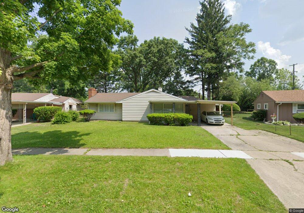
1716 Briarwood Dr Flint, MI 48507
South Side NeighborhoodEstimated Value: $112,000 - $119,000
3
Beds
2
Baths
1,828
Sq Ft
$63/Sq Ft
Est. Value
About This Home
This home is located at 1716 Briarwood Dr, Flint, MI 48507 and is currently estimated at $115,000, approximately $62 per square foot. 1716 Briarwood Dr is a home located in Genesee County with nearby schools including Neithercut Elementary School, Flint Southwestern Classical Academy, and International Academy of Flint (K-12).
Ownership History
Date
Name
Owned For
Owner Type
Purchase Details
Closed on
Oct 13, 2016
Sold by
Selene Finance Lp
Bought by
Dark Horse Development Group Llc
Current Estimated Value
Purchase Details
Closed on
Aug 12, 2015
Sold by
Rosales Gloria
Bought by
Selene Finance Lp
Purchase Details
Closed on
Jul 11, 2008
Sold by
Sample Scott E and Sample Jennifer B
Bought by
Rosales Gloira
Create a Home Valuation Report for This Property
The Home Valuation Report is an in-depth analysis detailing your home's value as well as a comparison with similar homes in the area
Home Values in the Area
Average Home Value in this Area
Purchase History
| Date | Buyer | Sale Price | Title Company |
|---|---|---|---|
| Dark Horse Development Group Llc | $16,250 | Abstract Title Agency | |
| Selene Finance Lp | $19,750 | Attorney | |
| Rosales Gloira | $74,500 | Guaranty Title Company |
Source: Public Records
Tax History Compared to Growth
Tax History
| Year | Tax Paid | Tax Assessment Tax Assessment Total Assessment is a certain percentage of the fair market value that is determined by local assessors to be the total taxable value of land and additions on the property. | Land | Improvement |
|---|---|---|---|---|
| 2025 | $1,931 | $56,300 | $0 | $0 |
| 2024 | $1,771 | $51,000 | $0 | $0 |
| 2023 | $1,717 | $43,700 | $0 | $0 |
| 2022 | $0 | $36,700 | $0 | $0 |
| 2021 | $1,749 | $27,500 | $0 | $0 |
| 2020 | $1,591 | $25,600 | $0 | $0 |
| 2019 | $1,541 | $23,300 | $0 | $0 |
| 2018 | $2,047 | $23,000 | $0 | $0 |
| 2017 | $1,833 | $0 | $0 | $0 |
| 2016 | $1,597 | $0 | $0 | $0 |
| 2015 | -- | $0 | $0 | $0 |
| 2014 | -- | $0 | $0 | $0 |
| 2012 | -- | $25,400 | $0 | $0 |
Source: Public Records
Map
Nearby Homes
- 1727 Briarwood Dr
- 1814 Carmanbrook Pkwy
- 1741 Carmanbrook Pkwy
- 1523 Waldman Ave
- 1225 Vermilya Ave
- 1209 Lincoln Ave
- 1410 Berrywood Ln
- 1225 Waldman Ave
- 1902 Crestbrook Ln
- 4101 Greenbrook Ln
- 2107 Stoney Brook Ct
- 1820 Chelsea Cir
- 1810 Chelsea Cir
- 1418 Blueberry Ln
- 1130 W Atherton Rd
- 1818 Rockcreek Ln
- 1228 Leland St
- 1725 Lincoln Dr
- 1905 Greenbriar Ln
- 4020 Park Forest Dr
- 1720 Briarwood Dr
- 1724 Briarwood Dr
- 3101 Briarwood Dr
- 1712 Briarwood Dr
- 1717 Briarwood Dr
- 1711 Briarwood Dr
- 1723 Briarwood Dr
- 3105 Briarwood Dr
- 1728 Briarwood Dr
- 1701 Briarwood Dr
- 1732 Briarwood Dr
- 3201 Cranbrook Cir
- 3102 Briarwood Dr
- 1801 Briarwood Dr
- 3202 Cranbrook Cir
- 3109 Briarwood Dr
- 1802 Briarwood Dr
- 3112 Briarwood Dr
- 3205 Cranbrook Cir
- 1805 Briarwood Dr