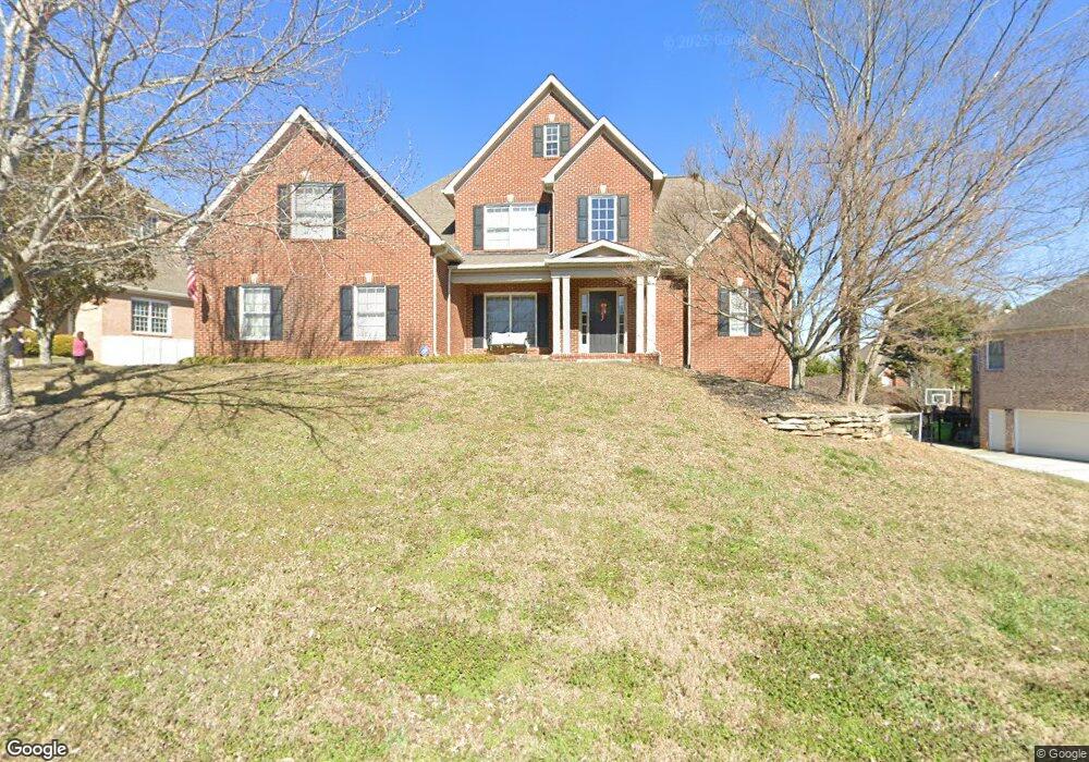
1716 Burnside Dr Maryville, TN 37801
Estimated Value: $750,000 - $796,127
--
Bed
4
Baths
3,460
Sq Ft
$225/Sq Ft
Est. Value
About This Home
This home is located at 1716 Burnside Dr, Maryville, TN 37801 and is currently estimated at $779,032, approximately $225 per square foot. 1716 Burnside Dr is a home located in Blount County with nearby schools including Mary Blount Elementary School, Union Grove Middle School, and William Blount High School.
Ownership History
Date
Name
Owned For
Owner Type
Purchase Details
Closed on
Nov 16, 2007
Sold by
Ragsdale Anthony G and Ragsdale Amy K
Bought by
Savell Richard Alan
Current Estimated Value
Home Financials for this Owner
Home Financials are based on the most recent Mortgage that was taken out on this home.
Original Mortgage
$367,200
Outstanding Balance
$231,034
Interest Rate
6.36%
Estimated Equity
$547,998
Purchase Details
Closed on
May 2, 2002
Sold by
Pjs Construction Co
Bought by
Ragsdale Anthony
Home Financials for this Owner
Home Financials are based on the most recent Mortgage that was taken out on this home.
Original Mortgage
$257,360
Interest Rate
7.18%
Create a Home Valuation Report for This Property
The Home Valuation Report is an in-depth analysis detailing your home's value as well as a comparison with similar homes in the area
Home Values in the Area
Average Home Value in this Area
Purchase History
| Date | Buyer | Sale Price | Title Company |
|---|---|---|---|
| Savell Richard Alan | $408,000 | -- | |
| Ragsdale Anthony | $321,712 | -- |
Source: Public Records
Mortgage History
| Date | Status | Borrower | Loan Amount |
|---|---|---|---|
| Open | Ragsdale Anthony | $367,200 | |
| Previous Owner | Ragsdale Anthony | $257,360 |
Source: Public Records
Tax History Compared to Growth
Tax History
| Year | Tax Paid | Tax Assessment Tax Assessment Total Assessment is a certain percentage of the fair market value that is determined by local assessors to be the total taxable value of land and additions on the property. | Land | Improvement |
|---|---|---|---|---|
| 2025 | $2,926 | $184,050 | $0 | $0 |
| 2024 | $2,926 | $184,050 | $22,500 | $161,550 |
| 2023 | $2,926 | $184,050 | $22,500 | $161,550 |
| 2022 | $2,585 | $104,650 | $16,500 | $88,150 |
| 2021 | $2,585 | $104,650 | $16,500 | $88,150 |
| 2020 | $2,585 | $104,650 | $16,500 | $88,150 |
| 2019 | $2,585 | $104,650 | $16,500 | $88,150 |
| 2018 | $2,487 | $100,700 | $12,000 | $88,700 |
| 2017 | $2,487 | $100,700 | $12,000 | $88,700 |
| 2016 | $2,487 | $100,700 | $12,000 | $88,700 |
| 2015 | $2,165 | $100,700 | $12,000 | $88,700 |
| 2014 | $2,183 | $100,700 | $12,000 | $88,700 |
| 2013 | $2,183 | $101,550 | $0 | $0 |
Source: Public Records
Map
Nearby Homes
- 1712 Burnside Dr
- 534 Argyle Way
- 1628 Loch Leigh Way
- 1633 Loch Leigh Way
- 611 Black Forest Dr
- 1939 Smoky View Cir
- 1533 Middlesettlements Rd
- 319 McCulley Ln
- 1906 W Lamar Alexander Pkwy
- 2117 Grey Ridge Rd
- 233 Rye Dr
- 2117 Camley Ct
- 1153 Brighton Dr
- 835 Marcaro Ln
- 112 Villa Ct
- 1709 Ansley Dr
- 1273 Middlesettlements Rd
- 225 Gadwall Ln
- 215 Gadwall Ln
- 125 County Farm Rd
- 1720 Burnside Dr
- 1708 Burnside Dr
- 1715 Burnside Dr
- 1719 Burnside Dr
- 1711 Burnside Dr
- 1721 Burnside Dr
- 1726 Burnside Dr
- 1611 Loch Leigh Way
- 1707 Burnside Dr
- 1704 Burnside Dr
- 1607 Loch Leigh Way
- 1617 Loch Leigh Way
- 1725 Burnside Dr
- 519 Argyle Way
- 1730 Burnside Dr
- 1603 Loch Leigh Way
- 1621 Loch Leigh Way
- 1729 Burnside Dr
- 511 Argyle Way
- 1734 Burnside Dr