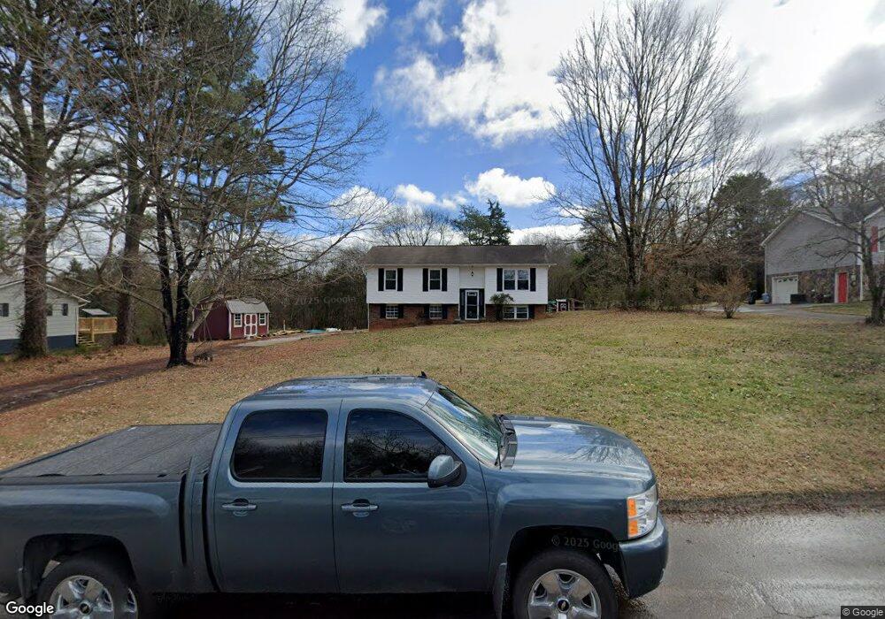
1716 Maplecrest Dr Louisville, TN 37777
Estimated Value: $296,519 - $314,000
3
Beds
2
Baths
1,340
Sq Ft
$227/Sq Ft
Est. Value
About This Home
This home is located at 1716 Maplecrest Dr, Louisville, TN 37777 and is currently estimated at $304,380, approximately $227 per square foot. 1716 Maplecrest Dr is a home located in Blount County with nearby schools including Middle Settlements Elementary School, Union Grove Middle School, and William Blount High School.
Ownership History
Date
Name
Owned For
Owner Type
Purchase Details
Closed on
Dec 8, 2020
Sold by
Smith Chad A
Bought by
Smith Tamara R
Current Estimated Value
Purchase Details
Closed on
May 5, 2011
Sold by
Boyd Lana J
Bought by
Smith Chad A and Smith Tamara R
Home Financials for this Owner
Home Financials are based on the most recent Mortgage that was taken out on this home.
Original Mortgage
$98,439
Interest Rate
4.75%
Mortgage Type
FHA
Purchase Details
Closed on
Jan 29, 1999
Sold by
Weston John H
Bought by
Boyd Lana
Home Financials for this Owner
Home Financials are based on the most recent Mortgage that was taken out on this home.
Original Mortgage
$84,900
Interest Rate
6.85%
Purchase Details
Closed on
Aug 12, 1998
Bought by
Weston John H
Purchase Details
Closed on
Nov 28, 1977
Bought by
Hill Gaylon L and Linda Gail
Create a Home Valuation Report for This Property
The Home Valuation Report is an in-depth analysis detailing your home's value as well as a comparison with similar homes in the area
Home Values in the Area
Average Home Value in this Area
Purchase History
| Date | Buyer | Sale Price | Title Company |
|---|---|---|---|
| Smith Tamara R | -- | -- | |
| Smith Chad A | $101,000 | -- | |
| Boyd Lana | $89,900 | -- | |
| Weston John H | $25,000 | -- | |
| Hill Gaylon L | -- | -- |
Source: Public Records
Mortgage History
| Date | Status | Borrower | Loan Amount |
|---|---|---|---|
| Previous Owner | Smith Chad A | $98,439 | |
| Previous Owner | Hill Gaylon L | $84,900 |
Source: Public Records
Tax History Compared to Growth
Tax History
| Year | Tax Paid | Tax Assessment Tax Assessment Total Assessment is a certain percentage of the fair market value that is determined by local assessors to be the total taxable value of land and additions on the property. | Land | Improvement |
|---|---|---|---|---|
| 2025 | $802 | $50,450 | $0 | $0 |
| 2024 | $802 | $50,450 | $6,250 | $44,200 |
| 2023 | $802 | $50,450 | $6,250 | $44,200 |
| 2022 | $714 | $28,925 | $5,625 | $23,300 |
| 2021 | $714 | $28,925 | $5,625 | $23,300 |
| 2020 | $714 | $28,925 | $5,625 | $23,300 |
| 2019 | $714 | $28,925 | $5,625 | $23,300 |
| 2018 | $602 | $24,375 | $4,725 | $19,650 |
| 2017 | $602 | $24,375 | $4,725 | $19,650 |
| 2016 | $602 | $24,375 | $4,725 | $19,650 |
| 2015 | $524 | $24,375 | $4,725 | $19,650 |
| 2014 | $587 | $24,375 | $4,725 | $19,650 |
| 2013 | $587 | $27,300 | $0 | $0 |
Source: Public Records
Map
Nearby Homes
- 1740 Maplecrest Dr
- 2209 Marble Cir
- 807 Killion St
- 1465 Johnathan Dr
- 1328 Hillvale Rd
- 4505 Sing Ln
- 1735 Scott Dr
- 3601 Wellington Ln
- 3609 Lakeside Dr
- 4656 Singleton Station Rd
- 4089 Glenmore Dr
- 4078 Glenmore Dr
- 505 Cusick Rd
- 4608 Lakeview Rd
- 3953 Wrights Ferry Rd
- 2840 Spruce Hill Rd
- 4220 Reed Rd
- 2337 Airbase Rd
- 4036 Wrights Ferry Rd
- 316 Rockford Walker Ct
- 1722 Maplecrest Dr
- 1710 Maplecrest Dr
- 1713 Maplecrest Dr
- 1719 Maplecrest Dr
- 1709 Maplecrest Dr
- 1723 Maplecrest Dr
- 1704 Maplecrest Dr
- 1703 Maplecrest Dr
- 3247 Wrights Ferry Rd
- 3247 Wrights Ferry Rd
- 1729 Maplecrest Dr
- 3213 Wrights Ferry Rd
- 1733 Maplecrest Dr
- 3249 Wrights Ferry Rd
- 1737 Maplecrest Dr
- 3218 Wrights Ferry Rd
- 2219 Stonybrook Rd
- 2215 Stonybrook Rd
- 3141 Wrights Ferry Rd
- 2225 Stonybrook Rd