Estimated Value: $371,000 - $490,000
5
Beds
3
Baths
2,043
Sq Ft
$201/Sq Ft
Est. Value
About This Home
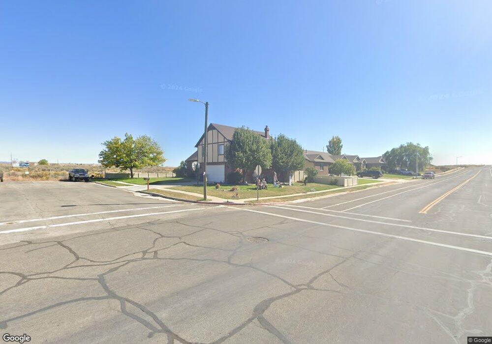
This home is located at 1716 Sagewood Rd, Price, UT 84501 and is currently estimated at $411,591, approximately $201 per square foot. 1716 Sagewood Rd is a home located in Carbon County with nearby schools including Castle Heights School, Mont Harmon Junior High School, and Carbon High School.
Ownership History
Date
Name
Owned For
Owner Type
Purchase Details
Closed on
Sep 1, 2023
Sold by
Bentley Karl D and Bentley Trieste L
Bought by
Allen Cody S and Allen Alexis
Current Estimated Value
Home Financials for this Owner
Home Financials are based on the most recent Mortgage that was taken out on this home.
Original Mortgage
$286,400
Outstanding Balance
$279,555
Interest Rate
6.78%
Mortgage Type
New Conventional
Estimated Equity
$132,036
Create a Home Valuation Report for This Property
The Home Valuation Report is an in-depth analysis detailing your home's value as well as a comparison with similar homes in the area
Home Values in the Area
Average Home Value in this Area
Purchase History
| Date | Buyer | Sale Price | Title Company |
|---|---|---|---|
| Allen Cody S | -- | Professional Title Services |
Source: Public Records
Mortgage History
| Date | Status | Borrower | Loan Amount |
|---|---|---|---|
| Open | Allen Cody S | $286,400 |
Source: Public Records
Tax History Compared to Growth
Tax History
| Year | Tax Paid | Tax Assessment Tax Assessment Total Assessment is a certain percentage of the fair market value that is determined by local assessors to be the total taxable value of land and additions on the property. | Land | Improvement |
|---|---|---|---|---|
| 2025 | $2,942 | $242,165 | $14,316 | $227,849 |
| 2024 | $2,681 | $223,193 | $13,200 | $209,993 |
| 2023 | $2,365 | $209,987 | $12,140 | $197,847 |
| 2022 | $2,481 | $197,618 | $10,094 | $187,525 |
| 2021 | $2,123 | $262,490 | $15,422 | $247,068 |
| 2020 | $2,080 | $129,032 | $0 | $0 |
| 2019 | $1,845 | $120,061 | $0 | $0 |
| 2018 | $1,637 | $108,673 | $0 | $0 |
| 2017 | $1,617 | $108,673 | $0 | $0 |
| 2016 | $1,459 | $108,673 | $0 | $0 |
| 2015 | $1,459 | $108,673 | $0 | $0 |
| 2014 | $1,449 | $108,673 | $0 | $0 |
| 2013 | $1,632 | $121,193 | $0 | $0 |
Source: Public Records
Map
Nearby Homes
- 546 Windsor Rd
- 703 N Windsor Cir
- 1689 Eastridge Rd
- 639 N 1550 E
- 1827 E 8th N Unit 79
- 1841 E 8th N Unit 78
- 831 N 1820 E Unit 66
- 1830 E 840 N Unit 80
- 1855 E 8th N Unit 77
- 1840 E 840 N Unit 81
- 1858 E 840 N Unit 82
- 688 Birch Cir
- 1829 E 840 N Unit 87
- 1843 E 840 N Unit 86
- 879 N 1820 E Unit 69
- 1857 E 840 N Unit 85
- 824 N 1880 E Unit 74
- 1871 E 840 N Unit 84
- 838 N 1880 E Unit 73
- 1860 E 880 N
- 580 Homestead Blvd
- 608 Homestead Blvd
- 608 Homestead Blvd
- 1686 Sagewood Rd
- 575 Homestead Blvd
- 572 Homestead Blvd
- 1685 Sagewood Rd
- 1685 Sagewood Rd
- 1685 Sagewood Rd
- 1685 Sagewood Rd
- 1685 Sagewood Rd
- 1685 Sagewood Rd
- 1685 Sagewood Rd
- 1685 Sagewood Rd
- 628 Homestead Blvd
- 1666 Sagewood Rd
- 567 Homestead Blvd
- 596 Dover Cir
- 550 Homestead Blvd
- 584 Dover Cir