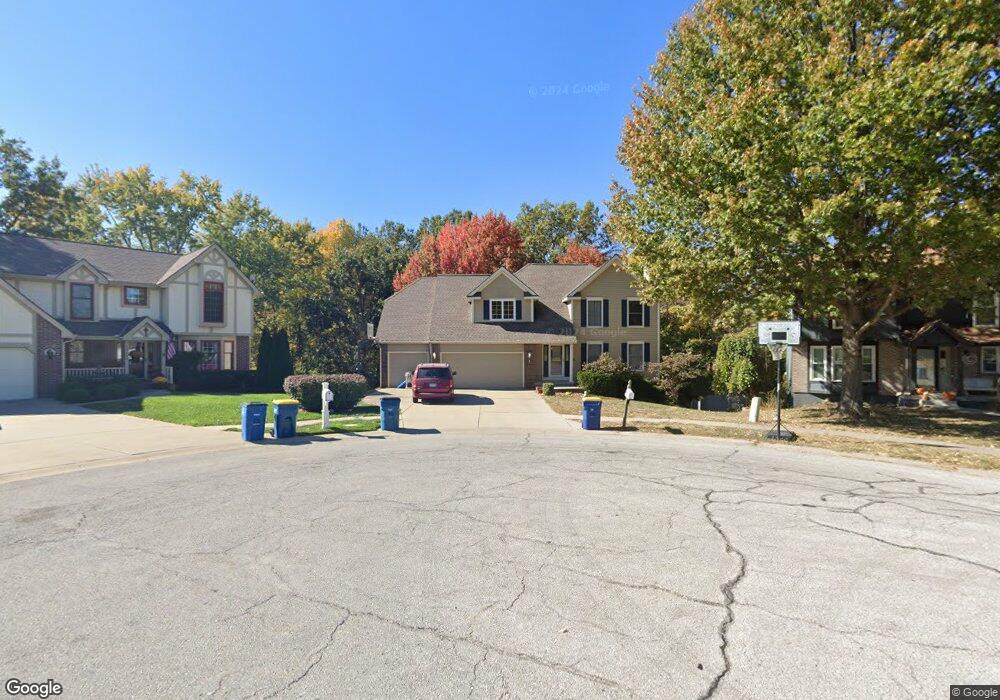
1717 S Wales Liberty, MO 64068
Estimated Value: $422,000 - $445,000
4
Beds
4
Baths
2,145
Sq Ft
$202/Sq Ft
Est. Value
About This Home
This home is located at 1717 S Wales, Liberty, MO 64068 and is currently estimated at $433,091, approximately $201 per square foot. 1717 S Wales is a home located in Clay County with nearby schools including Alexander Doniphan Elementary School, Liberty Middle School, and Liberty High School.
Ownership History
Date
Name
Owned For
Owner Type
Purchase Details
Closed on
May 20, 2025
Sold by
Norris Lori
Bought by
Mahoney Nicholas R and Mahoney Taylor C
Current Estimated Value
Home Financials for this Owner
Home Financials are based on the most recent Mortgage that was taken out on this home.
Original Mortgage
$332,500
Outstanding Balance
$331,021
Interest Rate
6.64%
Mortgage Type
New Conventional
Estimated Equity
$102,070
Purchase Details
Closed on
Jun 25, 2007
Sold by
Welle Brad A and Welle Karen M
Bought by
Norris James Todd and Norris Lori A
Purchase Details
Closed on
Jul 13, 2000
Sold by
Renfrow Arlin N and Renfrow Nancy R
Bought by
Welle Brad A and Welle Karen M
Home Financials for this Owner
Home Financials are based on the most recent Mortgage that was taken out on this home.
Original Mortgage
$187,100
Interest Rate
8.36%
Purchase Details
Closed on
Jan 7, 1998
Sold by
Renfrow Arlin N and Renfrow Nancy R
Bought by
Renfrow John A and Renfrow Melissa K
Create a Home Valuation Report for This Property
The Home Valuation Report is an in-depth analysis detailing your home's value as well as a comparison with similar homes in the area
Home Values in the Area
Average Home Value in this Area
Purchase History
| Date | Buyer | Sale Price | Title Company |
|---|---|---|---|
| Mahoney Nicholas R | -- | Lakeside Title | |
| Mahoney Nicholas R | -- | Lakeside Title | |
| Norris James Todd | -- | United Title Company Inc | |
| Welle Brad A | -- | United Title Company Inc | |
| Renfrow John A | -- | -- |
Source: Public Records
Mortgage History
| Date | Status | Borrower | Loan Amount |
|---|---|---|---|
| Open | Mahoney Nicholas R | $332,500 | |
| Closed | Mahoney Nicholas R | $332,500 | |
| Previous Owner | Welle Brad A | $187,100 |
Source: Public Records
Tax History Compared to Growth
Tax History
| Year | Tax Paid | Tax Assessment Tax Assessment Total Assessment is a certain percentage of the fair market value that is determined by local assessors to be the total taxable value of land and additions on the property. | Land | Improvement |
|---|---|---|---|---|
| 2025 | $4,438 | $69,770 | -- | -- |
| 2024 | $4,438 | $57,700 | -- | -- |
| 2023 | $4,513 | $57,700 | $0 | $0 |
| 2022 | $3,868 | $48,830 | $0 | $0 |
| 2021 | $3,838 | $48,830 | $6,650 | $42,180 |
| 2020 | $3,645 | $43,550 | $0 | $0 |
| 2019 | $3,644 | $43,548 | $6,080 | $37,468 |
| 2018 | $3,462 | $40,620 | $0 | $0 |
| 2017 | $3,348 | $40,620 | $4,750 | $35,870 |
| 2016 | $3,348 | $39,650 | $4,750 | $34,900 |
| 2015 | $3,349 | $39,650 | $4,750 | $34,900 |
| 2014 | $3,201 | $37,600 | $4,370 | $33,230 |
Source: Public Records
Map
Nearby Homes
- 1733 Welleslay Ln
- 1537 Canterbury Ln
- 1507 Amesbury Ave
- 1323 Amesbury Ave
- 1218 Canterbury Ln
- 1327 Easton Ct
- 1304 Wellington Way
- 1124 Amesbury Ave
- 1205 Blackberry Dr
- 1856 Arbor Trail
- 1836 Green Meadow Dr
- 509 Belmont St
- 2188 Heritage Ct
- 415 Monterey Ave
- 1331 Park Ln
- McKinley Plan at Homestead of Liberty - Homestead
- Monroe Plan at Homestead of Liberty - Homestead
- Chestnut Plan at Homestead of Liberty - Homestead
- The Brooklyn Plan at Homestead of Liberty - Homestead
- Cypress Plan at Homestead of Liberty - Homestead
- 1721 S Wales
- 1713 S Wales
- 202 Kirkland Ave
- 1709 S Wales
- 1701 S Wales
- 1705 S Wales
- 1809 Welleslay Ct
- 1716 S Wales
- 200 Kirkland Ave
- 1801 Welleslay Ct
- 1813 Welleslay Ct
- 1700 S Wales
- 1805 Welleslay Ct
- 1604 Canterbury Ct
- 1712 S Wales
- 1737 Welleslay Ln
- 1600 Canterbury Ct
- 102 Kirkland Ave
- 402 Wherritt Ln
- 1729 Welleslay Ln