Estimated Value: $486,000 - $634,000
3
Beds
3
Baths
2,348
Sq Ft
$243/Sq Ft
Est. Value
About This Home
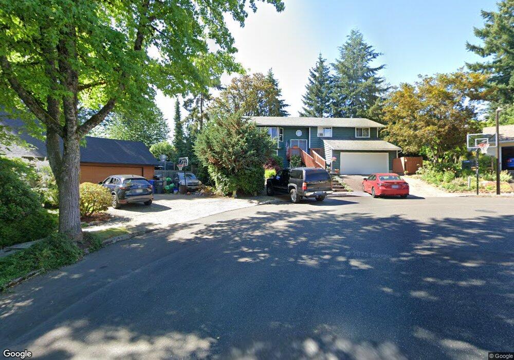
This home is located at 17175 New Cir, Sandy, OR 97055 and is currently estimated at $571,577, approximately $243 per square foot. 17175 New Cir is a home located in Clackamas County with nearby schools including Kelso Elementary School, Boring Middle School, and Sandy High School.
Ownership History
Date
Name
Owned For
Owner Type
Purchase Details
Closed on
Jul 29, 2004
Sold by
Langella Connie E
Bought by
Anderson Bret L and Anderson Teresa A
Current Estimated Value
Home Financials for this Owner
Home Financials are based on the most recent Mortgage that was taken out on this home.
Original Mortgage
$146,400
Outstanding Balance
$73,991
Interest Rate
6.29%
Mortgage Type
Purchase Money Mortgage
Estimated Equity
$497,586
Purchase Details
Closed on
Sep 29, 1995
Sold by
Langella Joseph V
Bought by
Langella Connie E
Create a Home Valuation Report for This Property
The Home Valuation Report is an in-depth analysis detailing your home's value as well as a comparison with similar homes in the area
Home Values in the Area
Average Home Value in this Area
Purchase History
| Date | Buyer | Sale Price | Title Company |
|---|---|---|---|
| Anderson Bret L | $183,000 | Chicago Title Insurance Comp | |
| Langella Connie E | -- | -- | |
| Langella Connie E | -- | -- |
Source: Public Records
Mortgage History
| Date | Status | Borrower | Loan Amount |
|---|---|---|---|
| Open | Anderson Bret L | $146,400 | |
| Closed | Anderson Bret L | $36,600 |
Source: Public Records
Tax History Compared to Growth
Tax History
| Year | Tax Paid | Tax Assessment Tax Assessment Total Assessment is a certain percentage of the fair market value that is determined by local assessors to be the total taxable value of land and additions on the property. | Land | Improvement |
|---|---|---|---|---|
| 2025 | $4,468 | $260,448 | -- | -- |
| 2024 | $4,280 | $252,863 | -- | -- |
| 2023 | $4,280 | $245,499 | $0 | $0 |
| 2022 | $4,054 | $238,349 | $0 | $0 |
| 2021 | $3,915 | $231,407 | $0 | $0 |
| 2020 | $3,809 | $224,667 | $0 | $0 |
| 2019 | $3,772 | $218,124 | $0 | $0 |
| 2018 | $3,667 | $211,771 | $0 | $0 |
| 2017 | $3,578 | $205,603 | $0 | $0 |
| 2016 | $3,455 | $199,615 | $0 | $0 |
| 2015 | $3,357 | $193,801 | $0 | $0 |
| 2014 | $3,269 | $188,156 | $0 | $0 |
Source: Public Records
Map
Nearby Homes
- 17368 Aubin St
- 37115 Highway 26
- 17647 Hardenbrook Ave
- 35570 SE Barnum Rd
- 16370 Bell St
- 16370 Bell St Unit 2
- 16765 Champion Way
- 16825 Chula Vista Ave
- 37600 Sunset St Unit 26
- 18335 SE 370th Ave
- 37465 Dubarko Rd
- 16994 University Ave
- 37355 Coralburst St
- 37867 College St
- 37455 Emerald Cascade St
- 17829 Balken Ave
- 36919 SE Olson St
- 17655 Bluff Rd Unit 73
- 17655 Bluff Rd Unit 42
- 36904 Salmonberry St
- 17225 New Cir
- 36500 Yocum Loop
- 36530 Yocum Loop
- 17150 New Cir
- 17200 Littlepage Ave
- 36480 Yocum Loop
- 17300 Littlepage Ave
- 17275 New Cir
- 17200 New Cir
- 36580 Yocum Loop
- 0 Littlepage Ave
- 36600 Yocum Loop
- 17250 New Cir
- 36505 Yocum Loop
- 36445 Dubarko Rd
- 36475 Dubarkoroad
- 36525 Yocum Loop
- 36475 Dubarko Rd
- 36650 Yocum Loop
- 17215 Littlepage Ave