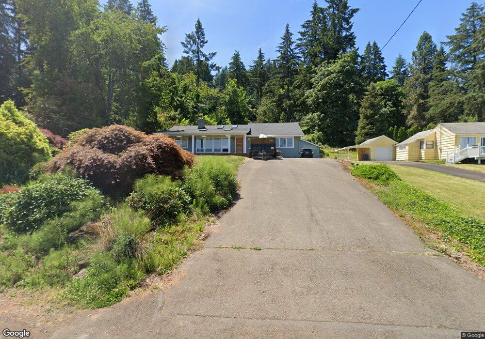
17177 Chapin Way Lake Oswego, OR 97034
Glenmorrie NeighborhoodEstimated Value: $908,000 - $966,000
3
Beds
2
Baths
1,764
Sq Ft
$535/Sq Ft
Est. Value
About This Home
This home is located at 17177 Chapin Way, Lake Oswego, OR 97034 and is currently estimated at $943,872, approximately $535 per square foot. 17177 Chapin Way is a home located in Clackamas County with nearby schools including Hallinan Elementary School, Lakeridge Middle School, and Lakeridge High School.
Ownership History
Date
Name
Owned For
Owner Type
Purchase Details
Closed on
Nov 15, 2018
Sold by
Barnes Laure E
Bought by
Gaar William E
Current Estimated Value
Home Financials for this Owner
Home Financials are based on the most recent Mortgage that was taken out on this home.
Original Mortgage
$415,300
Outstanding Balance
$363,700
Interest Rate
4.7%
Mortgage Type
New Conventional
Estimated Equity
$580,172
Purchase Details
Closed on
Sep 20, 2017
Sold by
Gaar William E
Bought by
Gaar William E and Barnes Lauren E
Home Financials for this Owner
Home Financials are based on the most recent Mortgage that was taken out on this home.
Original Mortgage
$424,100
Interest Rate
3.9%
Mortgage Type
New Conventional
Purchase Details
Closed on
Oct 10, 2006
Sold by
Paiz Jennifer Ann
Bought by
Gaar William E
Home Financials for this Owner
Home Financials are based on the most recent Mortgage that was taken out on this home.
Original Mortgage
$399,476
Interest Rate
5.75%
Mortgage Type
Unknown
Purchase Details
Closed on
Feb 23, 2005
Sold by
Paiz Francisco E
Bought by
Paiz Jennifer Ann
Home Financials for this Owner
Home Financials are based on the most recent Mortgage that was taken out on this home.
Original Mortgage
$204,000
Interest Rate
5.73%
Mortgage Type
FHA
Purchase Details
Closed on
Oct 6, 2003
Sold by
Lawson Michael C and Lawson Mary C
Bought by
Paiz Francisco E and Paiz Jennifer Ann
Home Financials for this Owner
Home Financials are based on the most recent Mortgage that was taken out on this home.
Original Mortgage
$150,000
Interest Rate
6.22%
Mortgage Type
Unknown
Purchase Details
Closed on
May 26, 1995
Sold by
Hursick John
Bought by
Lawson Michael C and Lawson Mary C
Home Financials for this Owner
Home Financials are based on the most recent Mortgage that was taken out on this home.
Original Mortgage
$136,800
Interest Rate
8%
Purchase Details
Closed on
Apr 7, 1995
Sold by
Hursick John
Bought by
Hursick John
Home Financials for this Owner
Home Financials are based on the most recent Mortgage that was taken out on this home.
Original Mortgage
$136,800
Interest Rate
8%
Create a Home Valuation Report for This Property
The Home Valuation Report is an in-depth analysis detailing your home's value as well as a comparison with similar homes in the area
Home Values in the Area
Average Home Value in this Area
Purchase History
| Date | Buyer | Sale Price | Title Company |
|---|---|---|---|
| Gaar William E | -- | Lawyers Title | |
| Gaar William E | -- | Lawyers Title | |
| Gaar William E | $499,345 | Fidelity Natl Title Co Of Or | |
| Paiz Jennifer Ann | -- | Transnation Title Agency Or | |
| Paiz Francisco E | $329,000 | Fidelity Natl Title Co Of Or | |
| Lawson Michael C | $171,000 | First American Title Ins Co | |
| Hursick John | -- | Transamerica Title Insurance |
Source: Public Records
Mortgage History
| Date | Status | Borrower | Loan Amount |
|---|---|---|---|
| Open | Gaar William E | $415,300 | |
| Previous Owner | Gaar William E | $424,100 | |
| Previous Owner | Gaar William E | $399,476 | |
| Previous Owner | Paiz Jennifer Ann | $204,000 | |
| Previous Owner | Paiz Francisco E | $150,000 | |
| Previous Owner | Lawson Michael C | $136,800 | |
| Previous Owner | Hursick John | $93,000 | |
| Closed | Paiz Francisco E | $21,600 |
Source: Public Records
Tax History Compared to Growth
Tax History
| Year | Tax Paid | Tax Assessment Tax Assessment Total Assessment is a certain percentage of the fair market value that is determined by local assessors to be the total taxable value of land and additions on the property. | Land | Improvement |
|---|---|---|---|---|
| 2025 | $8,855 | $462,126 | -- | -- |
| 2024 | $7,830 | $407,594 | -- | -- |
| 2023 | $7,830 | $395,723 | $0 | $0 |
| 2022 | $7,375 | $384,198 | $0 | $0 |
| 2021 | $6,811 | $373,008 | $0 | $0 |
| 2020 | $6,640 | $362,144 | $0 | $0 |
| 2019 | $6,476 | $351,597 | $0 | $0 |
| 2018 | $6,158 | $341,356 | $0 | $0 |
| 2017 | $5,942 | $331,414 | $0 | $0 |
| 2016 | $5,409 | $321,761 | $0 | $0 |
| 2015 | $5,226 | $312,389 | $0 | $0 |
| 2014 | $5,158 | $303,290 | $0 | $0 |
Source: Public Records
Map
Nearby Homes
- 2424 Glenmorrie Dr
- 17514 Brookhurst Dr
- 1261 Wells St
- 17700 Upper Cherry Ln
- 2147 Glenmorrie Ln
- 17623 Brookhurst Dr
- 1640 Meadows Dr
- 17634 Brookhurst Dr
- 1777 Skyland Dr
- 777 Cherry Cir
- 18004 Eastridge Ln
- 1060 Upper Devon Ln
- 990 Lund St
- 200 Burnham Rd Unit 200
- 1354 Skye Pkwy
- 1384 Celtic Ct
- 115 Ash St
- 17911 Hillside Dr
- 2455 College Hill Place
- 17833 Marylcreek Dr
- 17225 Chapin Way
- 17137 Chapin Way
- 1547 Glenmorrie Dr
- 17255 Chapin Way
- 17085 Chapin Way
- 1515 Glenmorrie Dr
- 17212 Chapin Way
- 17101 Chapin Way
- 17108 Chapin Way
- 17055 Chapin Way
- 1623 Glenmorrie Dr
- 17060 Chapin Way
- 1465 Glenmorrie Dr
- 17250 Chapin Way
- 17033 Chapin Way
- 17054 Chapin Way
- 17300 Grandview Ct
- 17072 Chapin Way
- 17020 Chapin Way
- 1677 Glenmorrie Dr