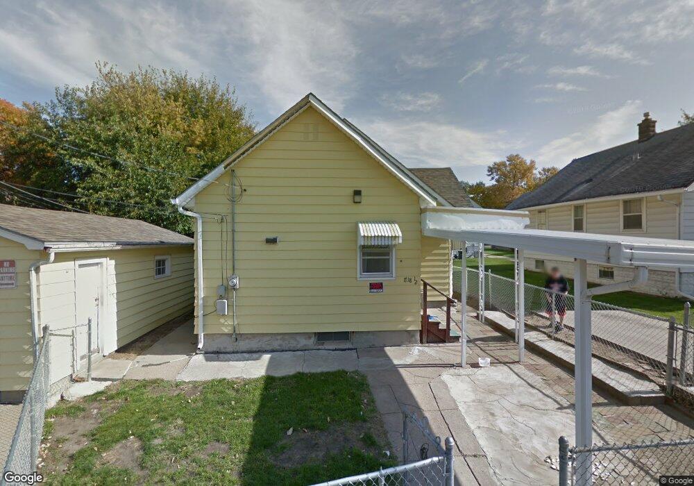
1718 1/2 S 10th St Omaha, NE 68108
Little Italy NeighborhoodEstimated Value: $152,873 - $176,000
2
Beds
1
Bath
904
Sq Ft
$182/Sq Ft
Est. Value
About This Home
This home is located at 1718 1/2 S 10th St, Omaha, NE 68108 and is currently estimated at $164,218, approximately $181 per square foot. 1718 1/2 S 10th St is a home located in Douglas County with nearby schools including Norris Middle School, Central High School, and All Saints Catholic School.
Ownership History
Date
Name
Owned For
Owner Type
Purchase Details
Closed on
Sep 25, 2009
Sold by
Deutsche Bank National Trust
Bought by
Albers Ryan
Current Estimated Value
Purchase Details
Closed on
Mar 5, 2009
Sold by
Swanson Steffi A Tr
Bought by
Deutsche Bank National Tr Co
Purchase Details
Closed on
Jun 22, 2006
Sold by
Peerman Larry
Bought by
Peerman Larry
Purchase Details
Closed on
Jul 16, 2003
Sold by
Taulborg Terry J and Taulborg Karen
Bought by
Peerman Larry and Taulborg Grey
Home Financials for this Owner
Home Financials are based on the most recent Mortgage that was taken out on this home.
Original Mortgage
$51,300
Interest Rate
7.79%
Mortgage Type
Purchase Money Mortgage
Create a Home Valuation Report for This Property
The Home Valuation Report is an in-depth analysis detailing your home's value as well as a comparison with similar homes in the area
Home Values in the Area
Average Home Value in this Area
Purchase History
| Date | Buyer | Sale Price | Title Company |
|---|---|---|---|
| Albers Ryan | $25,000 | -- | |
| Deutsche Bank National Tr Co | $71,300 | -- | |
| Peerman Larry | $27,000 | -- | |
| Peerman Larry | $54,000 | Clean Title & Escrow Llc |
Source: Public Records
Mortgage History
| Date | Status | Borrower | Loan Amount |
|---|---|---|---|
| Previous Owner | Peerman Larry | $51,300 |
Source: Public Records
Tax History Compared to Growth
Tax History
| Year | Tax Paid | Tax Assessment Tax Assessment Total Assessment is a certain percentage of the fair market value that is determined by local assessors to be the total taxable value of land and additions on the property. | Land | Improvement |
|---|---|---|---|---|
| 2024 | $2,346 | $129,600 | $12,400 | $117,200 |
| 2023 | $2,346 | $111,200 | $12,400 | $98,800 |
| 2022 | $2,256 | $105,700 | $6,900 | $98,800 |
| 2021 | $2,148 | $101,500 | $6,900 | $94,600 |
| 2020 | $2,173 | $101,500 | $6,900 | $94,600 |
| 2019 | $1,303 | $60,700 | $3,800 | $56,900 |
| 2018 | $1,208 | $56,200 | $3,800 | $52,400 |
| 2017 | $1,214 | $56,200 | $3,800 | $52,400 |
| 2016 | $1,206 | $56,200 | $3,800 | $52,400 |
| 2015 | $1,190 | $56,200 | $3,800 | $52,400 |
| 2014 | $1,190 | $56,200 | $3,800 | $52,400 |
Source: Public Records
Map
Nearby Homes
- 1316 S 6th St
- 502 William St Unit 1,2,3,4
- 1211 S 5th St
- 408 William St
- 1236 S 10th St
- 1249 S 11th St
- 1502 S 10th St Unit 401
- 1417 S 11th St
- 1915 Dahlman Rows Plaza
- 1917 Dahlman Rows Plaza
- 1919 Dahlman Rows Plaza
- 1217 Pacific St Unit 202
- 1217 Pacific St Unit 302
- 1217 Pacific St Unit 201
- 1217 Pacific St Unit 301
- 1923 Dahlman Rows Plaza
- 429 Center St
- 1903 S 7th St
- 1457 S 12th St
- 1135 Leavenworth St
- 1227 Park Wild Ave
- 1223 Park Wild Ave
- 1231 Park Wild Ave
- 1219 Park Wild Ave
- 617 Poppleton Ave
- 1213 Park Wild Ave
- 616 Poppleton Ave
- 615 Poppleton Ave
- 614 Poppleton Ave
- 1235 Park Wild Ave
- 613 Poppleton Ave
- 1228 Park Wild Ave
- 1230 Park Wild Ave
- 1224 Park Wild Ave
- 1234 Park Wild Ave
- 617 1/2 Pierce St
- 1222 Park Wild Ave
- 1236 Park Wild Ave
- 617 1/2 Pierce St
- 612 Poppleton Ave