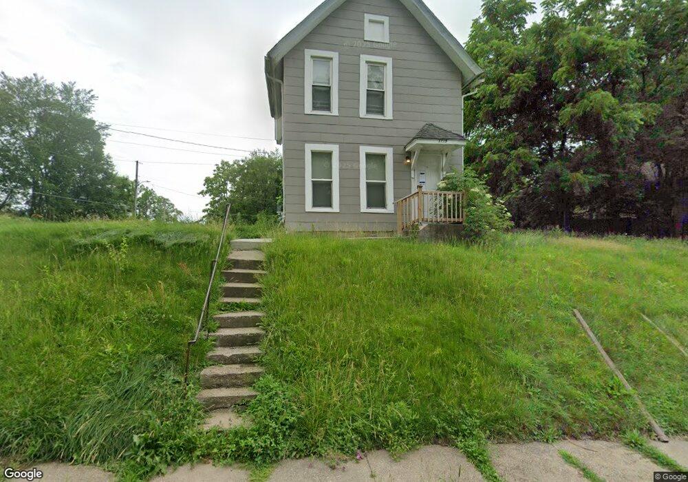
1719 E 13th St Davenport, IA 52803
East End NeighborhoodEstimated Value: $80,000 - $114,000
3
Beds
1
Bath
1,170
Sq Ft
$88/Sq Ft
Est. Value
About This Home
This home is located at 1719 E 13th St, Davenport, IA 52803 and is currently estimated at $102,678, approximately $87 per square foot. 1719 E 13th St is a home located in Scott County with nearby schools including McKinley Elementary School, Casey County Middle School, and Sudlow Intermediate School.
Ownership History
Date
Name
Owned For
Owner Type
Purchase Details
Closed on
May 3, 2022
Sold by
Roi Capital Llc
Bought by
Sfr3-050 Llc
Current Estimated Value
Purchase Details
Closed on
Dec 27, 2013
Sold by
Gullickson Group Real Estate Llc
Bought by
Gg Holdings Llc
Purchase Details
Closed on
Mar 30, 2005
Sold by
Jaresa Properties Llc
Bought by
Gullickson Group Real Estate Llc
Create a Home Valuation Report for This Property
The Home Valuation Report is an in-depth analysis detailing your home's value as well as a comparison with similar homes in the area
Home Values in the Area
Average Home Value in this Area
Purchase History
| Date | Buyer | Sale Price | Title Company |
|---|---|---|---|
| Sfr3-050 Llc | $285,000 | None Listed On Document | |
| Gg Holdings Llc | -- | None Available | |
| Gullickson Group Real Estate Llc | $38,000 | None Available |
Source: Public Records
Tax History Compared to Growth
Tax History
| Year | Tax Paid | Tax Assessment Tax Assessment Total Assessment is a certain percentage of the fair market value that is determined by local assessors to be the total taxable value of land and additions on the property. | Land | Improvement |
|---|---|---|---|---|
| 2025 | $2,029 | $98,850 | $19,600 | $79,250 |
| 2024 | $1,452 | $88,280 | $19,600 | $68,680 |
| 2023 | $1,136 | $76,310 | $19,600 | $56,710 |
| 2022 | $1,140 | $53,160 | $6,160 | $47,000 |
| 2021 | $1,140 | $53,160 | $6,160 | $47,000 |
| 2020 | $1,154 | $53,160 | $6,160 | $47,000 |
| 2019 | $1,124 | $50,090 | $6,160 | $43,930 |
| 2018 | $1,052 | $50,090 | $6,160 | $43,930 |
| 2017 | $1,088 | $47,890 | $6,160 | $41,730 |
| 2016 | $1,048 | $47,890 | $0 | $0 |
| 2015 | $1,048 | $47,530 | $0 | $0 |
| 2014 | $1,056 | $47,530 | $0 | $0 |
| 2013 | $1,038 | $0 | $0 | $0 |
| 2012 | -- | $49,850 | $7,520 | $42,330 |
Source: Public Records
Map
Nearby Homes
- 1233 Eastern Ave
- 1202 Adams St
- 1325 Mississippi Ave
- 1220 College Ave
- 1310 Kirkwood Blvd
- 1102 College Ave
- 1224 E 11th St
- 1616 Esplanade Ave
- 1004 College Ave
- 1626 Esplanade Ave
- 1504 Christie St
- 1012 Bridge Ave
- 2316 East St
- 1020 E 15th St
- 1803 Belle Ave
- 1815 Belle Ave
- 1515 Jersey Ridge Rd
- 1134 Tremont Ave
- 1704 Jersey Ridge Rd
- 2125 Eastern Ave
- 1222 Judson St
- 1713 E 13th St
- 1718 E 13th St
- 1803 E 13th St
- 1229 Eastern Ave
- 1225 Eastern Ave
- 1712 E 13th St
- 1221 Eastern Ave
- 1219 Eastern Ave
- 1708 E 13th St
- 1804 E 13th St
- 1716 E 12th St
- 1213 Eastern Ave
- 1720 E 12th St
- 1704 E 13th St
- 1702 E 12th St
- 1810 E 13th St
- 1804 E 12th St
- 1224 Eastern Ave
- 1216 Eastern Ave