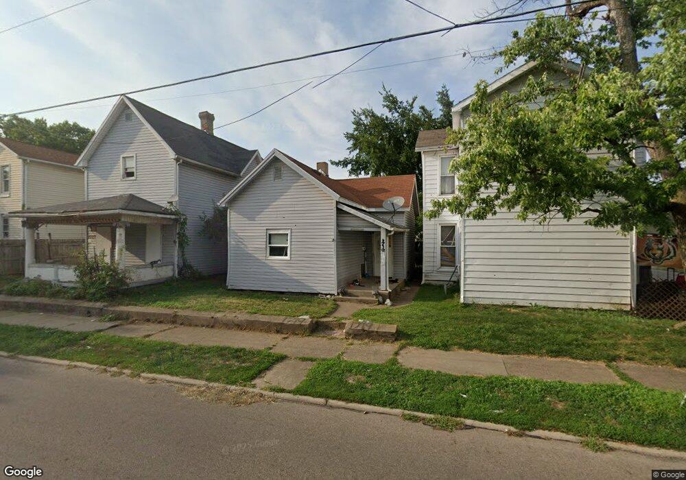
1719 Manchester Ave Middletown, OH 45042
Church NeighborhoodEstimated Value: $59,000 - $113,000
2
Beds
1
Bath
821
Sq Ft
$105/Sq Ft
Est. Value
About This Home
This home is located at 1719 Manchester Ave, Middletown, OH 45042 and is currently estimated at $86,388, approximately $105 per square foot. 1719 Manchester Ave is a home located in Butler County with nearby schools including Rosa Parks Elementary School, Highview 6th Grade Center, and Middletown Middle School.
Ownership History
Date
Name
Owned For
Owner Type
Purchase Details
Closed on
Aug 20, 2019
Sold by
Merg Properties Llc
Bought by
Ap Rentals Llc
Current Estimated Value
Purchase Details
Closed on
May 21, 2010
Sold by
Tracy Dan W and Tracy Ruthann
Bought by
Merg Properties Llc
Purchase Details
Closed on
Sep 19, 2005
Sold by
Svarda Harold and Svarda Joyce
Bought by
Tracy Dan and Tracy Ruthann
Create a Home Valuation Report for This Property
The Home Valuation Report is an in-depth analysis detailing your home's value as well as a comparison with similar homes in the area
Home Values in the Area
Average Home Value in this Area
Purchase History
| Date | Buyer | Sale Price | Title Company |
|---|---|---|---|
| Ap Rentals Llc | $420,000 | None Available | |
| Merg Properties Llc | -- | None Available | |
| Tracy Dan | $34,000 | -- |
Source: Public Records
Tax History Compared to Growth
Tax History
| Year | Tax Paid | Tax Assessment Tax Assessment Total Assessment is a certain percentage of the fair market value that is determined by local assessors to be the total taxable value of land and additions on the property. | Land | Improvement |
|---|---|---|---|---|
| 2024 | $651 | $9,170 | $3,660 | $5,510 |
| 2023 | $813 | $17,530 | $3,660 | $13,870 |
| 2022 | $302 | $5,060 | $3,660 | $1,400 |
| 2021 | $290 | $5,060 | $3,660 | $1,400 |
| 2020 | $302 | $5,060 | $3,660 | $1,400 |
| 2019 | $482 | $6,650 | $2,160 | $4,490 |
| 2018 | $431 | $6,650 | $2,160 | $4,490 |
| 2017 | $431 | $6,650 | $2,160 | $4,490 |
| 2016 | $451 | $6,650 | $2,160 | $4,490 |
| 2015 | $444 | $6,650 | $2,160 | $4,490 |
| 2014 | $505 | $11,130 | $3,610 | $7,520 |
| 2013 | $505 | $8,220 | $3,610 | $4,610 |
Source: Public Records
Map
Nearby Homes
- 206 N Sutphin St
- 113 N Sutphin St
- 15 Garfield St
- 1609 1st Ave
- 1812 Carroll Ave
- 6800 Fielders Way
- 2007 Central Ave
- 211 Harrison St
- 2016 Linden Ave
- 2113 Central Ave
- 2115 Central Ave
- 2112 Central Ave
- 2119 Central Ave
- 214 Garfield St
- 606 Mary Etta St
- 319 Moore St
- 1321 1st Ave
- 215 Baltimore St
- 1814 Logan Ave
- 1814.5 Logan Ave
- 1717 Manchester Ave
- 1721 Manchester Ave
- 106 N Grimes St
- 1715 Manchester Ave
- 1801 Manchester Ave
- 1713 Manchester Ave
- 1803 Manchester Ave
- 110 N Grimes St
- 1711 Manchester Ave
- 1722 Manchester Ave
- 1724 Manchester Ave
- 1714 Manchester Ave
- 1804 Casper St
- 1805 Manchester Ave
- 109 N Grimes St
- 1709 Manchester Ave
- 114 N Grimes St
- 1806 Casper St
- 1720 Manchester Ave
- 1716 Manchester Ave