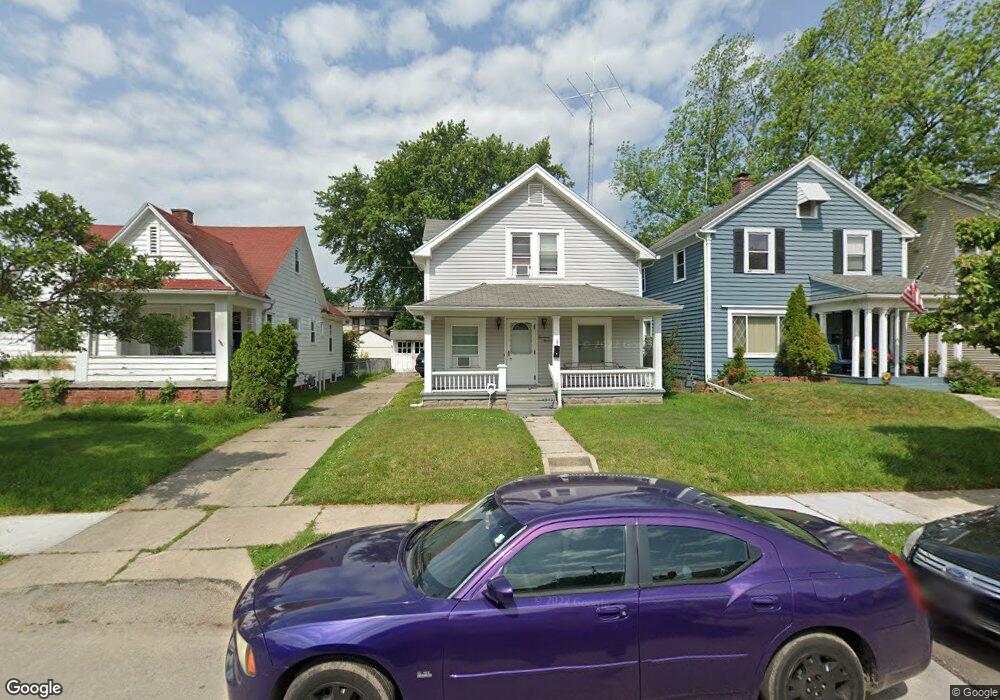
1719 Perth St Toledo, OH 43607
Ottawa NeighborhoodEstimated Value: $101,088 - $117,000
3
Beds
1
Bath
1,030
Sq Ft
$107/Sq Ft
Est. Value
About This Home
This home is located at 1719 Perth St, Toledo, OH 43607 and is currently estimated at $110,272, approximately $107 per square foot. 1719 Perth St is a home located in Lucas County with nearby schools including Old Orchard Elementary School, Start High School, and Explorers Academy.
Ownership History
Date
Name
Owned For
Owner Type
Purchase Details
Closed on
Sep 1, 2017
Sold by
Fiel Linda A
Bought by
Schreiner Thomas E and Schreiner Diana M
Current Estimated Value
Home Financials for this Owner
Home Financials are based on the most recent Mortgage that was taken out on this home.
Original Mortgage
$24,800
Outstanding Balance
$12,966
Interest Rate
3.92%
Mortgage Type
New Conventional
Estimated Equity
$97,306
Purchase Details
Closed on
Feb 23, 2017
Sold by
Fiel Linda A
Bought by
Fiel Linda A and Under Trust Agreement
Purchase Details
Closed on
Mar 24, 2000
Sold by
Partnership R & S Enterprises An Ohio General
Bought by
Fiel Linda A
Home Financials for this Owner
Home Financials are based on the most recent Mortgage that was taken out on this home.
Original Mortgage
$42,053
Interest Rate
8.43%
Mortgage Type
FHA
Purchase Details
Closed on
May 19, 1992
Sold by
Stevenson Geneva I
Create a Home Valuation Report for This Property
The Home Valuation Report is an in-depth analysis detailing your home's value as well as a comparison with similar homes in the area
Home Values in the Area
Average Home Value in this Area
Purchase History
| Date | Buyer | Sale Price | Title Company |
|---|---|---|---|
| Schreiner Thomas E | $31,000 | Louisville Title Agency For | |
| Fiel Linda A | -- | None Available | |
| Fiel Linda A | -- | None Available | |
| Fiel Linda A | $42,400 | -- | |
| -- | $25,300 | -- |
Source: Public Records
Mortgage History
| Date | Status | Borrower | Loan Amount |
|---|---|---|---|
| Open | Schreiner Thomas E | $24,800 | |
| Previous Owner | Fiel Linda A | $42,053 |
Source: Public Records
Tax History
| Year | Tax Paid | Tax Assessment Tax Assessment Total Assessment is a certain percentage of the fair market value that is determined by local assessors to be the total taxable value of land and additions on the property. | Land | Improvement |
|---|---|---|---|---|
| 2025 | -- | $24,115 | $7,560 | $16,555 |
| 2024 | $1,611 | $24,115 | $7,560 | $16,555 |
| 2023 | $1,045 | $15,120 | $5,845 | $9,275 |
| 2022 | $1,046 | $15,120 | $5,845 | $9,275 |
| 2021 | $1,066 | $15,120 | $5,845 | $9,275 |
| 2020 | $1,127 | $14,105 | $4,515 | $9,590 |
| 2019 | $1,094 | $14,105 | $4,515 | $9,590 |
| 2018 | $1,095 | $14,105 | $4,515 | $9,590 |
| 2017 | $1,098 | $13,790 | $4,410 | $9,380 |
| 2016 | $1,102 | $39,400 | $12,600 | $26,800 |
| 2015 | $1,092 | $39,400 | $12,600 | $26,800 |
| 2014 | $867 | $13,790 | $4,410 | $9,380 |
| 2013 | $867 | $13,790 | $4,410 | $9,380 |
Source: Public Records
Map
Nearby Homes
- 1723 Evansdale Ave
- 1814 Alvin St
- 1732 Evansdale Ave
- 1901 Alvin St
- 2026 Kensington Rd
- 1206 Warwick Ave
- 1118 Alldays Ave
- 2143 Alvin St
- 2547 Greenway St
- 2145 Dorr St
- 1723 Potomac Dr
- 913 Coventry Ave
- 1424 Addington Rd
- 1215 Woodstock Ave
- 1318 Addington Rd
- 2033 Crosswell Place
- 824 N University Ave
- 811 N University Ave
- 1938 Fernwood Ave
- 1511 Upton Ave
Your Personal Tour Guide
Ask me questions while you tour the home.