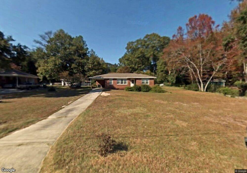
1719 Winston Dr Macon, GA 31206
Estimated Value: $96,000 - $123,000
3
Beds
2
Baths
1,100
Sq Ft
$100/Sq Ft
Est. Value
About This Home
This home is located at 1719 Winston Dr, Macon, GA 31206 and is currently estimated at $110,424, approximately $100 per square foot. 1719 Winston Dr is a home located in Bibb County with nearby schools including Hartley Elementary School, Southwest High School, and Cirrus Charter Academy.
Ownership History
Date
Name
Owned For
Owner Type
Purchase Details
Closed on
Feb 4, 2010
Sold by
Self Jim
Bought by
Self James A and Self Annice I
Current Estimated Value
Purchase Details
Closed on
Sep 20, 2005
Sold by
Bumgardner Frederick A
Bought by
Self Jim
Home Financials for this Owner
Home Financials are based on the most recent Mortgage that was taken out on this home.
Original Mortgage
$42,750
Interest Rate
5.86%
Mortgage Type
New Conventional
Create a Home Valuation Report for This Property
The Home Valuation Report is an in-depth analysis detailing your home's value as well as a comparison with similar homes in the area
Home Values in the Area
Average Home Value in this Area
Purchase History
| Date | Buyer | Sale Price | Title Company |
|---|---|---|---|
| Self James A | -- | None Available | |
| Self Jim | $47,500 | None Available |
Source: Public Records
Mortgage History
| Date | Status | Borrower | Loan Amount |
|---|---|---|---|
| Closed | Self Jim | $42,750 |
Source: Public Records
Tax History Compared to Growth
Tax History
| Year | Tax Paid | Tax Assessment Tax Assessment Total Assessment is a certain percentage of the fair market value that is determined by local assessors to be the total taxable value of land and additions on the property. | Land | Improvement |
|---|---|---|---|---|
| 2025 | $878 | $35,710 | $7,040 | $28,670 |
| 2024 | $907 | $35,710 | $7,040 | $28,670 |
| 2023 | $829 | $32,638 | $7,040 | $25,598 |
| 2022 | $850 | $24,553 | $5,375 | $19,178 |
| 2021 | $711 | $18,707 | $4,095 | $14,612 |
| 2020 | $545 | $14,030 | $3,071 | $10,959 |
| 2019 | $549 | $14,030 | $3,071 | $10,959 |
| 2018 | $1,021 | $14,030 | $3,071 | $10,959 |
| 2017 | $526 | $14,030 | $3,071 | $10,959 |
| 2016 | $485 | $14,030 | $3,071 | $10,959 |
| 2015 | $776 | $15,856 | $3,071 | $12,785 |
| 2014 | $893 | $15,856 | $3,071 | $12,785 |
Source: Public Records
Map
Nearby Homes
- 1740 Downing Cir
- 1504 Berkshire Dr
- 2350 Anthony Terrace
- 3254 Markwood Dr
- 2249 Lowe St
- 808 Patton Ave
- 815 Edwards Ave
- 800 Patton Ave
- 3339 Markwood Dr
- 1545 Anthony Rd
- 736 Key St
- 742 Grayson Ave
- 777 Grosso Ave
- 755 Grosso Ave
- 717 Patton Ave
- 1049 Anthony Rd
- 1045 Anthony Rd
- 3445 Travis Blvd
- 3446 Tamplin Terrace
- 2349 Mason St
- 1715 Winston Dr
- 1723 Winston Dr
- 1977 Neville Way
- 1985 Neville Way
- 1969 Neville Way
- 1709 Winston Dr
- 1727 Winston Dr
- 1716 Winston Dr
- 1961 Neville Way
- 1720 Winston Dr
- 1991 Neville Way
- 1726 Winston Dr
- 1708 Winston Dr
- 1953 Neville Way
- 1701 Winston Dr
- 2673 Kent Dr
- 2663 Kent Dr
- 2623 Kent Dr
- 2649 Kent Dr
- 2635 Kent Dr