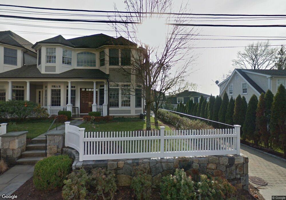
172 Field Point Rd Unit 7 Greenwich, CT 06830
Downtown Greenwich NeighborhoodEstimated Value: $1,537,000 - $1,843,000
3
Beds
4
Baths
2,244
Sq Ft
$733/Sq Ft
Est. Value
About This Home
This home is located at 172 Field Point Rd Unit 7, Greenwich, CT 06830 and is currently estimated at $1,644,291, approximately $732 per square foot. 172 Field Point Rd Unit 7 is a home located in Fairfield County with nearby schools including Julian Curtiss School, Central Middle School, and Greenwich High School.
Ownership History
Date
Name
Owned For
Owner Type
Purchase Details
Closed on
Jan 8, 2003
Sold by
Pike Gary L and Mcilduff Kenneth P
Bought by
Garelick Lynn B
Current Estimated Value
Home Financials for this Owner
Home Financials are based on the most recent Mortgage that was taken out on this home.
Original Mortgage
$300,700
Interest Rate
6.19%
Purchase Details
Closed on
Jul 26, 1999
Sold by
Pike Gary L
Bought by
Pike Gary L and Mcilduff Kenneth P
Create a Home Valuation Report for This Property
The Home Valuation Report is an in-depth analysis detailing your home's value as well as a comparison with similar homes in the area
Home Values in the Area
Average Home Value in this Area
Purchase History
| Date | Buyer | Sale Price | Title Company |
|---|---|---|---|
| Garelick Lynn B | $880,000 | -- | |
| Pike Gary L | $285,000 | -- |
Source: Public Records
Mortgage History
| Date | Status | Borrower | Loan Amount |
|---|---|---|---|
| Open | Pike Gary L | $166,100 | |
| Closed | Pike Gary L | $260,000 | |
| Closed | Pike Gary L | $300,700 | |
| Previous Owner | Pike Gary L | $600,000 |
Source: Public Records
Tax History Compared to Growth
Tax History
| Year | Tax Paid | Tax Assessment Tax Assessment Total Assessment is a certain percentage of the fair market value that is determined by local assessors to be the total taxable value of land and additions on the property. | Land | Improvement |
|---|---|---|---|---|
| 2025 | $8,456 | $684,180 | $0 | $684,180 |
| 2024 | $8,166 | $684,180 | $0 | $684,180 |
| 2023 | $7,961 | $684,180 | $0 | $684,180 |
| 2022 | $7,889 | $684,180 | $0 | $684,180 |
| 2021 | $8,516 | $707,350 | $0 | $707,350 |
| 2020 | $8,502 | $707,350 | $0 | $707,350 |
| 2019 | $8,587 | $707,350 | $0 | $707,350 |
| 2018 | $8,396 | $707,350 | $0 | $707,350 |
| 2017 | $8,502 | $707,350 | $0 | $707,350 |
| 2016 | $8,367 | $707,350 | $0 | $707,350 |
| 2015 | $7,941 | $665,910 | $0 | $665,910 |
| 2014 | $7,741 | $665,910 | $0 | $665,910 |
Source: Public Records
Map
Nearby Homes
- 172 Field Point Rd Unit 9
- 125 Field Point Rd Unit PH B5
- 57 Prospect St
- 98 Prospect St
- 25 Woodland Dr Unit C
- 1 Sound View Terrace
- 150 Prospect St Unit 27
- 201 Shore Rd
- 18 Grigg St
- 6 Benedict Place
- 75 Ritch Ave Unit A
- 25 W Elm St Unit 36
- 123 Hamilton Ave
- 8 View St Unit 10
- 68 Dearfield Dr
- 34 Edgewood Dr
- 15 Lafayette Ct Unit 4D
- 555 W Putnam Ave
- 59 Locust St Unit A
- 59 Locust St Unit B
- 172 Field Point Rd Unit 8
- 172 Field Point Rd Unit 6
- 172 Field Point Rd Unit 5
- 172 Field Point Rd Unit 4
- 172 Field Point Rd Unit 3
- 172 Field Point Rd Unit 2
- 172 Field Point Rd Unit 1
- 172 Field Point Rd
- 175 Field Point Rd
- 175 Field Point Rd Unit A
- 175 Field Point Rd Unit B
- 171 Field Point Rd
- 171 Field Point Rd Unit 2
- 171 Field Point Rd Unit 1
- 171 Field Point Rd Unit Garden Apt
- 171 Field Point Rd Unit 3
- 186 Field Point Rd Unit 6B
- 186 Field Point Rd Unit 6A
- 186 Field Point Rd Unit 5C
- 186 Field Point Rd Unit 5B