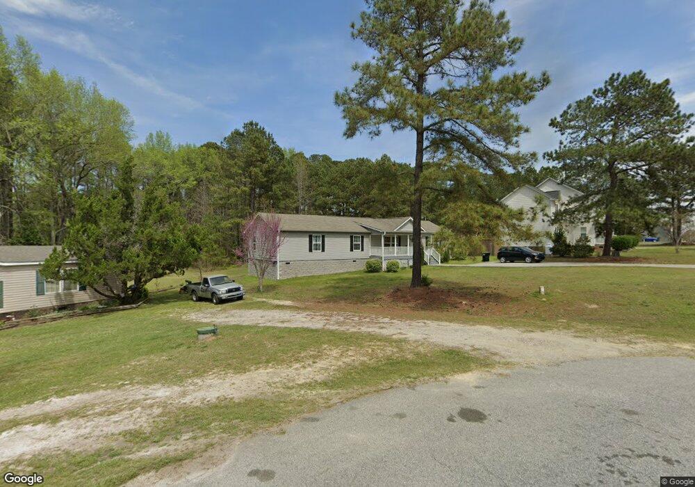
172 Mac Ln Unit 12 Angier, NC 27501
Pleasant Grove NeighborhoodEstimated Value: $298,000 - $364,000
4
Beds
2
Baths
1,925
Sq Ft
$175/Sq Ft
Est. Value
About This Home
This home is located at 172 Mac Ln Unit 12, Angier, NC 27501 and is currently estimated at $337,667, approximately $175 per square foot. 172 Mac Ln Unit 12 is a home located in Johnston County with nearby schools including McGee's Crossroads Elementary School, McGee's Crossroads Middle School, and West Johnston High School.
Ownership History
Date
Name
Owned For
Owner Type
Purchase Details
Closed on
Jan 20, 2016
Sold by
Cmh Homes Inc
Bought by
Miller Phillip and Miller Coletria
Current Estimated Value
Home Financials for this Owner
Home Financials are based on the most recent Mortgage that was taken out on this home.
Original Mortgage
$185,311
Outstanding Balance
$147,478
Interest Rate
3.98%
Mortgage Type
VA
Estimated Equity
$190,189
Purchase Details
Closed on
Aug 7, 2015
Sold by
Sacaccio Margaret Mary Quagliano
Bought by
Cmh Homes Inc
Purchase Details
Closed on
Nov 9, 2011
Sold by
D W B Properties Llc
Bought by
Sacaccio Margaret Mary Quagliano
Purchase Details
Closed on
Oct 21, 2010
Sold by
W Chase Homes Inc
Bought by
D W B Properties L L C
Create a Home Valuation Report for This Property
The Home Valuation Report is an in-depth analysis detailing your home's value as well as a comparison with similar homes in the area
Home Values in the Area
Average Home Value in this Area
Purchase History
| Date | Buyer | Sale Price | Title Company |
|---|---|---|---|
| Miller Phillip | $179,500 | None Available | |
| Cmh Homes Inc | $26,500 | Key Title Insurance Co | |
| Sacaccio Margaret Mary Quagliano | $33,000 | None Available | |
| D W B Properties L L C | $56,500 | None Available |
Source: Public Records
Mortgage History
| Date | Status | Borrower | Loan Amount |
|---|---|---|---|
| Open | Miller Phillip | $185,311 |
Source: Public Records
Tax History Compared to Growth
Tax History
| Year | Tax Paid | Tax Assessment Tax Assessment Total Assessment is a certain percentage of the fair market value that is determined by local assessors to be the total taxable value of land and additions on the property. | Land | Improvement |
|---|---|---|---|---|
| 2025 | $1,909 | $300,570 | $75,000 | $225,570 |
| 2024 | $1,562 | $192,890 | $32,000 | $160,890 |
| 2023 | $1,514 | $192,890 | $32,000 | $160,890 |
| 2022 | $1,562 | $192,890 | $32,000 | $160,890 |
| 2021 | $1,562 | $192,890 | $32,000 | $160,890 |
| 2020 | $1,620 | $192,890 | $32,000 | $160,890 |
| 2019 | $1,582 | $192,890 | $32,000 | $160,890 |
| 2018 | $1,465 | $174,380 | $33,000 | $141,380 |
| 2017 | $1,465 | $174,380 | $33,000 | $141,380 |
| 2016 | $1,009 | $120,060 | $33,000 | $87,060 |
| 2015 | -- | $33,000 | $33,000 | $0 |
| 2014 | -- | $33,000 | $33,000 | $0 |
Source: Public Records
Map
Nearby Homes
- 135 Brookstone Way
- 19 Silverside Dr
- 156 Harbor Cove Dr
- 264 Harbor Cove Dr
- 506 Harbor Cove Dr
- 154 Everland Pkwy
- 197 Silverside Dr
- Cypress Plan at Cedar Ridge
- Wescott Plan at Cedar Ridge
- Colfax Plan at Cedar Ridge
- Edgefield Plan at Cedar Ridge
- Cooper Plan at Cedar Ridge
- Hamilton Plan at Cedar Ridge
- Davidson Plan at Cedar Ridge
- McDowell Plan at Cedar Ridge
- 376 Everland Pkwy
- 232 Burrage Dr
- 105 Pinecrest Dr
- 25 Mannford Ln
- 115 S Bream Ct