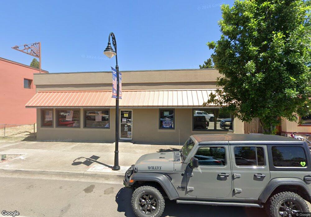
172 Main St Eagle Point, OR 97524
Estimated Value: $318,460
Studio
--
Bath
1,920
Sq Ft
$166/Sq Ft
Est. Value
About This Home
This home is located at 172 Main St, Eagle Point, OR 97524 and is currently estimated at $318,460, approximately $165 per square foot. 172 Main St is a home located in Jackson County with nearby schools including Eagle Rock Elementary School, Eagle Point Middle School, and White Mountain Middle School.
Ownership History
Date
Name
Owned For
Owner Type
Purchase Details
Closed on
Jul 13, 2015
Sold by
Stansell Rex Allen and Stansell Patsy Ann
Bought by
The Schulz Living Trust
Current Estimated Value
Home Financials for this Owner
Home Financials are based on the most recent Mortgage that was taken out on this home.
Original Mortgage
$126,000
Outstanding Balance
$72,318
Interest Rate
3.83%
Mortgage Type
Commercial
Estimated Equity
$246,142
Create a Home Valuation Report for This Property
The Home Valuation Report is an in-depth analysis detailing your home's value as well as a comparison with similar homes in the area
Home Values in the Area
Average Home Value in this Area
Purchase History
| Date | Buyer | Sale Price | Title Company |
|---|---|---|---|
| The Schulz Living Trust | $180,000 | First American |
Source: Public Records
Mortgage History
| Date | Status | Borrower | Loan Amount |
|---|---|---|---|
| Open | The Schulz Living Trust | $126,000 |
Source: Public Records
Tax History
| Year | Tax Paid | Tax Assessment Tax Assessment Total Assessment is a certain percentage of the fair market value that is determined by local assessors to be the total taxable value of land and additions on the property. | Land | Improvement |
|---|---|---|---|---|
| 2026 | $2,859 | $210,080 | -- | -- |
| 2025 | $2,791 | $203,970 | $45,610 | $158,360 |
| 2024 | $2,791 | $198,030 | $44,280 | $153,750 |
| 2023 | $2,696 | $192,270 | $42,990 | $149,280 |
| 2022 | $2,623 | $192,270 | $42,990 | $149,280 |
| 2021 | $2,545 | $186,670 | $41,740 | $144,930 |
| 2020 | $2,668 | $181,240 | $40,520 | $140,720 |
| 2019 | $2,655 | $170,850 | $38,190 | $132,660 |
| 2018 | $2,612 | $165,880 | $37,080 | $128,800 |
| 2017 | $2,525 | $165,880 | $37,080 | $128,800 |
| 2016 | $2,468 | $156,360 | $34,950 | $121,410 |
| 2015 | $2,417 | $156,360 | $34,950 | $121,410 |
| 2014 | -- | $147,390 | $32,940 | $114,450 |
Source: Public Records
Map
Nearby Homes
- 71 Tracy Ave Unit 71 & 73
- 318 S Buchanan Ave
- 407 S Shasta Ave
- 522 Meadow Ln
- 142 Onyx St
- 650 Sarah Ln
- 620 S Royal Ave
- 250 Tierra Cir
- 621 S Shasta Ave
- 421 Stevens Rd Unit 20
- 421 Stevens Rd Unit 14
- 421 Stevens Rd Unit 52
- 277 Cambridge Terrace
- 633 E Archwood Dr Unit 89
- 633 E Archwood Dr Unit 86
- 633 E Archwood Dr Unit 44
- 633 E Archwood Dr Unit 12
- 633 E Archwood Dr Unit 70
- 633 E Archwood Dr Unit 53
- 633 E Archwood Dr Unit 130
- 172 E Main St
- 172 W Main St
- 178 Main St Unit 178 & 10
- 178 Main St
- 169 W Main St
- 118 W Main St
- 171 Main St
- 204 W Main St
- 158 W Main St Unit 2
- 11 S Platt Ave
- 203 W Main St
- 0 Napa Tl 1900 St Unit 220133143
- 203 ~ 209 W Main St Eagle Point
- 159 W Main St
- 183 Napa St
- 210 W Main St
- 167 Napa St
- 21 N Platt Ave
- 25 N Platt Ave
- 218 E Main St
Your Personal Tour Guide
Ask me questions while you tour the home.