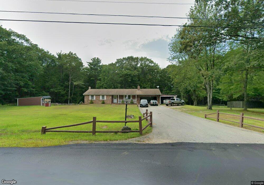
172 Robbins Rd Rindge, NH 03461
Estimated Value: $259,000 - $461,000
4
Beds
2
Baths
1,890
Sq Ft
$208/Sq Ft
Est. Value
About This Home
This home is located at 172 Robbins Rd, Rindge, NH 03461 and is currently estimated at $393,096, approximately $207 per square foot. 172 Robbins Rd is a home located in Cheshire County with nearby schools including Rindge Memorial School, Conant Middle High School, and Conant High School.
Ownership History
Date
Name
Owned For
Owner Type
Purchase Details
Closed on
Mar 14, 2025
Sold by
Comtois Christine S and Slaughter Brian H
Bought by
Slaughter Christine S and Slaughter Brian H
Current Estimated Value
Home Financials for this Owner
Home Financials are based on the most recent Mortgage that was taken out on this home.
Original Mortgage
$318,438
Outstanding Balance
$316,802
Interest Rate
6.85%
Mortgage Type
FHA
Estimated Equity
$76,294
Purchase Details
Closed on
Jun 21, 2006
Sold by
Grenier Thor Michael
Bought by
Slaughter Brian H and Comtois Christine S
Home Financials for this Owner
Home Financials are based on the most recent Mortgage that was taken out on this home.
Original Mortgage
$170,000
Interest Rate
6%
Mortgage Type
Adjustable Rate Mortgage/ARM
Create a Home Valuation Report for This Property
The Home Valuation Report is an in-depth analysis detailing your home's value as well as a comparison with similar homes in the area
Home Values in the Area
Average Home Value in this Area
Purchase History
| Date | Buyer | Sale Price | Title Company |
|---|---|---|---|
| Slaughter Christine S | -- | None Available | |
| Slaughter Christine S | -- | None Available | |
| Slaughter Brian H | $212,500 | -- | |
| Slaughter Brian H | $212,500 | -- |
Source: Public Records
Mortgage History
| Date | Status | Borrower | Loan Amount |
|---|---|---|---|
| Open | Slaughter Christine S | $318,438 | |
| Closed | Slaughter Christine S | $318,438 | |
| Previous Owner | Slaughter Brian H | $170,000 |
Source: Public Records
Tax History Compared to Growth
Tax History
| Year | Tax Paid | Tax Assessment Tax Assessment Total Assessment is a certain percentage of the fair market value that is determined by local assessors to be the total taxable value of land and additions on the property. | Land | Improvement |
|---|---|---|---|---|
| 2024 | $5,472 | $216,200 | $47,500 | $168,700 |
| 2023 | $5,414 | $216,200 | $47,500 | $168,700 |
| 2022 | $4,979 | $216,200 | $47,500 | $168,700 |
| 2021 | $5,010 | $221,200 | $47,500 | $173,700 |
| 2020 | $4,966 | $221,200 | $47,500 | $173,700 |
| 2019 | $4,331 | $156,000 | $37,000 | $119,000 |
| 2018 | $4,290 | $156,000 | $37,000 | $119,000 |
| 2017 | $4,242 | $156,000 | $37,000 | $119,000 |
| 2016 | $4,354 | $156,000 | $37,000 | $119,000 |
| 2015 | $4,351 | $156,000 | $37,000 | $119,000 |
| 2014 | $4,326 | $166,200 | $63,000 | $103,200 |
| 2013 | $4,682 | $183,900 | $63,000 | $120,900 |
Source: Public Records
Map
Nearby Homes
- 22 Daria Dr
- 0 Thomas Rd Unit 10 5014817
- Lot 14 Saybrook Dr
- Lot 15-0 Saybrook Dr
- Lot 2 Saybrook Dr
- Lot 1 Saybrook Dr
- 239 Abel Rd
- 31 Willow Ln
- 39 Willow Ln
- 37 Willow Ln
- 41 Willow Ln
- 801 Rt 12 S
- 115 Brook Side Rd Unit 2-12
- 40 Maple Dr
- 45 Camp Cir
- 42 Cromwell Dr Unit 19
- 257 Lakeside Dr
- 74 Fern Cir
- 60 Fern Cir Unit 1-59
- 26 Weidner Dr