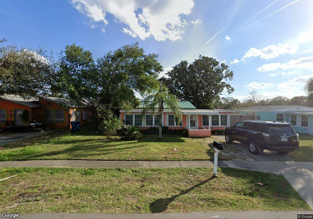
172 Roberta Rd Ormond Beach, FL 32176
Estimated Value: $298,000 - $313,000
3
Beds
1
Bath
1,104
Sq Ft
$277/Sq Ft
Est. Value
About This Home
This home is located at 172 Roberta Rd, Ormond Beach, FL 32176 and is currently estimated at $305,298, approximately $276 per square foot. 172 Roberta Rd is a home located in Volusia County with nearby schools including Ormond Beach Middle School, Seabreeze High School, and St Brendan Catholic School.
Ownership History
Date
Name
Owned For
Owner Type
Purchase Details
Closed on
May 23, 2022
Sold by
Peterson Jr Calvin H and Peterson Margaret R
Bought by
Irak Christopher J
Current Estimated Value
Home Financials for this Owner
Home Financials are based on the most recent Mortgage that was taken out on this home.
Original Mortgage
$252,616
Outstanding Balance
$238,614
Interest Rate
5.11%
Mortgage Type
New Conventional
Estimated Equity
$66,684
Purchase Details
Closed on
Apr 30, 2004
Sold by
Dynes Margaret Ann
Bought by
Peterson Calvin H and Vanpeterson Margaret R
Home Financials for this Owner
Home Financials are based on the most recent Mortgage that was taken out on this home.
Original Mortgage
$107,600
Interest Rate
5.36%
Mortgage Type
Purchase Money Mortgage
Purchase Details
Closed on
May 7, 2001
Sold by
Sherwin Dave A and Sherwin Nicole
Bought by
Wahl George W and Dyneswahl Margaret A
Home Financials for this Owner
Home Financials are based on the most recent Mortgage that was taken out on this home.
Original Mortgage
$51,003
Interest Rate
6.95%
Purchase Details
Closed on
Jun 29, 1995
Sold by
Stephenson Marion M
Bought by
Sherwin Dave A and Sherwin Nicole
Home Financials for this Owner
Home Financials are based on the most recent Mortgage that was taken out on this home.
Original Mortgage
$47,763
Interest Rate
7.82%
Mortgage Type
FHA
Purchase Details
Closed on
Oct 15, 1969
Bought by
Peterson Calvin H
Create a Home Valuation Report for This Property
The Home Valuation Report is an in-depth analysis detailing your home's value as well as a comparison with similar homes in the area
Home Values in the Area
Average Home Value in this Area
Purchase History
| Date | Buyer | Sale Price | Title Company |
|---|---|---|---|
| Irak Christopher J | $315,770 | First American Title | |
| Peterson Calvin H | $134,500 | Associated Land Title Group | |
| Wahl George W | $61,800 | -- | |
| Sherwin Dave A | $46,500 | -- | |
| Peterson Calvin H | $9,500 | -- |
Source: Public Records
Mortgage History
| Date | Status | Borrower | Loan Amount |
|---|---|---|---|
| Open | Irak Christopher J | $252,616 | |
| Previous Owner | Peterson Calvin H | $107,600 | |
| Previous Owner | Wahl George W | $51,003 | |
| Previous Owner | Sherwin Dave A | $47,763 | |
| Closed | Peterson Calvin H | $20,100 |
Source: Public Records
Tax History
| Year | Tax Paid | Tax Assessment Tax Assessment Total Assessment is a certain percentage of the fair market value that is determined by local assessors to be the total taxable value of land and additions on the property. | Land | Improvement |
|---|---|---|---|---|
| 2026 | $4,297 | $269,949 | $100,375 | $169,574 |
| 2025 | $4,297 | $267,454 | $100,375 | $167,079 |
| 2024 | $5,455 | $287,660 | $100,375 | $187,285 |
| 2023 | $5,455 | $284,392 | $92,950 | $191,442 |
| 2022 | $3,481 | $244,166 | $74,250 | $169,916 |
| 2021 | $2,872 | $133,410 | $52,250 | $81,160 |
| 2020 | $2,647 | $122,859 | $49,500 | $73,359 |
| 2019 | $2,545 | $123,536 | $49,500 | $74,036 |
| 2018 | $2,398 | $117,748 | $43,450 | $74,298 |
| 2017 | $2,218 | $102,837 | $42,350 | $60,487 |
| 2016 | $2,080 | $92,761 | $0 | $0 |
| 2015 | $1,959 | $81,975 | $0 | $0 |
| 2014 | $1,751 | $69,671 | $0 | $0 |
Source: Public Records
Map
Nearby Homes
- 82 Margaret Rd
- 66 Ocean Shore Dr
- 56 Margaret Rd
- 59 Margaret Rd
- 142 Holland Rd
- 4310 John Anderson Dr
- 55 Seaside Dr
- 36 River Shore Dr
- 51 Rivocean Dr
- 29 Ocean Shore Dr
- 31 River Shore Dr
- 4 Ocean Shore Dr
- 1575 Ocean Shore Blvd Unit 304
- 1575 Ocean Shore Blvd Unit 603
- 1575 Ocean Shore Blvd Unit J010
- 1575 Ocean Shore Blvd Unit 901
- 30 Azalea Dr
- 1510 Ocean Shore Blvd Unit 3150
- 1510 Ocean Shore Blvd Unit 4140
- 1510 Ocean Shore Blvd Unit 4150
Your Personal Tour Guide
Ask me questions while you tour the home.