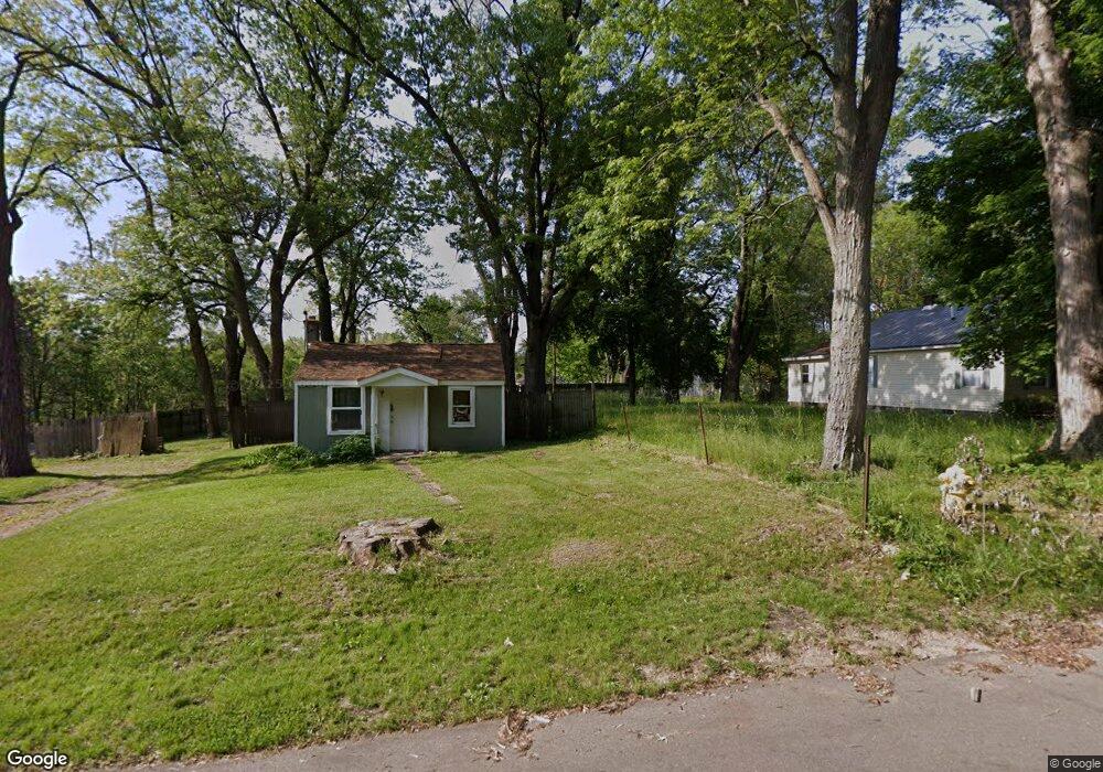
172 Rook St Battle Creek, MI 49014
Estimated Value: $70,000 - $134,000
2
Beds
1
Bath
657
Sq Ft
$154/Sq Ft
Est. Value
About This Home
This home is located at 172 Rook St, Battle Creek, MI 49014 and is currently estimated at $101,433, approximately $154 per square foot. 172 Rook St is a home located in Calhoun County with nearby schools including Harper Creek Middle School, Harper Creek High School, and Battle Creek Christian School.
Ownership History
Date
Name
Owned For
Owner Type
Purchase Details
Closed on
Nov 17, 2012
Sold by
Belles Debra K and Belles Alissa K
Bought by
Belles Debra K and Belles Adam P
Current Estimated Value
Purchase Details
Closed on
May 30, 2006
Sold by
Belles Debra K
Bought by
Belles Debra K and Belles Alissa K
Purchase Details
Closed on
Jun 14, 2002
Bought by
Belles Debra Kay
Purchase Details
Closed on
May 18, 1995
Purchase Details
Closed on
Oct 15, 1992
Purchase Details
Closed on
Aug 5, 1986
Create a Home Valuation Report for This Property
The Home Valuation Report is an in-depth analysis detailing your home's value as well as a comparison with similar homes in the area
Home Values in the Area
Average Home Value in this Area
Purchase History
| Date | Buyer | Sale Price | Title Company |
|---|---|---|---|
| Belles Debra K | -- | None Available | |
| Belles Debra K | -- | None Available | |
| Belles Debra Kay | $21,900 | -- | |
| -- | $21,900 | -- | |
| -- | $6,000 | -- | |
| -- | $5,000 | -- |
Source: Public Records
Tax History Compared to Growth
Tax History
| Year | Tax Paid | Tax Assessment Tax Assessment Total Assessment is a certain percentage of the fair market value that is determined by local assessors to be the total taxable value of land and additions on the property. | Land | Improvement |
|---|---|---|---|---|
| 2025 | $617 | $25,380 | $0 | $0 |
| 2024 | $439 | $17,120 | $0 | $0 |
| 2023 | $381 | $12,470 | $0 | $0 |
| 2022 | $225 | $9,730 | $0 | $0 |
| 2021 | $364 | $11,650 | $0 | $0 |
| 2020 | $371 | $11,300 | $0 | $0 |
| 2019 | $423 | $11,350 | $0 | $0 |
| 2018 | $319 | $9,700 | $650 | $9,050 |
| 2017 | $319 | $9,300 | $0 | $0 |
| 2016 | $319 | $9,050 | $0 | $0 |
| 2015 | $230 | $8,450 | $2,129 | $6,321 |
| 2014 | $230 | $9,750 | $2,129 | $7,621 |
Source: Public Records
Map
Nearby Homes
- 0 Rook St Unit 25019652
- 138 Rook St
- 23 Bradford St
- 79 Clark St
- 255 Livingston St
- 140 Princeton St S
- 131 Academy St
- 222 Lathrop Ave
- 507 Michigan Ave E
- 85 East Ave S
- 501 Michigan Ave E
- 232 Cliff St
- 116 Inn Rd
- 45 Traverse St
- 17 Wren St
- 118 Nelson St
- 174 Lathrop Ave
- 0 E River Rd
- 52 Maple Grove Ave
- 155 Post Ave