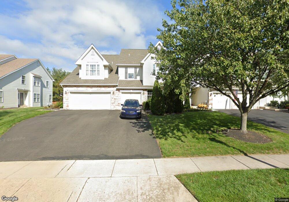
172 Stetson Dr Chalfont, PA 18914
Estimated Value: $526,653 - $582,000
3
Beds
3
Baths
2,101
Sq Ft
$262/Sq Ft
Est. Value
About This Home
This home is located at 172 Stetson Dr, Chalfont, PA 18914 and is currently estimated at $551,163, approximately $262 per square foot. 172 Stetson Dr is a home located in Bucks County with nearby schools including Mill Creek Elementary School, Unami Middle School, and Central Bucks High School - South.
Ownership History
Date
Name
Owned For
Owner Type
Purchase Details
Closed on
Oct 24, 2001
Sold by
Green Charles M and Abramson Green Jennifer
Bought by
Green Charles M
Current Estimated Value
Home Financials for this Owner
Home Financials are based on the most recent Mortgage that was taken out on this home.
Original Mortgage
$203,995
Interest Rate
6.7%
Purchase Details
Closed on
Jun 19, 2001
Sold by
Green Charles M and Abramson Green Jennifer
Bought by
Green Charles M
Home Financials for this Owner
Home Financials are based on the most recent Mortgage that was taken out on this home.
Original Mortgage
$199,800
Interest Rate
7.18%
Purchase Details
Closed on
Jun 11, 1999
Sold by
The Cutler Group Inc
Bought by
Green Charles M and Abramson Green Jennifer
Home Financials for this Owner
Home Financials are based on the most recent Mortgage that was taken out on this home.
Original Mortgage
$180,650
Interest Rate
7.37%
Create a Home Valuation Report for This Property
The Home Valuation Report is an in-depth analysis detailing your home's value as well as a comparison with similar homes in the area
Home Values in the Area
Average Home Value in this Area
Purchase History
| Date | Buyer | Sale Price | Title Company |
|---|---|---|---|
| Green Charles M | -- | -- | |
| Green Charles M | -- | -- | |
| Green Charles M | $190,203 | -- |
Source: Public Records
Mortgage History
| Date | Status | Borrower | Loan Amount |
|---|---|---|---|
| Previous Owner | Green Charles M | $203,995 | |
| Previous Owner | Green Charles M | $199,800 | |
| Previous Owner | Green Charles M | $180,650 |
Source: Public Records
Tax History Compared to Growth
Tax History
| Year | Tax Paid | Tax Assessment Tax Assessment Total Assessment is a certain percentage of the fair market value that is determined by local assessors to be the total taxable value of land and additions on the property. | Land | Improvement |
|---|---|---|---|---|
| 2025 | $6,232 | $33,760 | $3,360 | $30,400 |
| 2024 | $6,232 | $33,760 | $3,360 | $30,400 |
| 2023 | $5,770 | $33,760 | $3,360 | $30,400 |
| 2022 | $5,656 | $33,760 | $3,360 | $30,400 |
| 2021 | $5,593 | $33,760 | $3,360 | $30,400 |
| 2020 | $5,593 | $33,760 | $3,360 | $30,400 |
| 2019 | $5,559 | $33,760 | $3,360 | $30,400 |
| 2018 | $5,497 | $33,760 | $3,360 | $30,400 |
| 2017 | $5,423 | $33,760 | $3,360 | $30,400 |
| 2016 | $5,406 | $33,760 | $3,360 | $30,400 |
| 2015 | -- | $33,760 | $3,360 | $30,400 |
| 2014 | -- | $33,760 | $3,360 | $30,400 |
Source: Public Records
Map
Nearby Homes
- 3000 Tyler Way
- 3220 Wier Dr W Unit W
- 511 McNaney Farm Dr Lot #6
- 528 Fullerton Farm Ct
- 506 McNaney Farm Dr Lot # 27
- 506 Fullerton Farm Court Lot #22
- 503
- 508 Fullerton Farm Court Lot#21
- 222 Grove Valley Ct
- 214 Grove Valley Ct
- 1608 County Line Rd
- 204 Neighbors Rd
- 625 N Settlers Cir
- 1231 Lower State Rd
- 407 Maryjoe Way
- 87 Schreiner Dr
- 430 Homestead Cir
- 623 Addison Way
- 2627 County Line Rd
- 2617 County Line Rd