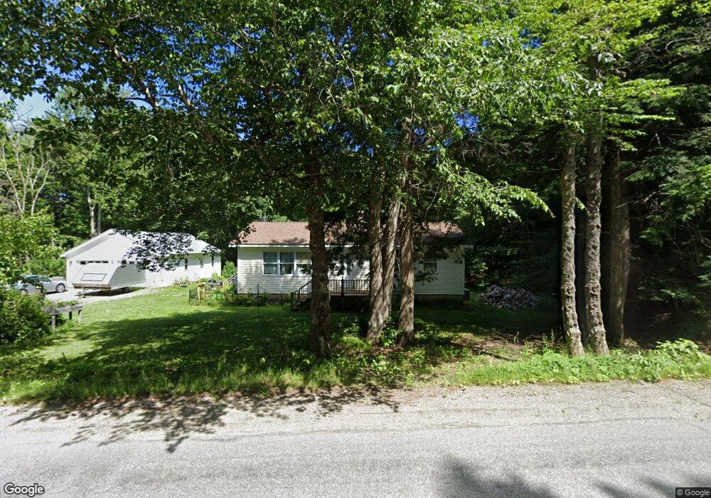
172 Upper Dedham Rd Holden, ME 04429
Estimated Value: $204,644 - $400,000
3
Beds
1
Bath
1,225
Sq Ft
$220/Sq Ft
Est. Value
About This Home
This home is located at 172 Upper Dedham Rd, Holden, ME 04429 and is currently estimated at $269,661, approximately $220 per square foot. 172 Upper Dedham Rd is a home located in Penobscot County.
Ownership History
Date
Name
Owned For
Owner Type
Purchase Details
Closed on
Mar 29, 2006
Sold by
Crossman Elizabeth E and Crossman Gregory E
Bought by
Straight Stephen A and Straight Linda M
Current Estimated Value
Home Financials for this Owner
Home Financials are based on the most recent Mortgage that was taken out on this home.
Original Mortgage
$99,910
Outstanding Balance
$57,282
Interest Rate
6.32%
Mortgage Type
Purchase Money Mortgage
Estimated Equity
$212,379
Create a Home Valuation Report for This Property
The Home Valuation Report is an in-depth analysis detailing your home's value as well as a comparison with similar homes in the area
Home Values in the Area
Average Home Value in this Area
Purchase History
| Date | Buyer | Sale Price | Title Company |
|---|---|---|---|
| Straight Stephen A | -- | -- |
Source: Public Records
Mortgage History
| Date | Status | Borrower | Loan Amount |
|---|---|---|---|
| Open | Straight Stephen A | $99,910 |
Source: Public Records
Tax History
| Year | Tax Paid | Tax Assessment Tax Assessment Total Assessment is a certain percentage of the fair market value that is determined by local assessors to be the total taxable value of land and additions on the property. | Land | Improvement |
|---|---|---|---|---|
| 2024 | $2,200 | $113,670 | $39,520 | $74,150 |
| 2023 | $2,089 | $113,830 | $39,520 | $74,310 |
| 2022 | $2,032 | $113,830 | $39,520 | $74,310 |
| 2021 | $1,960 | $109,800 | $38,020 | $71,780 |
| 2020 | $730 | $109,800 | $38,020 | $71,780 |
| 2019 | $1,874 | $97,550 | $38,020 | $59,530 |
| 2018 | $1,874 | $98,230 | $38,020 | $60,210 |
| 2017 | $1,562 | $98,230 | $38,020 | $60,210 |
| 2016 | $668 | $99,030 | $38,020 | $61,010 |
| 2015 | $1,585 | $101,300 | $37,650 | $63,650 |
| 2014 | $1,585 | $101,300 | $37,650 | $63,650 |
| 2013 | $1,580 | $101,300 | $37,650 | $63,650 |
Source: Public Records
Map
Nearby Homes
- 208 Upper Dedham Rd
- 37 Lower Dedham Rd
- 325 Lower Dedham Rd
- 59 Kidder Hill Rd
- 126 Kidder Hill Rd
- TBD Marks Mountain Way
- 41 Rowe Brook Rd
- 0 Dragonfly Dr
- Lot 5 Peakes Hill Rd
- 630 South Rd
- 26 Mill Rd
- Lot 006-3 Dole Hill Rd
- 358 Peakes Hill Rd
- 78 Sunset Rd
- 11 High Hill Ct
- 0 Tbd Mountain View Dr
- 15-3 Royal Ridge
- 2 Hornbeam Rd
- Lots 2&3 Maple Ridge Rd
- 443 Mann Hill Rd
- 154 Upper Dedham Rd
- 169 Upper Dedham Rd
- 173 Upper Dedham Rd
- 155 Upper Dedham Rd
- 190 Upper Dedham Rd
- Lot 8 Hillside Dr
- Lot 10 Hillside Dr
- Lot 6 Hillside Dr
- 34 Hillside Dr
- Lot 4 Hillside Dr
- 8-4 Hillside Dr
- 0 Hillside Dr
- Lot 9 Hillside Dr
- Lot 7 Hillside Dr
- Lot 5 Hillside Dr
- Lot 3 Hillside Dr
- Lot 1 Hillside Dr
- 11 Hillside Dr
- 27 Hillside Dr
- 131 Upper Dedham Rd
Your Personal Tour Guide
Ask me questions while you tour the home.