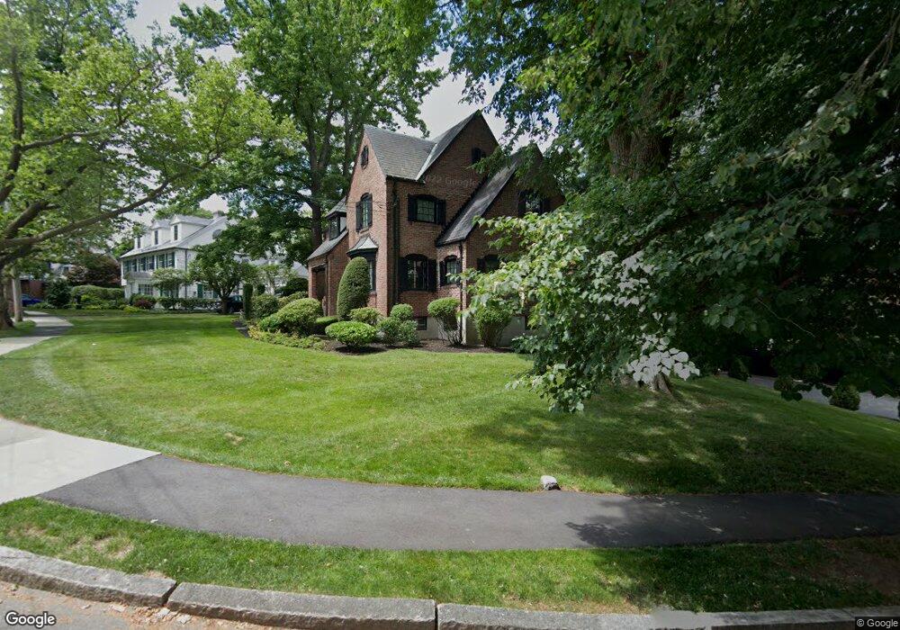
172 Walnut Hill Rd Chestnut Hill, MA 02467
South Brookline NeighborhoodEstimated Value: $1,813,000 - $2,273,000
3
Beds
4
Baths
2,700
Sq Ft
$757/Sq Ft
Est. Value
About This Home
This home is located at 172 Walnut Hill Rd, Chestnut Hill, MA 02467 and is currently estimated at $2,042,775, approximately $756 per square foot. 172 Walnut Hill Rd is a home located in Norfolk County with nearby schools including Baker School, Mount Alvernia Academy, and Dexter School.
Ownership History
Date
Name
Owned For
Owner Type
Purchase Details
Closed on
Feb 27, 2007
Sold by
Arnold Meredith A
Bought by
Ferguson Daniel H and Ferguson Joan M
Current Estimated Value
Home Financials for this Owner
Home Financials are based on the most recent Mortgage that was taken out on this home.
Original Mortgage
$767,600
Outstanding Balance
$463,854
Interest Rate
6.23%
Mortgage Type
Purchase Money Mortgage
Estimated Equity
$1,578,921
Purchase Details
Closed on
Mar 1, 1999
Sold by
Levine Bette N
Bought by
Arnold Geoffrey and Arnold Meredith
Create a Home Valuation Report for This Property
The Home Valuation Report is an in-depth analysis detailing your home's value as well as a comparison with similar homes in the area
Home Values in the Area
Average Home Value in this Area
Purchase History
| Date | Buyer | Sale Price | Title Company |
|---|---|---|---|
| Ferguson Daniel H | $959,500 | -- | |
| Arnold Geoffrey | $645,000 | -- |
Source: Public Records
Mortgage History
| Date | Status | Borrower | Loan Amount |
|---|---|---|---|
| Open | Arnold Geoffrey | $200,000 | |
| Open | Ferguson Daniel H | $767,600 |
Source: Public Records
Tax History Compared to Growth
Tax History
| Year | Tax Paid | Tax Assessment Tax Assessment Total Assessment is a certain percentage of the fair market value that is determined by local assessors to be the total taxable value of land and additions on the property. | Land | Improvement |
|---|---|---|---|---|
| 2025 | $17,863 | $1,809,800 | $796,500 | $1,013,300 |
| 2024 | $17,026 | $1,742,700 | $765,800 | $976,900 |
| 2023 | $15,742 | $1,578,900 | $621,000 | $957,900 |
| 2022 | $15,323 | $1,503,700 | $591,400 | $912,300 |
| 2021 | $14,170 | $1,445,900 | $568,700 | $877,200 |
| 2020 | $13,062 | $1,382,200 | $516,900 | $865,300 |
| 2019 | $12,335 | $1,316,400 | $492,300 | $824,100 |
| 2018 | $12,360 | $1,306,600 | $492,400 | $814,200 |
| 2017 | $12,178 | $1,232,600 | $464,500 | $768,100 |
| 2016 | $12,004 | $1,152,000 | $434,100 | $717,900 |
| 2015 | $11,498 | $1,076,600 | $405,700 | $670,900 |
| 2014 | $11,713 | $1,028,400 | $368,800 | $659,600 |
Source: Public Records
Map
Nearby Homes
- 1125 W Roxbury Pkwy
- 72 Wallis Rd
- 50 Bellingham Rd
- 65 Lagrange St
- 91 Grove St
- 57 Broadlawn Park Unit 4B
- 44 Broadlawn Park Unit 22
- 64 Bryon Rd Unit 1
- 21 Westgate Rd Unit 6
- 42 Bryon Rd Unit 6
- 23 Westgate Rd Unit 6
- 109 Harwich Rd
- 138 Woodland Rd
- 83 Payson Rd
- 14 Rolling Ln
- 70 Pond Brook Rd
- 701 Vfw Pkwy
- 0 Glenoe Rd
- 3 Glenoe Rd
- 1206 Lagrange St Unit 1206
- 140 Shaw Rd
- 166 Walnut Hill Rd
- 183 Wallis Rd
- 133 Shaw Rd
- 171 Walnut Hill Rd
- 123 Shaw Rd
- 150 Shaw Rd
- 117 Shaw Rd
- 158 Walnut Hill Rd
- 192 Wallis Rd
- 186 Wallis Rd
- 171 Wallis Rd
- 153 Walnut Hill Rd
- 11 Wolcott Road Extension
- 161 Wallis Rd
- 84 Alberta Rd
- 107 Alberta Rd
- 158 Shaw Rd
- 158 Shaw Rd
- 158 Shaw Rd Unit 1