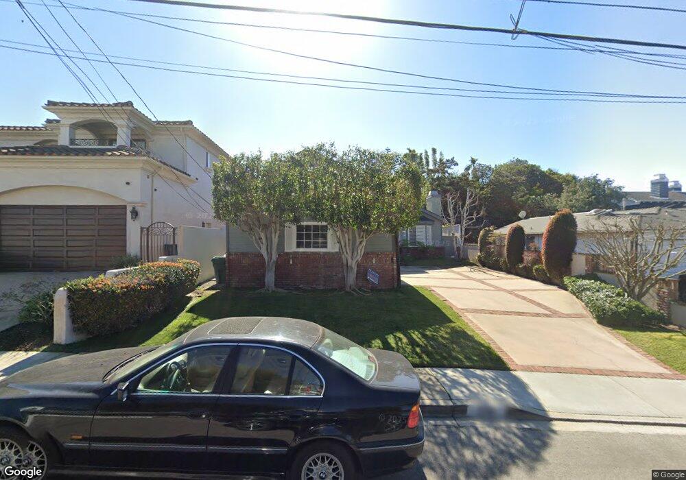
1720 Curtis Ave Manhattan Beach, CA 90266
Estimated Value: $2,951,401 - $3,805,000
4
Beds
3
Baths
3,119
Sq Ft
$1,018/Sq Ft
Est. Value
About This Home
This home is located at 1720 Curtis Ave, Manhattan Beach, CA 90266 and is currently estimated at $3,176,100, approximately $1,018 per square foot. 1720 Curtis Ave is a home located in Los Angeles County with nearby schools including Aurelia Pennekamp Elementary School, Manhattan Beach Middle School, and Mira Costa High School.
Ownership History
Date
Name
Owned For
Owner Type
Purchase Details
Closed on
Jun 28, 2003
Sold by
Claman Douglas A
Bought by
Sepanek James Robert and Sepanek Darren
Current Estimated Value
Home Financials for this Owner
Home Financials are based on the most recent Mortgage that was taken out on this home.
Original Mortgage
$550,000
Interest Rate
5.46%
Mortgage Type
Purchase Money Mortgage
Purchase Details
Closed on
Oct 16, 2001
Sold by
Claman Douglas A
Bought by
Claman Douglas A and Claman Jennifer Y
Home Financials for this Owner
Home Financials are based on the most recent Mortgage that was taken out on this home.
Original Mortgage
$540,000
Interest Rate
6.87%
Purchase Details
Closed on
Nov 17, 2000
Sold by
Claman Douglas A
Bought by
Claman Douglas A and Claman Jennifer Y
Purchase Details
Closed on
Dec 19, 1997
Sold by
Harvey Robert Thomas
Bought by
Claman Douglas A and Claman Jennifer Y
Home Financials for this Owner
Home Financials are based on the most recent Mortgage that was taken out on this home.
Original Mortgage
$559,000
Interest Rate
6.87%
Purchase Details
Closed on
Jul 1, 1997
Sold by
Gallagher Michael E
Bought by
Harvey Robert Thomas and Robbins Brooke Lancaster
Home Financials for this Owner
Home Financials are based on the most recent Mortgage that was taken out on this home.
Original Mortgage
$511,600
Interest Rate
7%
Create a Home Valuation Report for This Property
The Home Valuation Report is an in-depth analysis detailing your home's value as well as a comparison with similar homes in the area
Home Values in the Area
Average Home Value in this Area
Purchase History
| Date | Buyer | Sale Price | Title Company |
|---|---|---|---|
| Sepanek James Robert | $1,130,000 | Lawyers Title | |
| Claman Douglas A | -- | American Title Co | |
| Claman Douglas A | -- | -- | |
| Claman Douglas A | $699,500 | Lawyers Title Company | |
| Harvey Robert Thomas | $639,500 | Lawyers Title Company |
Source: Public Records
Mortgage History
| Date | Status | Borrower | Loan Amount |
|---|---|---|---|
| Previous Owner | Sepanek James Robert | $550,000 | |
| Previous Owner | Claman Douglas A | $540,000 | |
| Previous Owner | Claman Douglas A | $559,000 | |
| Previous Owner | Harvey Robert Thomas | $511,600 |
Source: Public Records
Tax History Compared to Growth
Tax History
| Year | Tax Paid | Tax Assessment Tax Assessment Total Assessment is a certain percentage of the fair market value that is determined by local assessors to be the total taxable value of land and additions on the property. | Land | Improvement |
|---|---|---|---|---|
| 2025 | $18,423 | $1,606,605 | $1,253,016 | $353,589 |
| 2024 | $18,423 | $1,575,104 | $1,228,448 | $346,656 |
| 2023 | $17,814 | $1,544,220 | $1,204,361 | $339,859 |
| 2022 | $17,509 | $1,513,943 | $1,180,747 | $333,196 |
| 2021 | $17,218 | $1,484,259 | $1,157,596 | $326,663 |
| 2019 | $16,760 | $1,440,237 | $1,123,262 | $316,975 |
| 2018 | $16,354 | $1,411,998 | $1,101,238 | $310,760 |
| 2016 | $15,137 | $1,357,171 | $1,058,477 | $298,694 |
| 2015 | $14,824 | $1,336,786 | $1,042,578 | $294,208 |
| 2014 | $14,620 | $1,310,601 | $1,022,156 | $288,445 |
Source: Public Records
Map
Nearby Homes
- 207 S Aviation Blvd
- 1756 Ruhland Ave
- 2406 Aviation Blvd Unit C
- 1902 Gates Ave
- 2700 Aviation Blvd
- 615 Aviation Way
- 1643 3rd St
- 1906 Plant Ave
- 1500 2nd St
- 1752 Carver St
- 1752 Dixon St
- 1758 Reed St
- 2021 Curtis Ave
- 1711 Axenty Way
- 2001 Artesia Blvd Unit 207
- 1900 Vanderbilt Ln
- 1742 Reed St
- 2113 Voorhees Ave Unit D
- 1760 9th St
- 2106 Nelson Ave Unit A
- 1726 Curtis Ave
- 1730 Curtis Ave
- 1712 Curtis Ave
- 1736 Curtis Ave
- 1721 Voorhees Ave
- 1706 Curtis Ave
- 1717 Voorhees Ave
- 1727 Voorhees Ave
- 1713 Voorhees Ave
- 308 S Redondo Ave
- 1731 Voorhees Ave
- 1721 Curtis Ave
- 1713 Curtis Ave
- 1727 Curtis Ave
- 1717 Curtis Ave
- 1740 Curtis Ave
- 328 S Redondo Ave
- 1700 Curtis Ave
- 1731 Curtis Ave
- 1707 Curtis Ave