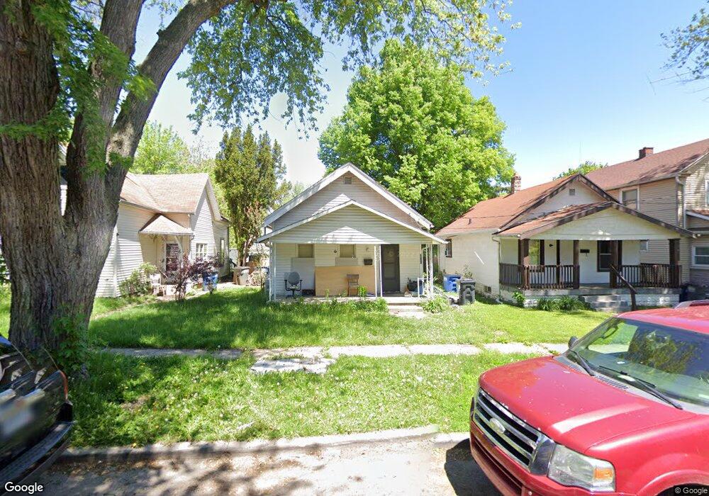
1720 Freeman St Toledo, OH 43606
Ottawa NeighborhoodEstimated Value: $47,000 - $66,000
2
Beds
1
Bath
868
Sq Ft
$67/Sq Ft
Est. Value
About This Home
This home is located at 1720 Freeman St, Toledo, OH 43606 and is currently estimated at $57,792, approximately $66 per square foot. 1720 Freeman St is a home located in Lucas County with nearby schools including Jesup W. Scott High School, GESU Catholic School, and St. Francis de Sales School.
Ownership History
Date
Name
Owned For
Owner Type
Purchase Details
Closed on
Feb 20, 2004
Sold by
Micham Philip L and Micham Mary F
Bought by
Venson John and Venson Chirleen
Current Estimated Value
Home Financials for this Owner
Home Financials are based on the most recent Mortgage that was taken out on this home.
Original Mortgage
$10,000
Outstanding Balance
$4,562
Interest Rate
5.77%
Mortgage Type
Seller Take Back
Estimated Equity
$53,230
Purchase Details
Closed on
Mar 17, 1994
Sold by
Micham Philip L
Purchase Details
Closed on
Jun 21, 1988
Sold by
Thompson Bernetha
Create a Home Valuation Report for This Property
The Home Valuation Report is an in-depth analysis detailing your home's value as well as a comparison with similar homes in the area
Home Values in the Area
Average Home Value in this Area
Purchase History
| Date | Buyer | Sale Price | Title Company |
|---|---|---|---|
| Venson John | $10,000 | -- | |
| -- | -- | -- | |
| -- | -- | -- |
Source: Public Records
Mortgage History
| Date | Status | Borrower | Loan Amount |
|---|---|---|---|
| Open | Venson John | $10,000 |
Source: Public Records
Tax History
| Year | Tax Paid | Tax Assessment Tax Assessment Total Assessment is a certain percentage of the fair market value that is determined by local assessors to be the total taxable value of land and additions on the property. | Land | Improvement |
|---|---|---|---|---|
| 2025 | $1,796 | $8,015 | $1,400 | $6,615 |
| 2024 | $1,583 | $8,015 | $1,400 | $6,615 |
| 2023 | $133 | $4,795 | $1,225 | $3,570 |
| 2022 | $139 | $4,795 | $1,225 | $3,570 |
| 2021 | $128 | $4,795 | $1,225 | $3,570 |
| 2020 | $133 | $4,550 | $1,155 | $3,395 |
| 2019 | $138 | $4,550 | $1,155 | $3,395 |
| 2018 | $132 | $4,550 | $1,155 | $3,395 |
| 2017 | $693 | $4,445 | $1,120 | $3,325 |
| 2016 | $605 | $12,700 | $3,200 | $9,500 |
| 2015 | $134 | $12,700 | $3,200 | $9,500 |
| 2014 | -- | $4,450 | $1,120 | $3,330 |
| 2013 | -- | $4,450 | $1,120 | $3,330 |
Source: Public Records
Map
Nearby Homes
- 1943 Macomber St
- 1749 Milburn Ave
- 1522 Cone St
- 2141 Joffre Ave
- 2144 Hawthorne St
- 2242 Auburn Ave
- 2114 Parkdale Ave
- 1428 Freeman St
- 2040 Joffre Ave
- 2322 Upton Ave
- 1833 Ottawa Dr
- 2026 Hawthorne St
- 1950 Calumet Ave
- 1938 Cone St
- 1917 Clinton St
- 1914 Upton Ave
- 1405 Prospect Ave
- 1510 Lincoln Ave
- 1401 Foster Ave
- 1420 Goodale Ave
- 1718 Freeman St
- 1722 Freeman St
- 1716 Freeman St
- 1724 Freeman St
- 1714 Freeman St
- 1728 Freeman St
- 1710 Freeman St
- 1719 Macomber St
- 1732 Freeman St
- 1717 Macomber St
- 1727 Macomber St
- 1715 Macomber St
- 1708 Freeman St
- 1729 Macomber St
- 1733 Macomber St
- 1736 Freeman St
- 1711 Macomber St
- 1719 Freeman St
- 1715 Freeman St
- 1706 Freeman St
Your Personal Tour Guide
Ask me questions while you tour the home.