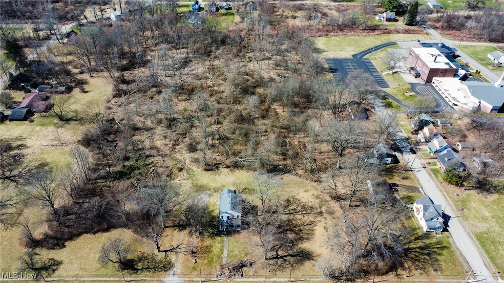
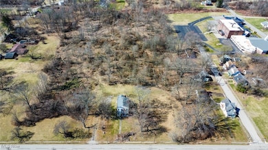
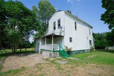
1720 Jacobs Rd Youngstown, OH 44505
McGuffey Heights NeighborhoodEstimated payment $1,334/month
About This Lot
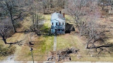
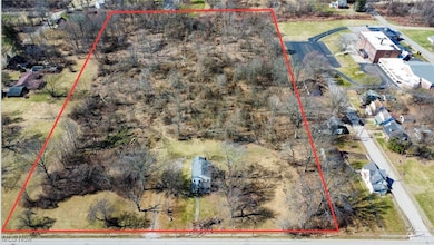
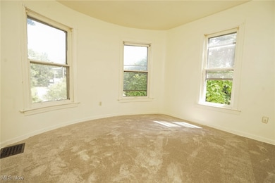
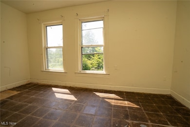
Welcome to 1720 Jacobs Road, Youngstown, OH 44505 — a rare and valuable opportunity to acquire nearly 12 acres of land located within the city limits. This property presents exceptional potential for developers, investors, or business owners looking to establish a footprint in a rapidly evolving urban corridor. Currently zoned residential, this property offers the potential for commercial rezoning, making it ideal for a wide range of uses including multi-family housing, mixed-use development, storage facilities, or commercial expansion. Approximately one acre has been cleared, with the remaining acreage offering dense coverage — a blank canvas for redevelopment or investment. Whether you're looking to develop housing, open a business, or hold for long-term value, this site provides flexibility and opportunity in one of Youngstown’s strategic locations. Conveniently located near major highways, shopping centers, dining, and public services, this property delivers both accessibility and visibility, making it a smart acquisition for today’s investor or entrepreneur. As urban land becomes increasingly limited, 1720 Jacobs Road offers a strategic edge for anyone seeking opportunity in the heart of the city.
Listing Agent
Howard Hanna Brokerage Email: bryanspurlock@howardhanna.com 330-506-5652 License #2020001890 Listed on: 03/14/2025

Property Details
Property Type
- Land
Est. Annual Taxes
- $476
Lot Details
- 11.8 Acre Lot
- 53-217-0-031.00-0,53-217-0-029.00-0
- May Be Possible The Lot Can Be Split Into 2+ Parcels
Parking
- Off-Street Parking
Utilities
- Natural Gas Connected
Community Details
- No Home Owners Association
- Alexander Stafford Subdivision
Listing and Financial Details
- Assessor Parcel Number 53-217-0-030.00-0
Map
Home Values in the Area
Average Home Value in this Area
Tax History
| Year | Tax Paid | Tax Assessment Tax Assessment Total Assessment is a certain percentage of the fair market value that is determined by local assessors to be the total taxable value of land and additions on the property. | Land | Improvement |
|---|---|---|---|---|
| 2024 | $386 | $7,850 | $3,470 | $4,380 |
| 2023 | $383 | $7,850 | $3,470 | $4,380 |
| 2022 | $222 | $3,480 | $2,380 | $1,100 |
| 2021 | $222 | $3,480 | $2,380 | $1,100 |
| 2020 | $223 | $3,480 | $2,380 | $1,100 |
| 2019 | $233 | $3,230 | $2,210 | $1,020 |
| 2018 | $247 | $3,230 | $2,210 | $1,020 |
| 2017 | $251 | $3,230 | $2,210 | $1,020 |
| 2016 | $270 | $4,050 | $2,210 | $1,840 |
| 2015 | $278 | $4,050 | $2,210 | $1,840 |
| 2014 | $263 | $4,050 | $2,210 | $1,840 |
| 2013 | $260 | $4,050 | $2,210 | $1,840 |
Property History
| Date | Event | Price | List to Sale | Price per Sq Ft |
|---|---|---|---|---|
| 09/12/2025 09/12/25 | Price Changed | $245,000 | -2.0% | -- |
| 08/19/2025 08/19/25 | For Sale | $250,000 | -- | -- |
Purchase History
| Date | Type | Sale Price | Title Company |
|---|---|---|---|
| Deed | -- | -- |
Source: MLS Now (Howard Hanna)
MLS Number: 5106319
APN: 53-217-0-030.00-0
Disclaimer: Certain information contained herein is derived from information provided by parties other than Homes.com. All information provided is deemed reliable, but is not guaranteed to be accurate and should be independently verified.
![]() Certain information contained herein is derived from information provided by parties other than Homes.com. All information provided is deemed reliable, but is not guaranteed to be accurate and should be independently verified.
Certain information contained herein is derived from information provided by parties other than Homes.com. All information provided is deemed reliable, but is not guaranteed to be accurate and should be independently verified.
- 1214 Brighton St
- V/L Jacobs Rd
- 2951 Megan Cir
- 2831 Benford Ln
- 2954 Megan Cir
- 2824 Benford Ln
- 3725 Ron Ln
- 1325 Miami Ave
- 902 Miami St
- 2160 Lansdowne Blvd
- 366 Westview Ave
- 1538 Republic Ave
- 269 Westview Ave
- 531 Meadowland Dr
- 5843 Fairlawn Ave
- 0 Homestead Rd
- 257 Westview Ave
- 6068 Evans Dr
- 227 Greeley Ln
- 405 Drake Ave
- 1042-1096 Eastway Dr
- 2960 Megan Cir
- 205 Beachwood Dr
- 3687 Franklin Ave SE
- 157 Youngstown Hubbard Rd
- 114 Gluck St
- 518 W Liberty St
- 206 Caroline Ave Unit 206
- 4151-4201 Logan Gate Rd
- 212 N Main St
- 3555 Mccartney Rd
- 25 Zents Ave
- 301 Park Dr
- 175 Brookline Ave
- 177 Brookline Ave Unit 179
- 4116 Monticello Blvd
- 139 Madison Ave
- 288 Granada Ave
- 371 Kendall Ave Unit 1
- 112 W Commerce St