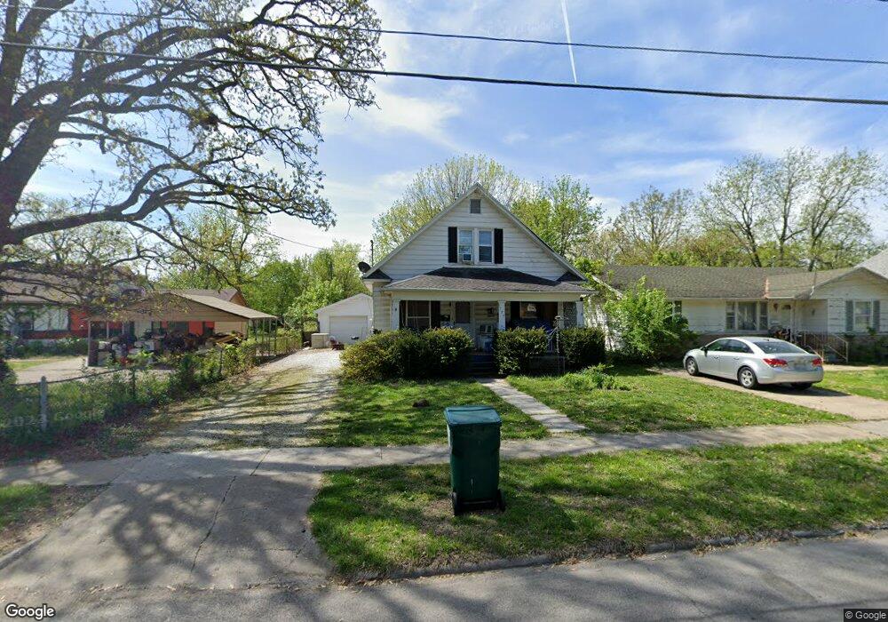
1720 W Atlantic St Springfield, MO 65803
Tom Watkins NeighborhoodEstimated Value: $129,000 - $177,000
3
Beds
2
Baths
1,440
Sq Ft
$103/Sq Ft
Est. Value
About This Home
This home is located at 1720 W Atlantic St, Springfield, MO 65803 and is currently estimated at $147,942, approximately $102 per square foot. 1720 W Atlantic St is a home located in Greene County with nearby schools including Williams Elementary School, Reed Academy, and Hillcrest High School.
Ownership History
Date
Name
Owned For
Owner Type
Purchase Details
Closed on
May 31, 2019
Sold by
Childers Melanie A
Bought by
Childers William A
Current Estimated Value
Purchase Details
Closed on
Jul 18, 2013
Sold by
Clark Richard Lynn and Clark Jennifer Jo
Bought by
Childers Melanie Alayne
Home Financials for this Owner
Home Financials are based on the most recent Mortgage that was taken out on this home.
Original Mortgage
$48,000
Outstanding Balance
$34,933
Interest Rate
3.94%
Mortgage Type
New Conventional
Estimated Equity
$113,009
Purchase Details
Closed on
Sep 18, 2012
Sold by
Clark Christine
Bought by
Clark Richard Lynn and Clark Jennifer Jo
Create a Home Valuation Report for This Property
The Home Valuation Report is an in-depth analysis detailing your home's value as well as a comparison with similar homes in the area
Home Values in the Area
Average Home Value in this Area
Purchase History
| Date | Buyer | Sale Price | Title Company |
|---|---|---|---|
| Childers William A | -- | None Available | |
| Childers Melanie Alayne | -- | None Available | |
| Clark Richard Lynn | -- | None Available |
Source: Public Records
Mortgage History
| Date | Status | Borrower | Loan Amount |
|---|---|---|---|
| Open | Childers Melanie Alayne | $48,000 |
Source: Public Records
Tax History Compared to Growth
Tax History
| Year | Tax Paid | Tax Assessment Tax Assessment Total Assessment is a certain percentage of the fair market value that is determined by local assessors to be the total taxable value of land and additions on the property. | Land | Improvement |
|---|---|---|---|---|
| 2025 | $660 | $13,810 | $2,850 | $10,960 |
| 2024 | $660 | $12,310 | $1,900 | $10,410 |
| 2023 | $657 | $12,310 | $1,900 | $10,410 |
| 2022 | $646 | $11,820 | $1,900 | $9,920 |
| 2021 | $645 | $11,820 | $1,900 | $9,920 |
| 2020 | $621 | $10,870 | $1,900 | $8,970 |
| 2019 | $603 | $10,870 | $1,900 | $8,970 |
| 2018 | $597 | $10,770 | $1,900 | $8,870 |
| 2017 | $591 | $10,750 | $1,900 | $8,850 |
| 2016 | $589 | $10,750 | $1,900 | $8,850 |
| 2015 | $584 | $10,750 | $1,900 | $8,850 |
| 2014 | $589 | $10,770 | $1,900 | $8,870 |
Source: Public Records
Map
Nearby Homes
- 1700 W Atlantic St
- 1630 W Atlantic St
- 1925 W Atlantic St
- 1944 W Thoman St
- 1956 W Atlantic St
- 2010 W Atlantic St
- 1516 W Lee St
- 2074 N Albertha Ave
- 1710 W High St
- 2042 N Marion Ave
- 2130 N Elizabeth Ave
- 2100 W Lee St
- 2028 N Hoffman Ave
- 2234 N Fay Ave
- 2228 N Farmer Ave
- 3171 N Park Ave
- 2227 N Elizabeth Ave
- 2219 N Nettleton Ave
- 2122 N Newton Ave
- 2009 N Park Ave
- 1726 W Atlantic St
- 1712 W Atlantic St
- 1730 W Atlantic St
- 1706 W Atlantic St
- 1734 W Atlantic St
- 1721 W Thoman St
- 1717 W Thoman St
- 1727 W Thoman St
- 1711 W Thoman St
- 1731 W Thoman St
- 1721 W Atlantic St
- 1717 W Atlantic St
- 1737 W Thoman St
- 1707 W Thoman St
- 1801 W Atlantic St
- 1713 W Atlantic St
- 1636 W Atlantic St
- 1800 W Atlantic St
- 1707 W Atlantic St
- 1805 W Atlantic St