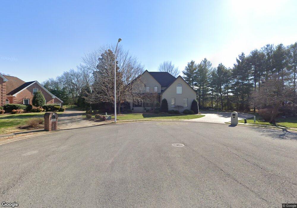
1720 Waters Edge Ct Murfreesboro, TN 37130
Estimated Value: $893,000 - $1,330,031
--
Bed
4
Baths
4,386
Sq Ft
$237/Sq Ft
Est. Value
About This Home
This home is located at 1720 Waters Edge Ct, Murfreesboro, TN 37130 and is currently estimated at $1,041,344, approximately $237 per square foot. 1720 Waters Edge Ct is a home located in Rutherford County with nearby schools including Black Fox Elementary School, Whitworth-Buchanan Middle School, and Riverdale High School.
Ownership History
Date
Name
Owned For
Owner Type
Purchase Details
Closed on
Jun 18, 2024
Sold by
Hassan Elias E
Bought by
Witte Mathiew Jay and Witte Elizabeth Ann
Current Estimated Value
Home Financials for this Owner
Home Financials are based on the most recent Mortgage that was taken out on this home.
Original Mortgage
$1,200,000
Outstanding Balance
$1,184,686
Interest Rate
7.02%
Mortgage Type
VA
Estimated Equity
-$143,342
Purchase Details
Closed on
Oct 27, 1999
Sold by
Benjamin Hadden
Bought by
Hassan Elias E
Purchase Details
Closed on
Aug 23, 1999
Sold by
Sullivan The Family Trust
Bought by
Benjamin Hadden
Home Financials for this Owner
Home Financials are based on the most recent Mortgage that was taken out on this home.
Original Mortgage
$43,385
Interest Rate
7.5%
Purchase Details
Closed on
Jun 16, 1997
Sold by
Broadlands Venture
Bought by
Sullivan Family Trust
Create a Home Valuation Report for This Property
The Home Valuation Report is an in-depth analysis detailing your home's value as well as a comparison with similar homes in the area
Home Values in the Area
Average Home Value in this Area
Purchase History
| Date | Buyer | Sale Price | Title Company |
|---|---|---|---|
| Witte Mathiew Jay | $1,400,000 | Wagon Wheel Title | |
| Hassan Elias E | $48,000 | -- | |
| Benjamin Hadden | $46,800 | -- | |
| Sullivan Family Trust | $45,000 | -- |
Source: Public Records
Mortgage History
| Date | Status | Borrower | Loan Amount |
|---|---|---|---|
| Open | Witte Mathiew Jay | $1,200,000 | |
| Previous Owner | Sullivan Family Trust | $43,385 |
Source: Public Records
Tax History Compared to Growth
Tax History
| Year | Tax Paid | Tax Assessment Tax Assessment Total Assessment is a certain percentage of the fair market value that is determined by local assessors to be the total taxable value of land and additions on the property. | Land | Improvement |
|---|---|---|---|---|
| 2025 | $5,833 | $206,200 | $31,250 | $174,950 |
| 2024 | $5,833 | $206,200 | $31,250 | $174,950 |
| 2023 | $3,867 | $206,100 | $31,250 | $174,850 |
| 2022 | $3,331 | $206,100 | $31,250 | $174,850 |
| 2021 | $3,411 | $153,675 | $28,250 | $125,425 |
| 2020 | $3,411 | $153,675 | $28,250 | $125,425 |
| 2019 | $3,411 | $153,675 | $28,250 | $125,425 |
| 2018 | $4,685 | $153,675 | $0 | $0 |
| 2017 | $4,563 | $117,400 | $0 | $0 |
| 2016 | $4,563 | $117,400 | $0 | $0 |
| 2015 | $4,563 | $117,400 | $0 | $0 |
| 2014 | $2,919 | $117,400 | $0 | $0 |
| 2013 | -- | $117,600 | $0 | $0 |
Source: Public Records
Map
Nearby Homes
- 1519 Kensington Dr
- 1919 Chartwell Ct
- 1518 Cameron Ct
- 1806 Greerson Dr
- 1103 S Baird Ln
- 1834 Greerson Ct
- 1602 Cypress Dr
- 1819 Greerson Dr
- 1951 Russell Ct
- 1315 Bradyville Pike Unit 2
- 1315 Bradyville Pike Unit 1
- 2010 Bartway Dr Unit 2012
- 1919 Bradyville Pike
- 2010 Olympia Place
- 1848 Black Fox Crossing
- 1811 Cascade Ct
- 2209 Seahunter Ct
- 2210 Seahunter Ct
- 2218 Seahunter Ct
- 914 Kay St
- 1719 Waters Edge Ct
- 1439 Kensington Dr
- 1435 Kensington Dr
- 1443 Kensington Dr
- 1426 Broadlands Dr
- 1426 Broad Lands Dr
- 1715 Waters Edge Ct
- 1447 Kensington Dr
- 1431 Kensington Dr
- 1422 Broad Lands Dr
- 1432 Kensington Dr
- 1451 Kensington Dr
- 1436 Kensington Dr
- 1711 Waters Edge Ct
- 1427 Kensington Dr
- 1442 Kensington Dr
- 1428 Kensington Dr
- 1446 Kensington Dr
- 1455 Kensington Dr
- 1423 Kensington Dr