Estimated Value: $516,000 - $572,000
4
Beds
3
Baths
2,524
Sq Ft
$214/Sq Ft
Est. Value
About This Home
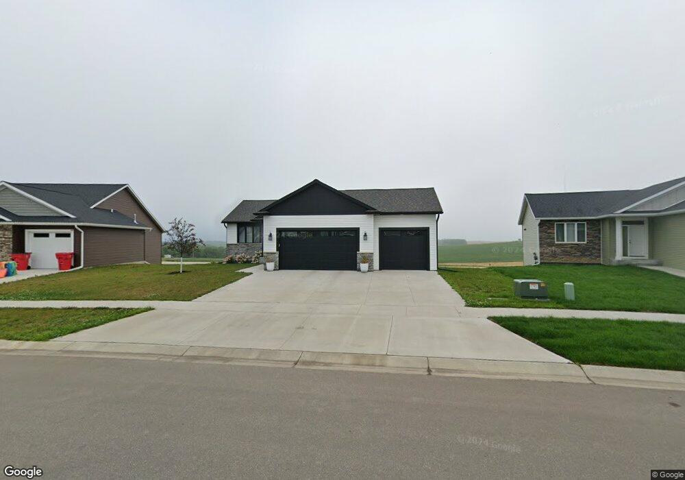
This home is located at 1721 Brandt Dr NE, Byron, MN 55920 and is currently estimated at $540,999, approximately $214 per square foot. 1721 Brandt Dr NE is a home located in Olmsted County with nearby schools including Byron Intermediate School, Byron Middle School, and Byron Senior High School.
Ownership History
Date
Name
Owned For
Owner Type
Purchase Details
Closed on
Oct 7, 2022
Sold by
Exclusive Home Builders And Remodelers L
Bought by
Roberts Christopher and Roberts Stephanie
Current Estimated Value
Home Financials for this Owner
Home Financials are based on the most recent Mortgage that was taken out on this home.
Original Mortgage
$399,920
Outstanding Balance
$383,487
Interest Rate
5.55%
Mortgage Type
New Conventional
Estimated Equity
$157,513
Purchase Details
Closed on
Apr 30, 2021
Sold by
The East Village Byron Llc
Bought by
Hus Christopher T
Purchase Details
Closed on
Nov 19, 2019
Sold by
Decook Bryce and Decook Brenda
Bought by
The East Village Byrom Llc
Create a Home Valuation Report for This Property
The Home Valuation Report is an in-depth analysis detailing your home's value as well as a comparison with similar homes in the area
Home Values in the Area
Average Home Value in this Area
Purchase History
| Date | Buyer | Sale Price | Title Company |
|---|---|---|---|
| Roberts Christopher | $499,900 | -- | |
| Hus Christopher T | $78,000 | Rochester Title & Escrow Co | |
| The East Village Byrom Llc | -- | None Available |
Source: Public Records
Mortgage History
| Date | Status | Borrower | Loan Amount |
|---|---|---|---|
| Open | Roberts Christopher | $399,920 |
Source: Public Records
Tax History Compared to Growth
Tax History
| Year | Tax Paid | Tax Assessment Tax Assessment Total Assessment is a certain percentage of the fair market value that is determined by local assessors to be the total taxable value of land and additions on the property. | Land | Improvement |
|---|---|---|---|---|
| 2024 | $7,342 | $458,800 | $80,000 | $378,800 |
| 2023 | $7,250 | $458,700 | $80,000 | $378,700 |
| 2022 | $1,464 | $314,100 | $80,000 | $234,100 |
| 2021 | $1,372 | $65,000 | $65,000 | $0 |
| 2020 | $55 | $65,000 | $65,000 | $0 |
| 2019 | $55 | $3,500 | $3,500 | $0 |
Source: Public Records
Map
Nearby Homes
- 1705 Brandt Dr NE
- 1676 Brandt Dr NE
- 1764 Brandt Dr NE
- 1644 Brandt Dr NE
- 1886 (L11,B2) Robinson Ln NE
- 1872 (L10,B2) Robinson Ln NE
- 1860 (L9,B2) Robinson Ln NE
- 1844 (L8,B2) Robinson Ln NE
- 1863 (L13,B2) Robinson Ln NE
- 1830 (L7,B2) Robinson Ln NE
- 1807 (L14,B2) Robinson Ln NE
- 1792 (L3,B1) Brandt Dr NE
- 1884 Ashley Dr NE
- 1806 Brandt Dr NE
- 1805 Brandt Dr NE
- 1812 Brandt Dr NE
- 1582 Brandt Dr NE
- 1824 Brandt Dr NE
- 1830 Brandt Dr NE
- 1802 NE Robinson Ln
- 1713 Brandt Dr NE
- 1729 Brandt Dr NE
- 1718 Brandt Dr NE
- 1737 Brandt Dr NE
- 1786 Brandt Dr NE
- 1726 Brandt Dr NE
- 1710 Brandt Dr NE
- 1743 Brandt Dr NE
- 686 Steenhoek Ln NE
- 1744 Brandt Dr NE
- 1702 Brandt Dr NE
- 594 Haar Ln NE
- 692 Steenhoek Ln NE
- 599 Haar Ln NE
- 1752 Brandt Dr NE
- 1755 Brandt Dr NE
- 1675 Brandt Dr NE
- 586 Haar Ln NE
- 1760 Brandt Dr NE
- 673 Steenhoek Ln NE