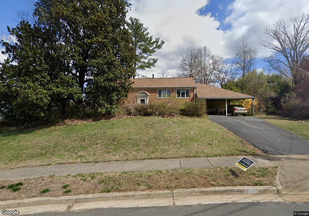
1721 Maxwell Ct McLean, VA 22101
Estimated Value: $1,198,413 - $1,362,000
4
Beds
3
Baths
1,176
Sq Ft
$1,089/Sq Ft
Est. Value
About This Home
This home is located at 1721 Maxwell Ct, McLean, VA 22101 and is currently estimated at $1,281,103, approximately $1,089 per square foot. 1721 Maxwell Ct is a home located in Fairfax County with nearby schools including Kent Gardens Elementary School, Longfellow Middle School, and McLean High School.
Ownership History
Date
Name
Owned For
Owner Type
Purchase Details
Closed on
Aug 17, 2001
Sold by
Charles D Brown Tr
Bought by
Worobec Stephen F
Current Estimated Value
Home Financials for this Owner
Home Financials are based on the most recent Mortgage that was taken out on this home.
Original Mortgage
$327,000
Outstanding Balance
$127,650
Interest Rate
7.16%
Mortgage Type
Purchase Money Mortgage
Estimated Equity
$1,153,453
Create a Home Valuation Report for This Property
The Home Valuation Report is an in-depth analysis detailing your home's value as well as a comparison with similar homes in the area
Home Values in the Area
Average Home Value in this Area
Purchase History
| Date | Buyer | Sale Price | Title Company |
|---|---|---|---|
| Worobec Stephen F | $409,000 | -- |
Source: Public Records
Mortgage History
| Date | Status | Borrower | Loan Amount |
|---|---|---|---|
| Open | Worobec Stephen F | $327,000 |
Source: Public Records
Tax History
| Year | Tax Paid | Tax Assessment Tax Assessment Total Assessment is a certain percentage of the fair market value that is determined by local assessors to be the total taxable value of land and additions on the property. | Land | Improvement |
|---|---|---|---|---|
| 2025 | $11,725 | $1,090,090 | $547,000 | $543,090 |
| 2024 | $11,725 | $992,360 | $497,000 | $495,360 |
| 2023 | $10,700 | $929,220 | $497,000 | $432,220 |
| 2022 | $10,088 | $864,820 | $442,000 | $422,820 |
| 2021 | $9,446 | $789,440 | $418,000 | $371,440 |
| 2020 | $9,373 | $776,910 | $418,000 | $358,910 |
| 2019 | $9,030 | $748,430 | $418,000 | $330,430 |
| 2018 | $8,561 | $744,430 | $414,000 | $330,430 |
| 2017 | $8,601 | $726,460 | $410,000 | $316,460 |
| 2016 | $8,427 | $713,240 | $406,000 | $307,240 |
Source: Public Records
Map
Nearby Homes
- 1715 Maxwell Ct
- 6816 Dean Dr
- 1713 Rupert St
- 1707 Westmoreland St
- 7000 Tyndale St
- 6935 Southridge Dr
- 1573 Westmoreland St
- 1566B Westmoreland St
- 1839 Baldwin Dr
- 1935 Foxhall Rd
- 7103 Westbury Rd
- 1726 Baldwin Dr
- 1710 Dalewood Place
- 1712 Dalewood Place
- 1601 Wrightson Dr
- 6539 Fairlawn Dr
- 7205 Bayside Ct
- 6526 Dryden Dr
- 1620 Chain Bridge Rd
- 7107 Penguin Place
- 1723 Maxwell Ct
- 6905 Southridge Dr
- 1719 Maxwell Ct
- 6903 Southridge Dr
- 1720 Westmoreland St
- 1722 Maxwell Ct
- 1722 Westmoreland St
- 1725 Maxwell Ct
- 6901 Southridge Dr
- 1718 Westmoreland St
- 1724 Westmoreland St
- 6911 Southridge Dr
- 1724 Maxwell Ct
- 1727 Maxwell Ct
- 1726 Westmoreland St
- 6904 Southridge Dr
- 6902 Southridge Dr
- 1726 Maxwell Ct
- 6913 Southridge Dr
- 6906 Southridge Dr
Your Personal Tour Guide
Ask me questions while you tour the home.